Maxar Intelligence has signed an agreement with startup Array Labs to gain access to data from a promising satellite constellation. The first vehicles are planned to be launched into orbit in 2026.
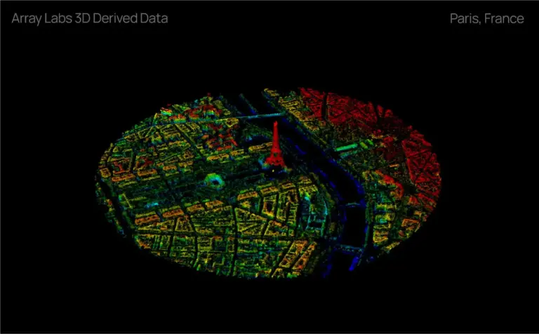
Array Labs is developing a constellation of radar satellites capable of taking detailed 3D images of the planet’s surface. This will provide up-to-date data for cartography, infrastructure monitoring and environmental change analysis.
As Peter Wilczynski, director of products at Maxar Intelligence, noted, the partnership will help the company expand its line of 3D solutions. “Our goal is to create a ‘living Earth’—a dynamic, real-time digital model of the planet,” he explained.
In 2024, Array Labs successfully launched two test satellites. By 2026, the startup is planning a demonstration mission, and then will deploy the first working group of four vehicles. They will be able to perform large-scale mapping and generate high-precision 3D models.
The collaboration between Maxar and Array Labs will focus on integrating new data into existing remote sensing products. This opens up prospects for business, science and public administration.
The collaboration between the two companies will accelerate the development of 3D mapping technologies. Access to timely and accurate data will help solve global problems – from predicting natural disasters to managing urban development.
Experts expect that the Maxar and Array Labs project will be a new step in the field of surveillance Earth. In the coming years, we will see a revolution in the quality and detail of satellite images.
The material was prepared with the support of the Russian Ministry of Education and Science as part of the Decade of Science and Technology
Source: @sputnikDZZ