Many people still perceive gravity exploration as a method “for studying giant structures—deep faults in the foundation and topography of the earth’s crust. This idea dates back to those times when the capabilities of the equipment did not allow recording macroscopic changes in the gravitational field. But today, modern gravimeters such as CG-6 (Scintrex, Canada) make it possible to work with high accuracy and solve problems not only at the regional level, but also to study individual ore bodies.
Geophysicist Maria Kostina carried out gravity exploration work in the Yukon to search for solid minerals. And now she will tell you what gravity survey methods exist, how they differ in accuracy and operating conditions, as well as what problems this method can solve today.
What gravity survey shows: from giant structures to ore bodies
Gravity survey is one of the geophysical methods, which studies the distribution of gravity on Earth to reveal structures hidden beneath the surface. Gravity is not a constant quantity: it is influenced by the shape of the planet, the topography and, most importantly, differences in the density of rocks. Areas where the density of rocks differs from the surrounding ones cause gravitational anomalies – small deviations in gravity that are recorded by instruments.
Using gravity surveys, you can study objects of various sizes. These are large geological structures – tectonic faults, boundaries of blocks of the earth’s crust, salt domes, uplifts and troughs of the foundation. But in addition to such giants, the method also allows one to identify relatively small-sized objects – ore bodies, kimberlite pipes, pegmatite veins.
In order for an object to “manifest” in a gravitational field, it must meet a number of conditions:
- noticeably differ in density from the host rocks, for reference: rock-forming minerals usually have a density of 2.6–3.0 g/cm³, and for ore minerals – more than 4.0 g/cm³ (see our density table),
- have a shape that creates an anomaly (not just a flat layer, but, for example, a columnar or dome-shaped body),
- and be at a depth that allows it to be recorded, taking into account the accuracy of the equipment and the errors of the method.
Let’s now talk about how exactly gravity survey can be used – where it is used and what types of work exist depending on the location and accuracy of the measurements.
Gravity survey methods: from the most accurate to the global
Gravity reconnaissance can be carried out in different ways – from detailed measurements “in field boots” to observations from orbit. Each method differs in accuracy, scope of coverage and problems that it can solve. Let’s look at what types of gravity surveys exist today, where they are used and how they differ from each other.
Terrestrial gravimetric survey
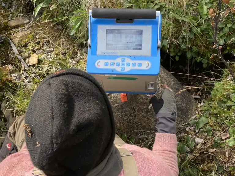
The most accurate way to measure the distribution of gravity on Earth. Used for detailed work – from searching for individual ore bodies to clarifying the structure of deposits. Field gravimeters record changes in gravity with an accuracy of thousandths of mGal, which makes it possible to identify even small density anomalies. The method is especially effective in ore geophysics, when it is important to “catch” the signal from high-density deposits – for example, iron or chromite ores.
Read also: how field gravimetric measurements are performed and what difficulties geophysicists face in the mountains – The gravity reconnaissance method or why we flew a helicopter over the Yukon”.
Variometric (gradient) shooting
For detailed exploration of ore bodies, salt domes and other local heterogeneities, the method of measuring the second derivatives of the gravitational field using variometers (gradientometers) is used. This approach makes it possible to increase the sensitivity of the method and identify anomalies even from small bodies against the background of larger structures. The survey is usually area-based, with a high density of points and careful geodetic reference, which makes it one of the most accurate in gravity surveys.
Marine gravity survey
Used for research in water areas. Gravimeters are installed on ships and measurements are taken while in motion. In its basic version, the method is used for regional studies and identification of large structures – faults, uplifts, depressions – which allows you to quickly cover large areas and identify promising areas for detailed work.
When operating in high resolution (taking into account the speed and direction of the vessel’s movement, waves and currents) the accuracy approaches that of ground-based methods. This approach is effective for searching for structures on the shelf, oil and gas traps, as well as ore objects exposed under the seabed.
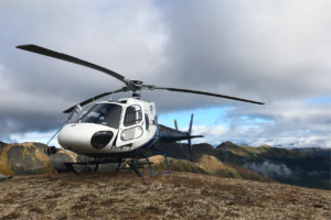
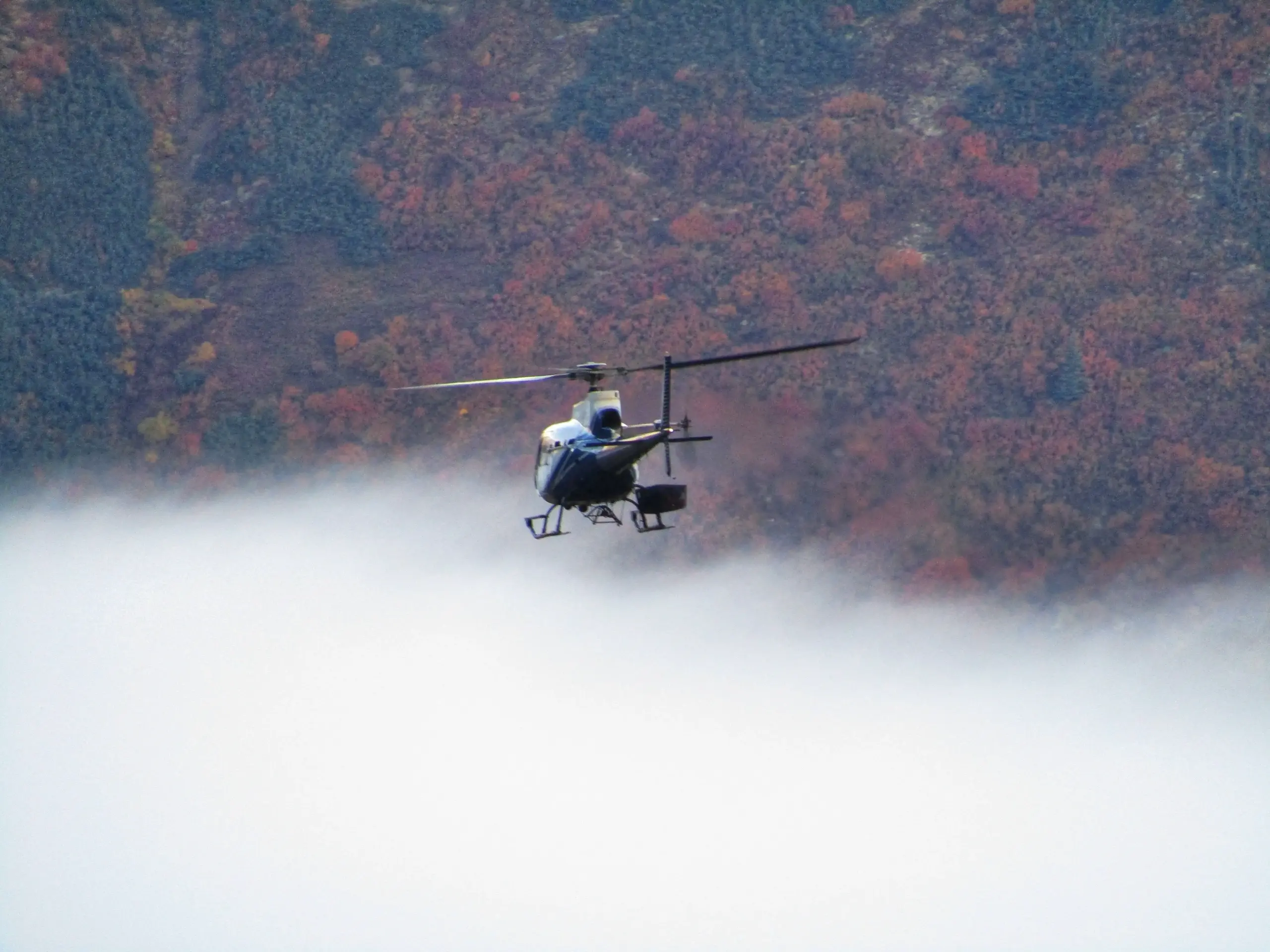
Airborne gravimetric survey
It is carried out from airplanes or helicopters on which airborne gravimeters are installed. Flight speed and altitude affect accuracy, so the method is inferior to ground and sea gravity reconnaissance. But its main advantage is the ability to cover hard-to-reach areas in a short time. It is used for regional work, mapping large tectonic structures, and sometimes for the primary identification of ore-bearing zones.
Satellite gravimetry
Gives the lowest detail, but covers the entire planet. On-board measurements satellites make it possible to build maps of the Earth’s gravitational field and identify giant structures—the boundaries of lithospheric plates, oceanic ridges, and trenches. In geological exploration it is used as a background for planning regional work.
What problems does gravity survey solve?
Gravity exploration is a method with a very wide range of tasks: from studying the structure of the lithosphere to searching for specific ore bodies. To simplify, it answers the question: where there are areas of abnormal density in the earth – and what this might be connected with.
Study of large structures and tectonics
The method makes it possible to map giant tectonic faults, deep foundation blocks, troughs and uplifts of the earth’s crust. This data is important in the early stages of regional work, when it is necessary to understand the general structure of the territory and the prospects of individual areas.
Search for oil and gas structures
Salt domes, anticlines, reef massifs – all this can be detected by gravity anomalies. The method helps delineate the boundaries of structural traps that may contain oil or gas.
Exploration of solid minerals
In ore geology, gravity prospecting—especially in high-precision versions, including variometric measurements—helps identify local density anomalies from bodies with high contents of ore minerals. These can be ferruginous quartzites, chromites, polymetallic ores, as well as rare and non-ferrous metals.
Find out how gravity survey works on a real project? Read the case: “How to find lithium-bearing pegmatites by ground-based gravity exploration”
Engineering-geological surveys
Gravity exploration can solve problems not directly related to the search for minerals – for example, determining the thickness of glaciers, identifying karst cavities or rock decompression zones, which are important in the construction of infrastructure.
How to choose a method and not lose data
Gravity survey is one of the basic methods of geophysical surveying, which detects anomalies in the Earth’s gravitational field. For the method to “see” an object, it must differ in density from the surrounding rocks.
The choice of technique depends on what exactly you are looking for. If the goal is to identify large structures and faults, you can limit yourself to regional or less detailed surveys. But to search for small ore bodies, high-precision gravity exploration and modern equipment of the latest modification will be required.
It is important to remember: gravity surveys are almost always used in combination with other geophysical methods. This approach allows you to clarify the object model, reduce the risk of errors and increase the efficiency of searches.