Hello! My name is Maria, I am a geophysicist and this summer I did gravity surveys in the Yukon. I admit, I haven’t used this method before. I had to remember what was taught at the university and master modern gravimeters. In this article, I propose to work with me to understand what gravity exploration studies, how it is useful to a geologist, and how field measurements are carried out.
From what task will help gravity survey
The site where I worked is located in the eastern part of the Yukon. Large-scale regional work has recently been launched here to find and then extract zinc, lead, silver and gold.
My colleagues and I got to our place of work like this: from the capital of the Yukon, Whitehorse, we flew on a small plane to the airfield next to the site. This is just a runway among the mountains without the usual airport building nearby. Then we transferred to a helicopter and flew to a small tent camp, where we lived and from where we went on gravity survey profiles.
What does gravity survey study?
Gravity exploration founded on the law of universal gravitation – all bodies attract each other. The attraction between ordinary objects, for example, between me and a table, laptop or pen, is very small, it can hardly be taken into account. What if we take a larger body, say, the entire Earth? Then you can no longer ignore the force of gravity – no matter how high you jump, you won’t be able to escape.
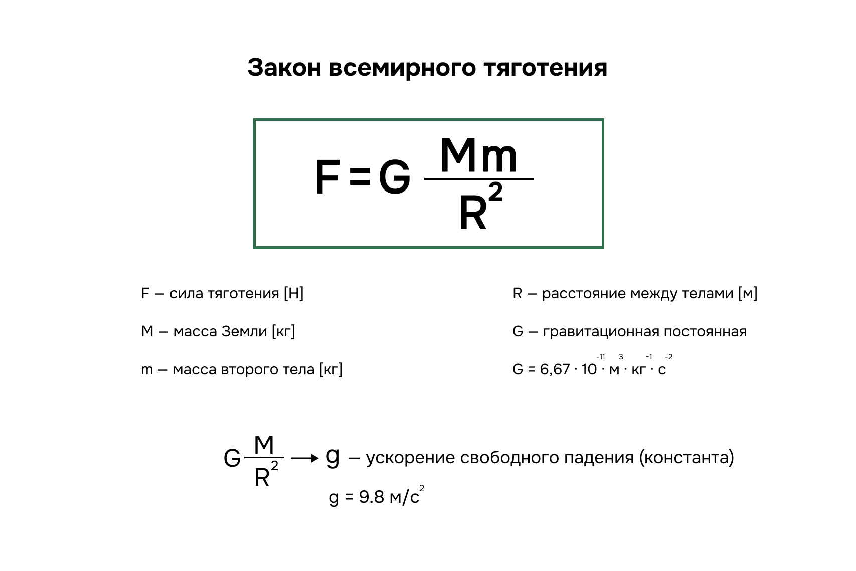
How will the formula change if one of the parameters is Earth? We know the mass, we know the distance and we get that the first part of the formula is a constant, the familiar acceleration of free fall g = 9.8 m/s2. And it seems that g is a constant quantity, and in school problems in physics it was so, but in gravitational exploration we have to take into account that the magnitude of free fall is still influenced by:
- earth shape,
- measurement method: static or in motion,
- the attraction of the Moon and the Sun (tides),
- altitude measurement – whether we take a report on the seashore or on the top of Everest.
Okay, they influence and influence. Show me the ore!
Why does a geologist need to know about the acceleration of free fall?
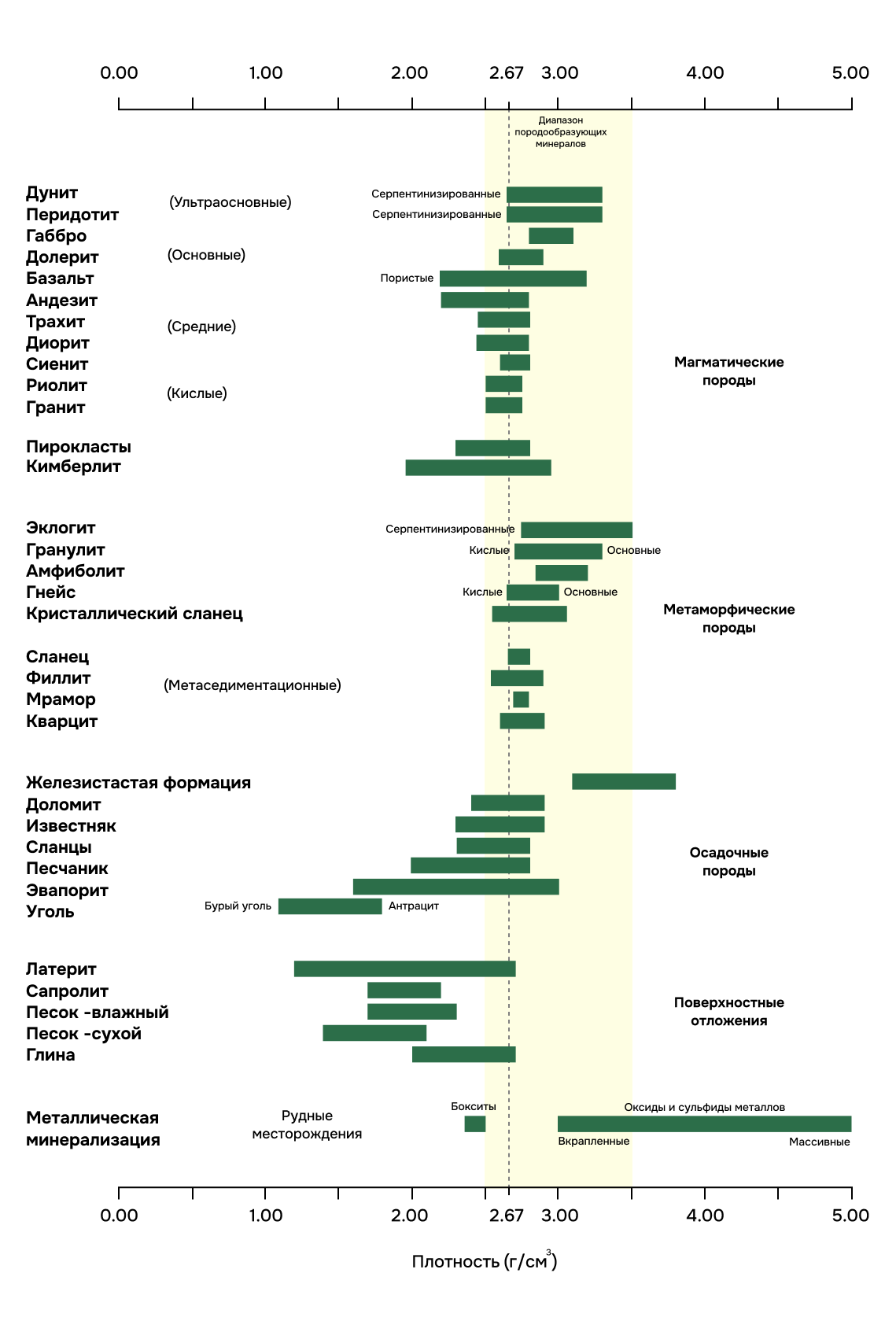
The thing is that geological bodies, including ore bodies, also affect the acceleration of gravity, but when their density is very different from the host rocks. This influence is much weaker than the factors listed above, so we need to carry out the most accurate field measurements, subtract everything unnecessary from the obtained values and leave only geological information. It’s like taking a piece of marble and cutting off everything unnecessary, then the gravitational anomalies will point us to the ore.
However, such anomalies are weak, so we require high precision field measurements of the order of 1 µGal or 0.000001 cm/s2. It is provided only by ground-based gravity reconnaissance.
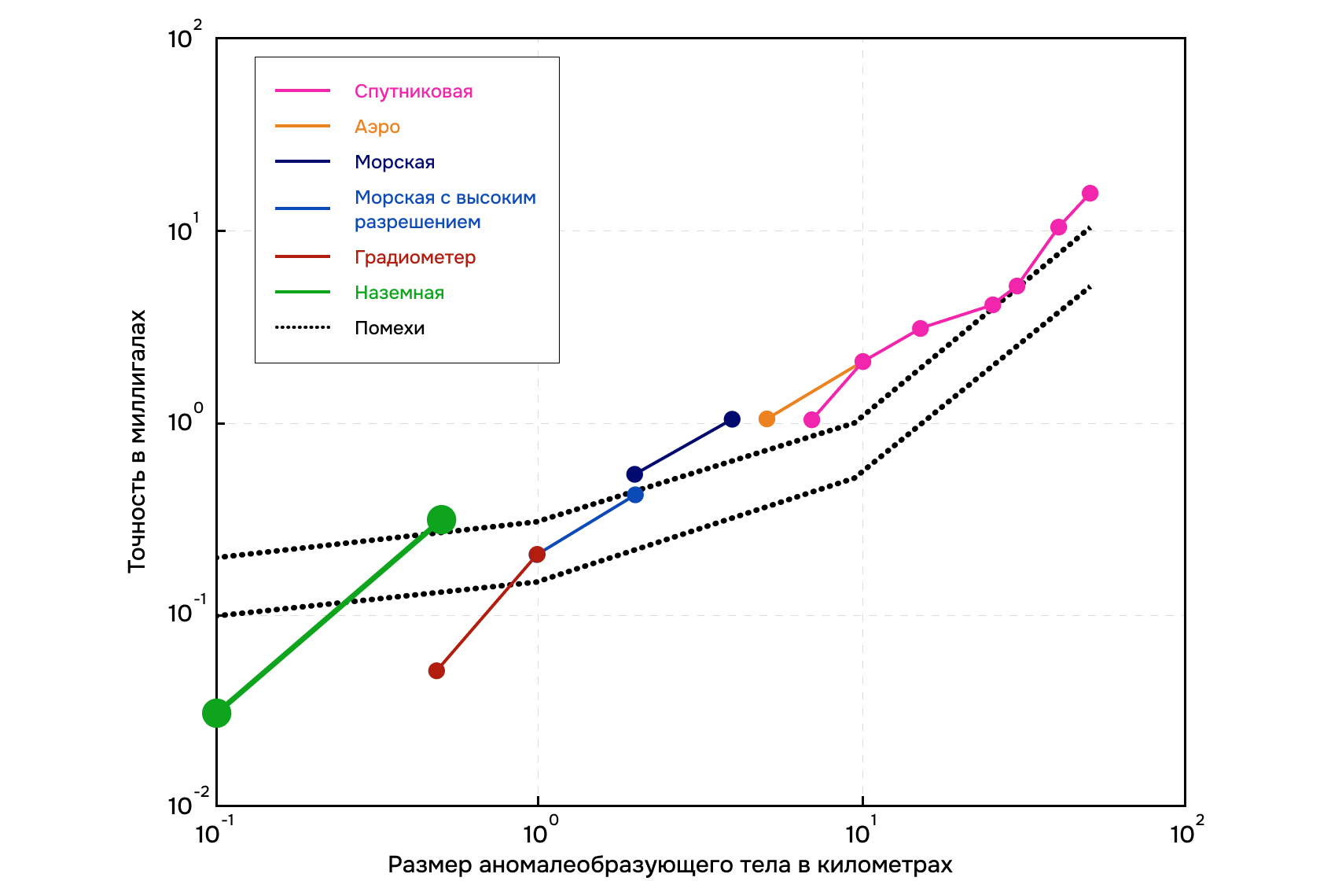
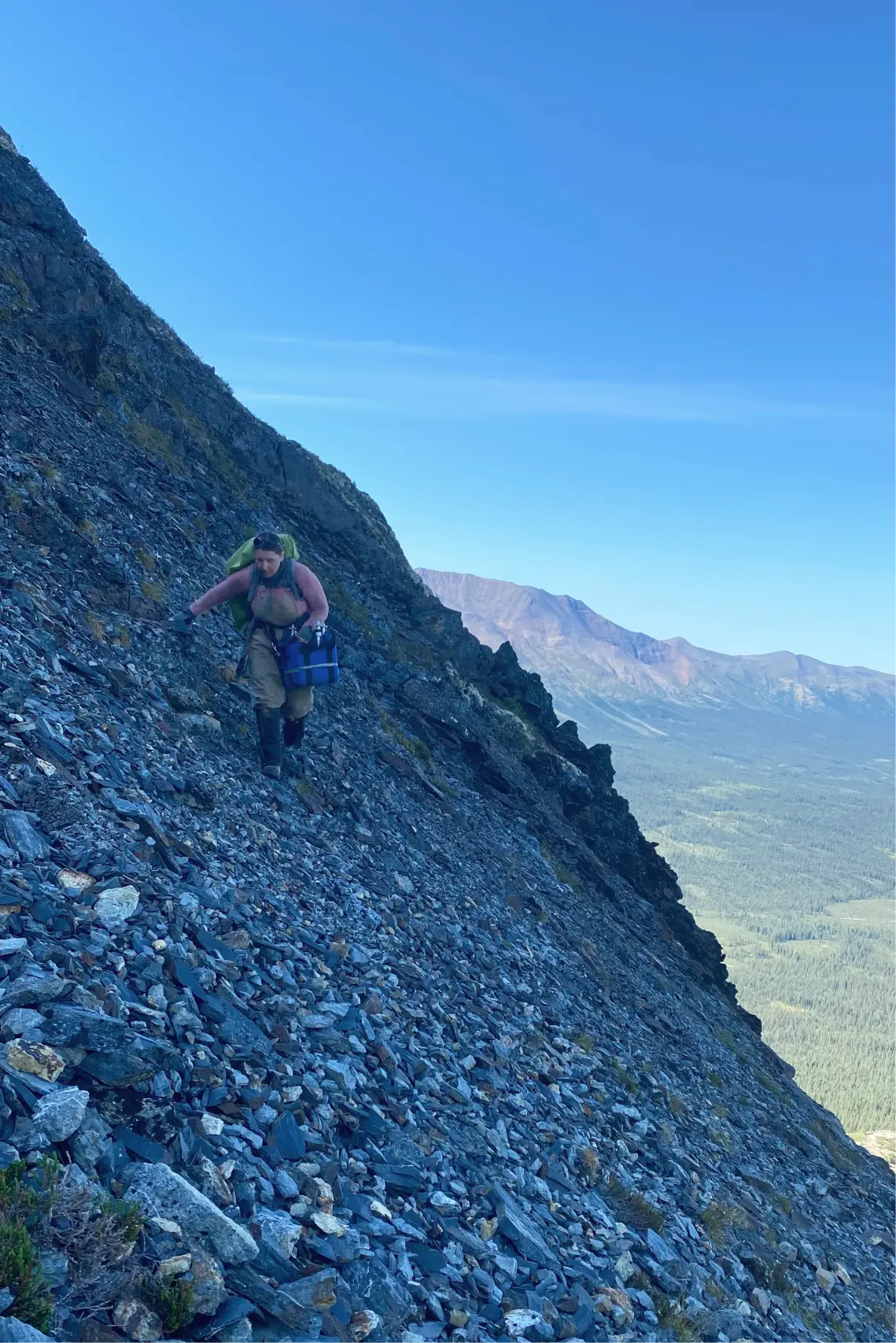
Now imagine a geophysicist who trudges among bushes or along rocky scree with a laboratory precision instrument. And you need to carry the gravimeter extremely gently, like a child, otherwise you will shake the quartz springs in the device, and the measurement will fail. So, somewhere in the thickets of bushes or after a broken road we get highly accurate values of the gravitational field. We will find out further how we achieve this.
Application of geological exploration in practice: how field measurements are carried out
Next, I will describe how a working day goes and explain the theory behind our actions. At the end you will find a bonus – a film about field work made by my colleagues. Creative people still work in geology.
Morning preparations
The working day starts early – the alarm clock rings at 5:20 in the morning, and by six you have to be at breakfast. After breakfast and before the start of the safety briefing, I usually had time to make gravimetric measurements at the base station, which was located right there in the field camp. If you skip them in the morning or evening, then all measurements for the day can be considered invalid. Usually people nervously remember whether they turned off the gas or the iron before work, but I was afraid of forgetting to take measurements on the base. Let’s talk further about why this is so important.
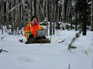
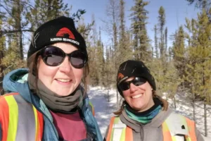
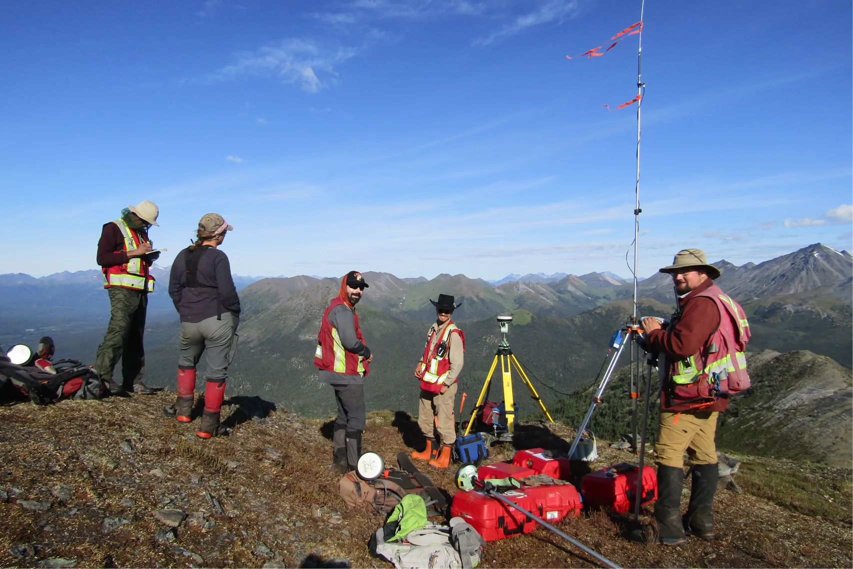
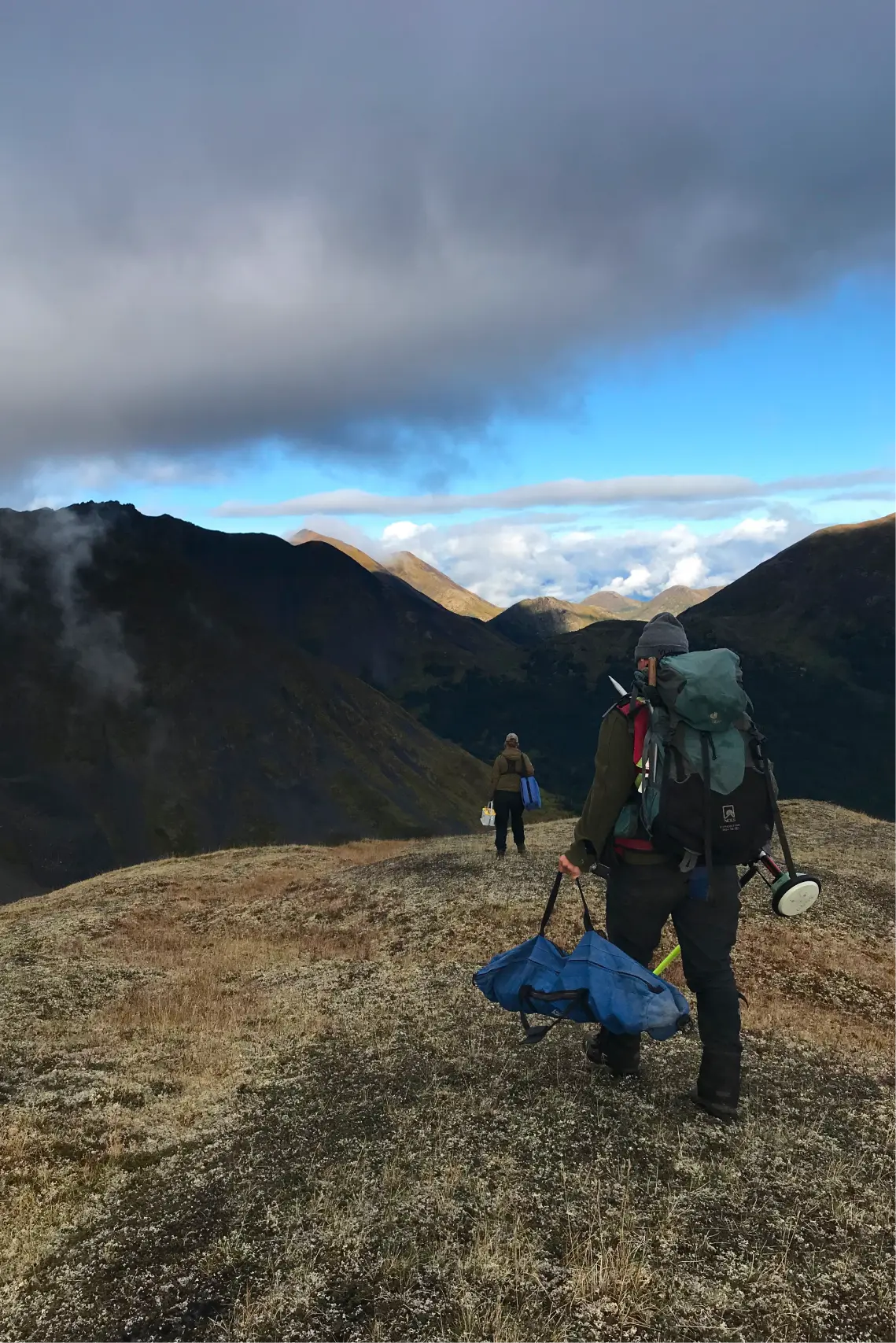
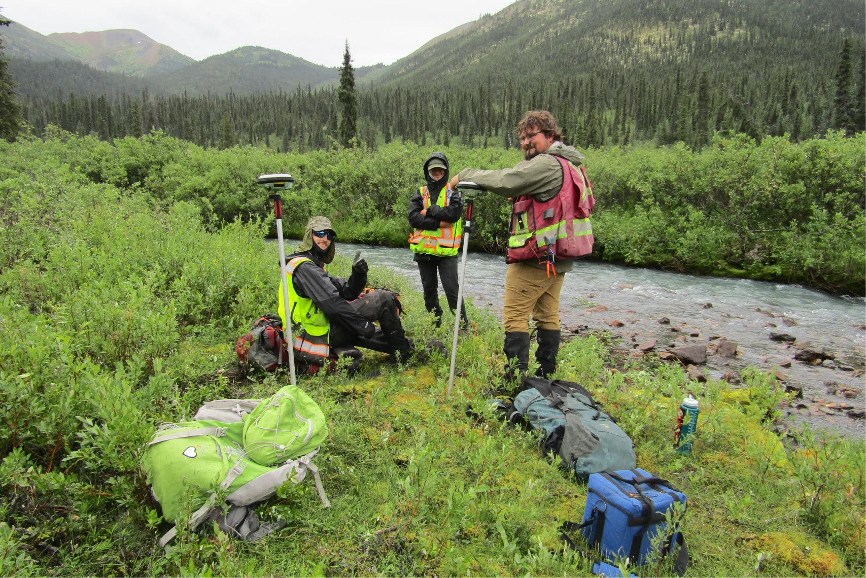
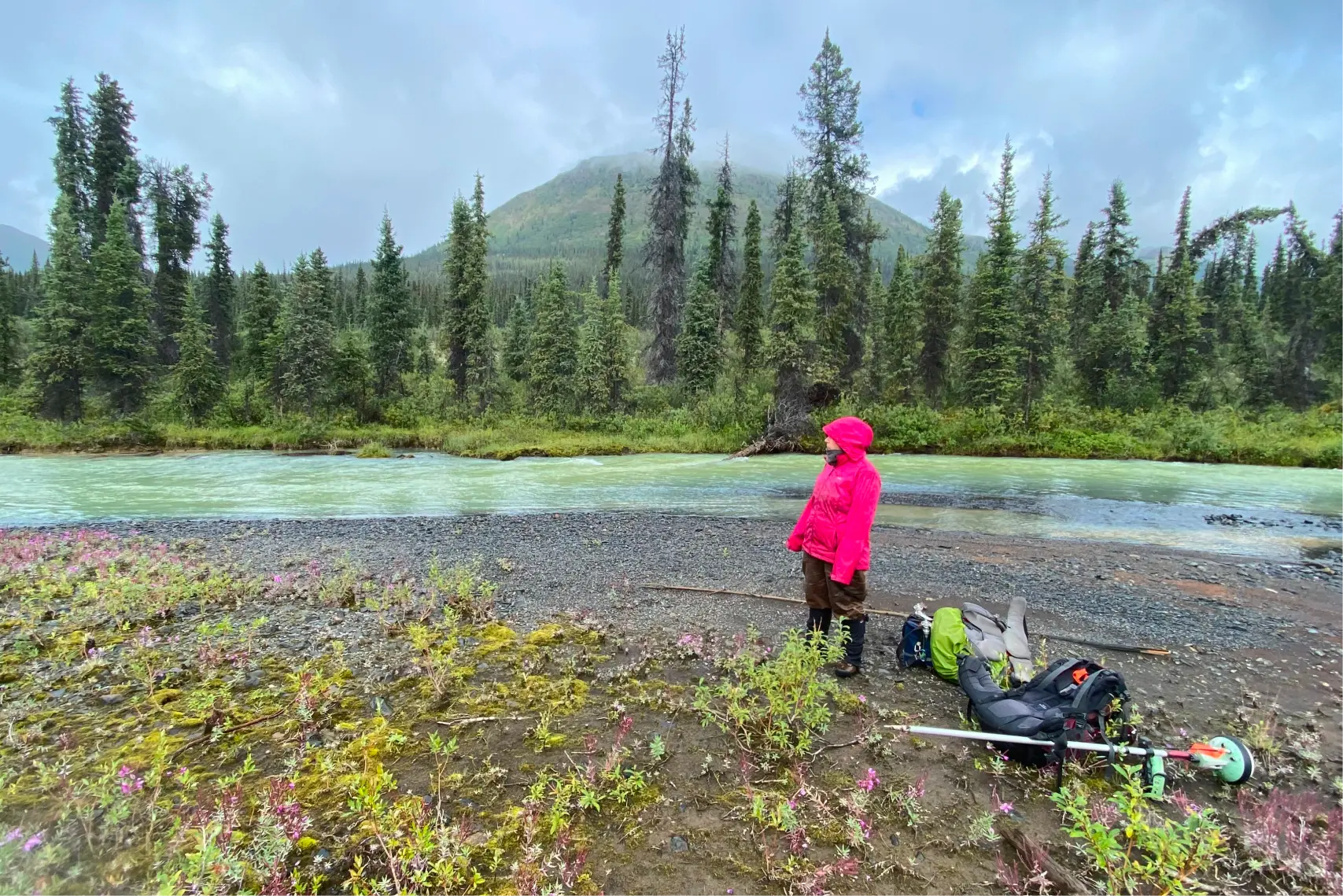
After the briefing, we got ready to go to work. We put equipment in our backpacks: gravimeters and RTK, walkie-talkies, GPS navigators, and did not forget about lunch. Five geophysical teams of two people each worked at the site. One of them took measurements of gravity, the other took exact coordinates.
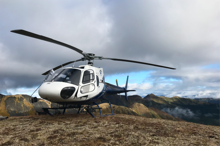
To work by helicopter
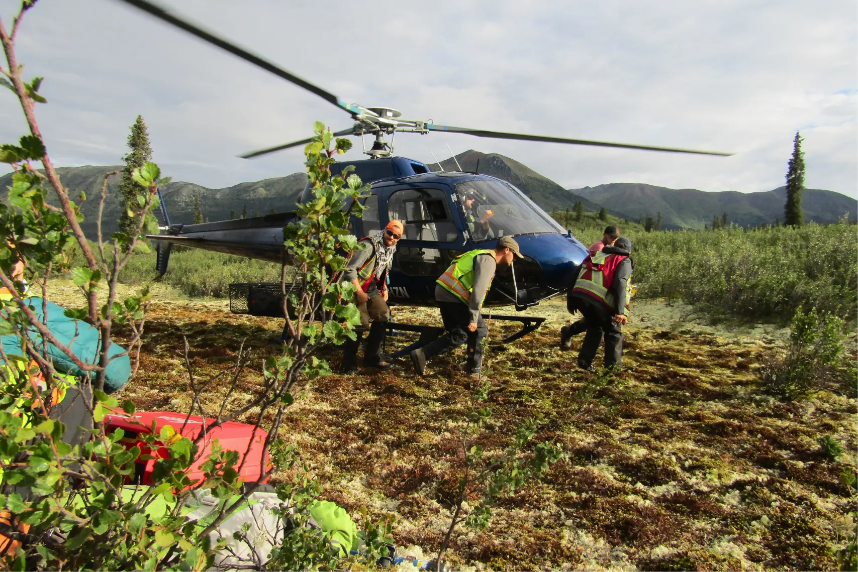
At 8 am we gathered at the helipad and then took off along one of two routes. The first is if they worked near the camp. Then we immediately flew to the profile. And if we worked on long-range profiles, then we had to take measurements at an intermediate base station, which was located between the main base and the profile, and only then fly to the profile. The second option is more picturesque, but longer, since there were not two, but four helicopter flights.
I was surprised when I found out that we would fly to the field by helicopter every day, and not like it was in Russia, when we were thrown into the field at the beginning of the season and only taken back at the end. Here in Canada, a helicopter is used every day to disperse people, bring water, and food.
Let me tell you how the gravimeter measures the acceleration of gravity, or the force of gravity, while we get to the profiles.
How is gravity measured?
There are two types of measurements: dynamic and static. Dynamic are methods in which they observe how a body moves under the influence of gravity and measure time. This is how the absolute values of gravity are obtained.
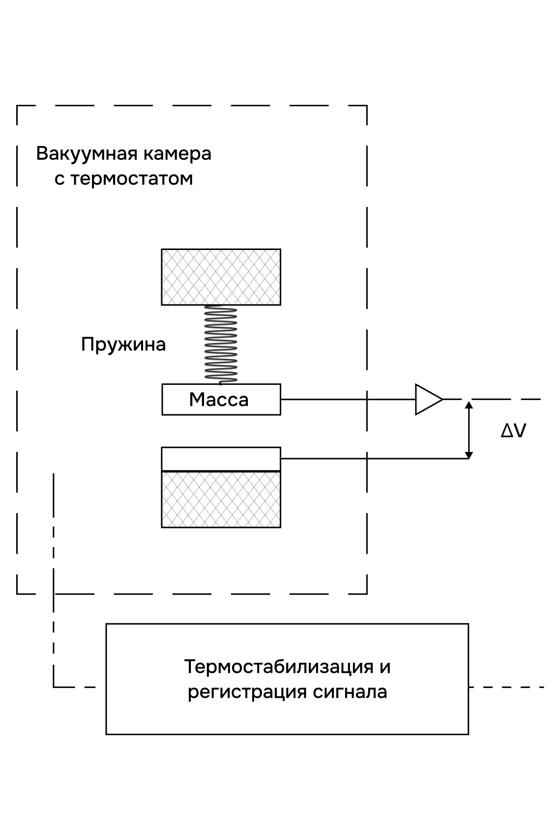
In statistical methods, a change in the equilibrium position of a body is observed under the influence of gravity and some force that balances it. The measured quantity is the linear or angular displacement of a body with constant mass. The balancing force can be the elastic force of solid bodies, for example, a spring.
With relative measurements, it is not the full value of gravity that is determined, but the increment at a given point relative to the base station, where the value of gravity is known. This is how gravimeters used in geological exploration measure.
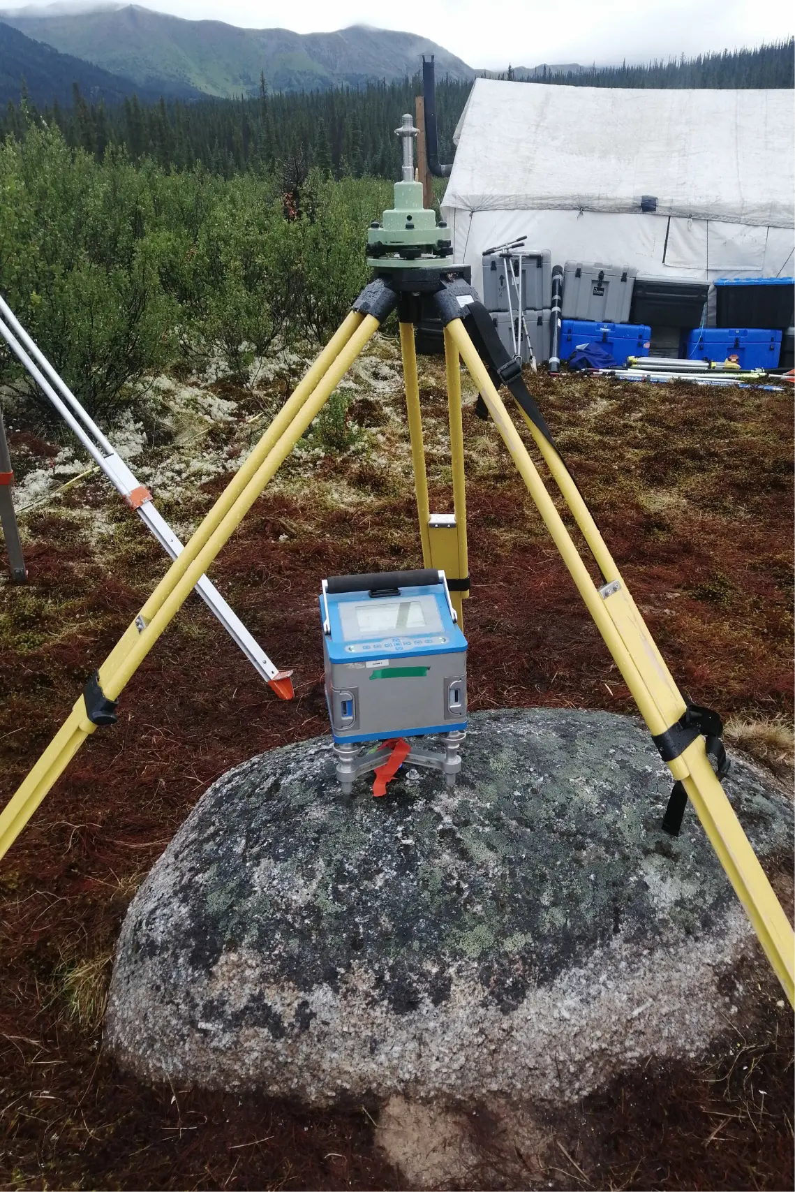
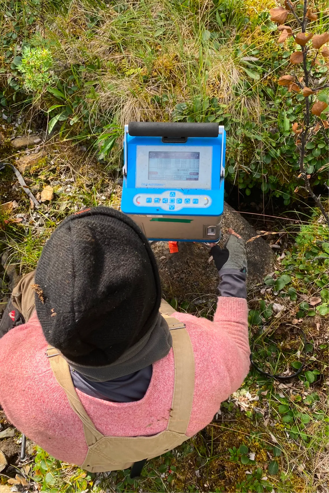
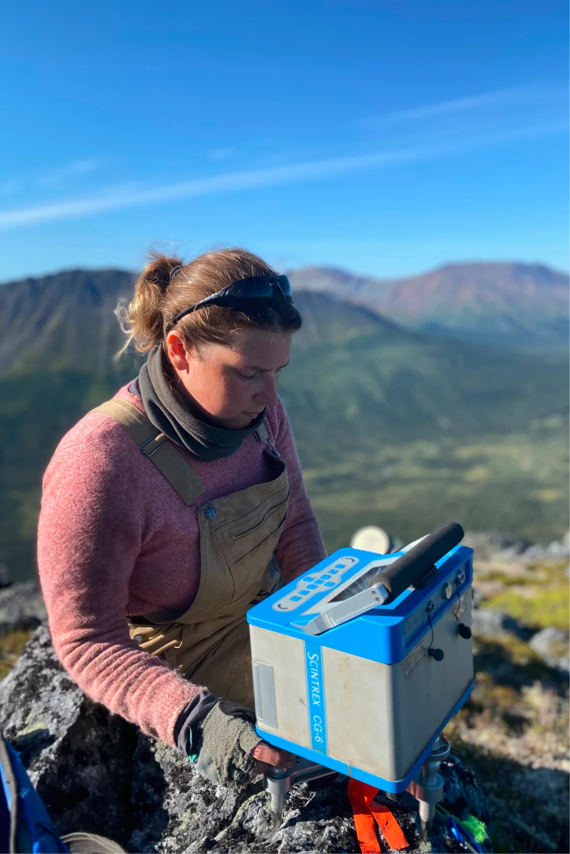
We worked with the Scintrex CG-6 gravimeter, this is how it works: the spring is stretched by gravity, but this stretch is compensated by an electrostatic capacitor and maintained at a constant level. The measure of the change in gravity is the voltage ΔV, which is recorded in the gravimeter’s memory.
Gravity in numbers
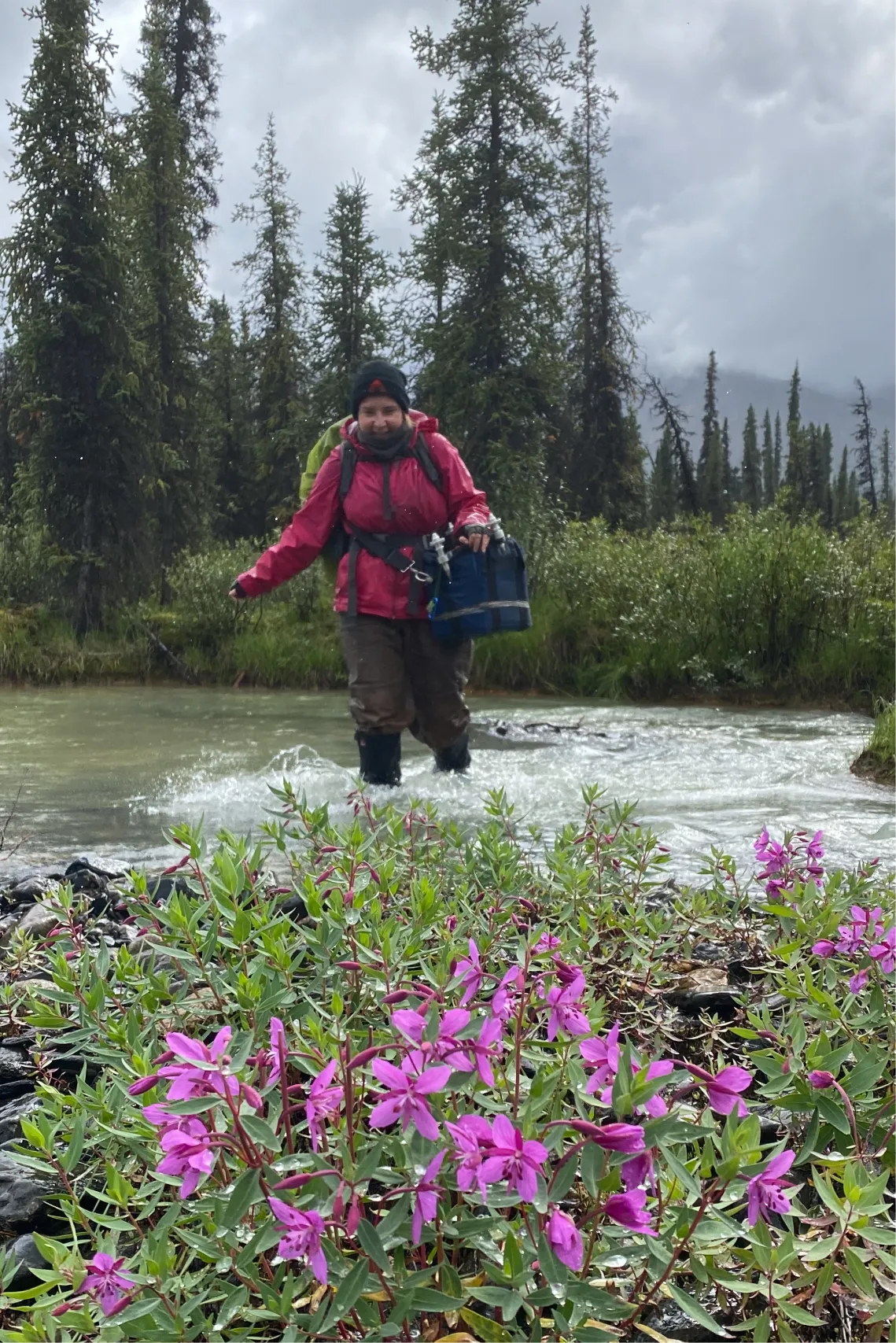
The helicopter sometimes dropped us off a couple of hundred meters from the profile, but sometimes we had to walk more than a kilometer. You probably now thought that these are funny numbers, but I assure you that when you walk through a windfall, dense bushes or along a steep slope over rocks, distances are perceived completely differently. It’s good that we often started with pickets at the top of the slope and gradually moved down as the profile was developed.
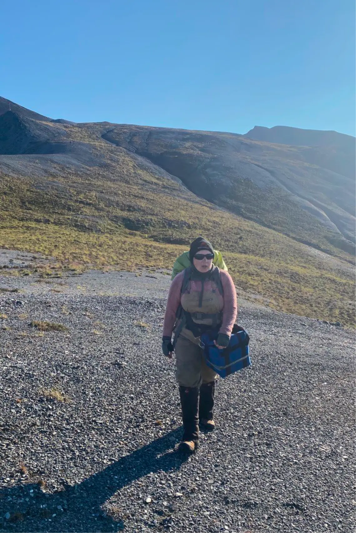
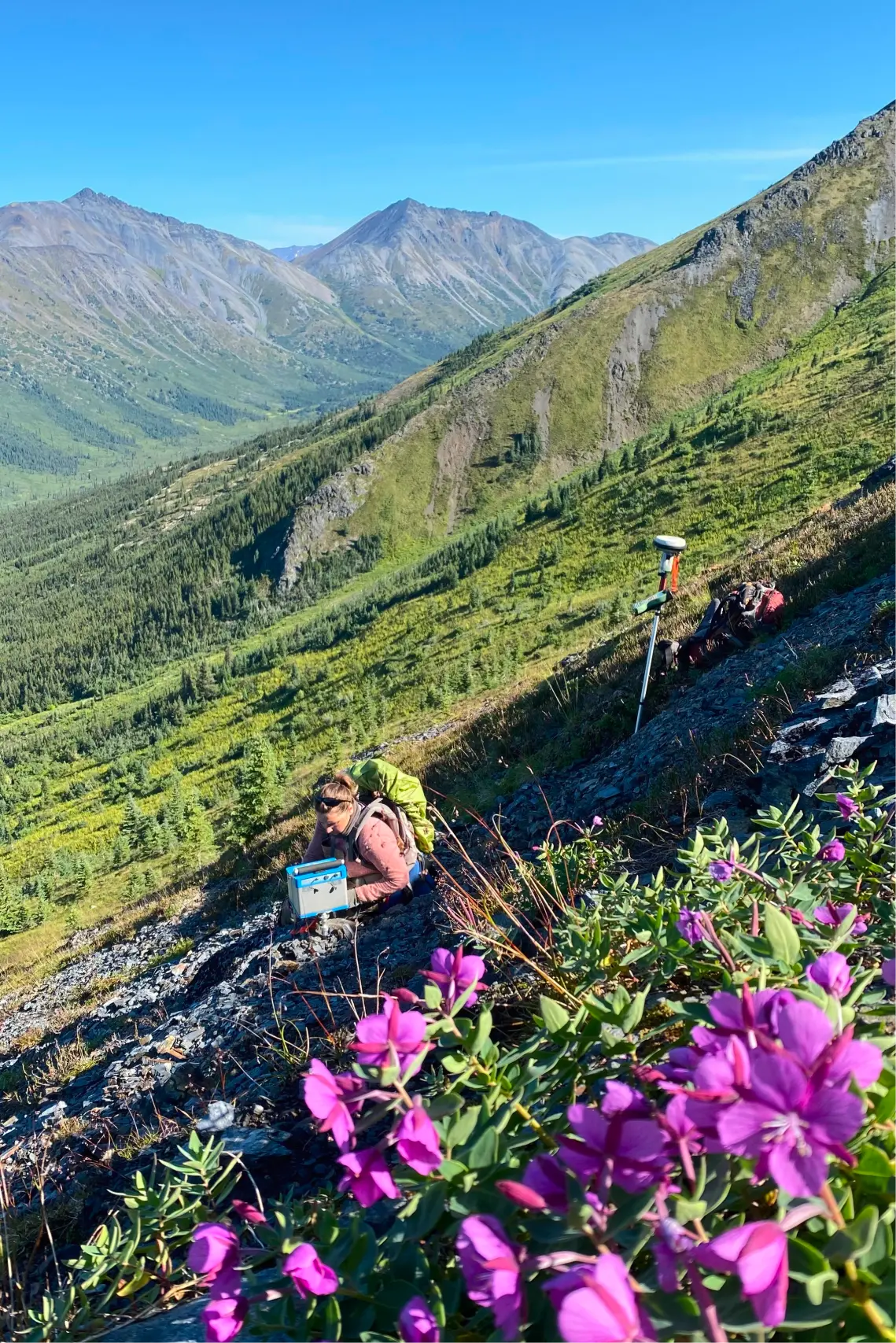
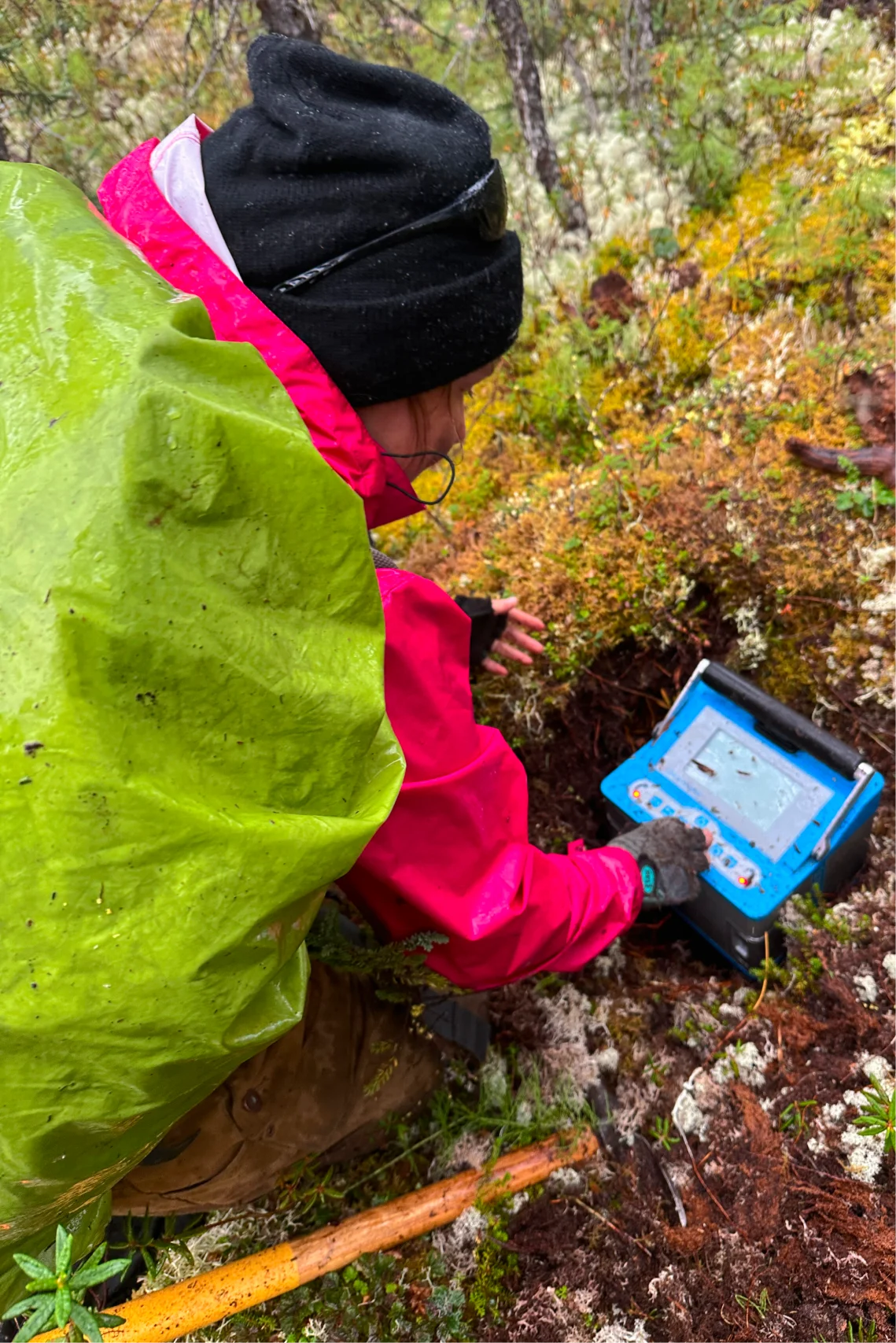
At the picket we looked for a convenient site to take measurements. It had to be a rocky surface on which the gravimeter could be placed level. We were not always lucky with an ideal surface, and often we had to dig small holes in wet moss or find at least some soil in the middle of a swamp or stream. In such a place, the gravimeter was unstable, and its micromovements on a soft surface made the measurement very difficult. The operator sat motionless during the measurement, afraid to move again and spoil the measurement.
The main quality criterion is that three measurements taken in a row should not differ from each other by more than 15 µGal. If the difference was greater, we repeated measurements or looked for another, more convenient site nearby.
Find out the location down to the centimeter
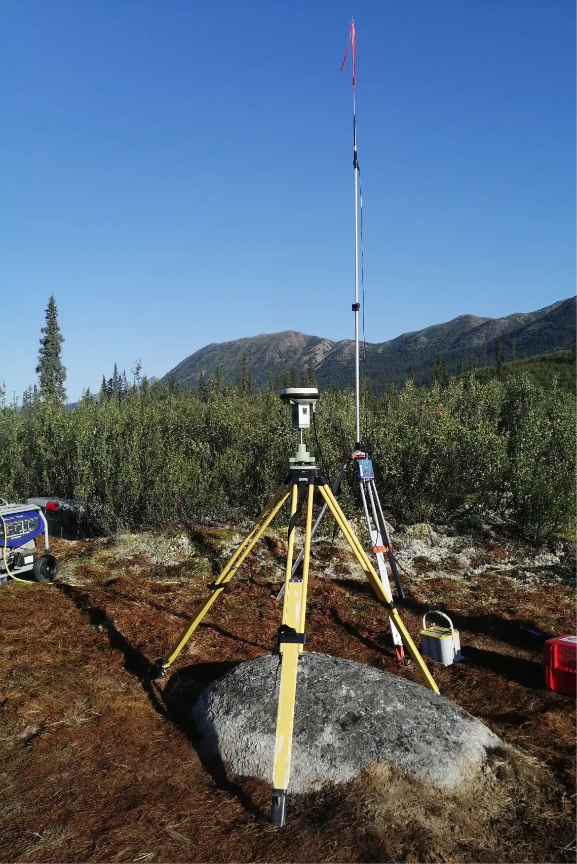
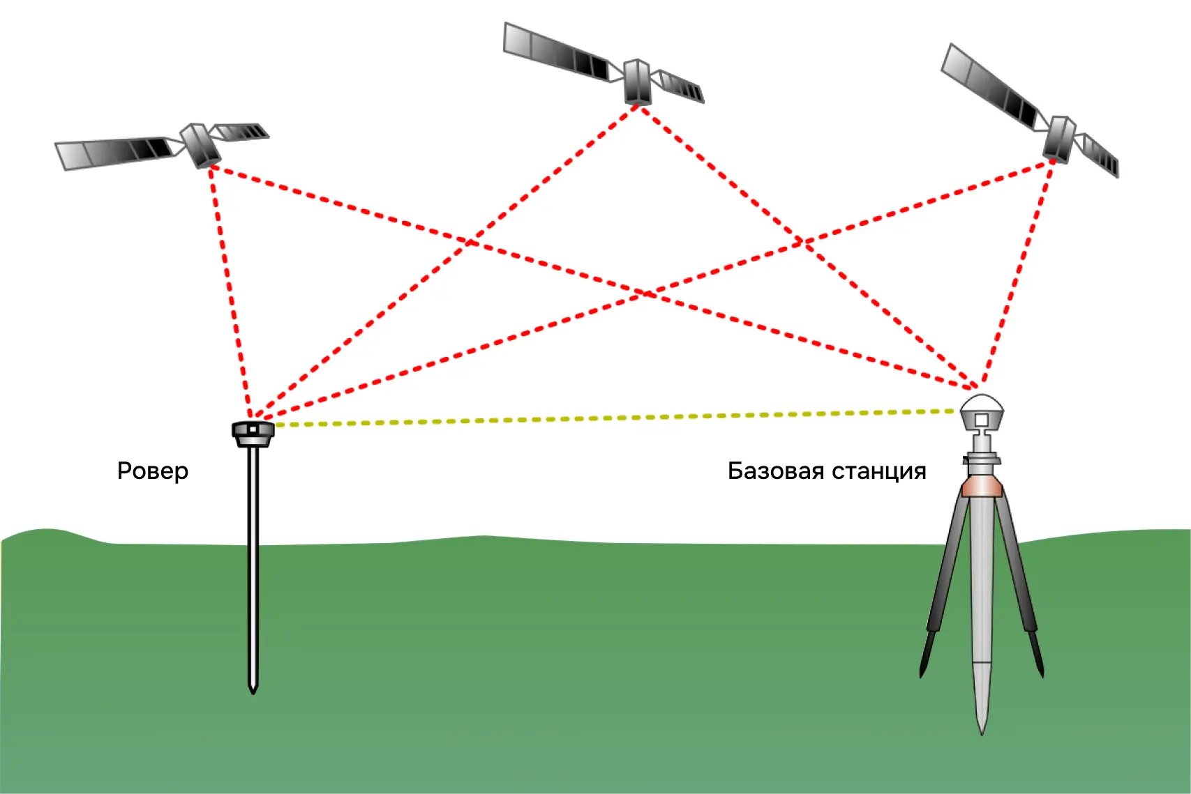
Along with measuring gravity, we recorded the coordinates of the picket. For each picket, we needed to know the location and altitude above sea level with an accuracy of 1 centimeter in order to correctly correct the observed field. A regular GPS navigator cannot boast of this, because its absolute accuracy is about 2 meters. What to do, how to achieve the required accuracy?
If you take two GNSS (Navigation Satellite System) receivers and place them next to each other, both receivers will have the same 2 meter error in one direction discussed above. This is a standard GNSS error. Thanks to this feature, it is possible to calculate the relative distance between receivers with an accuracy of 1 centimeter. So we still have an absolute error of 2 meters, but a relative accuracy of only 1 centimeter.
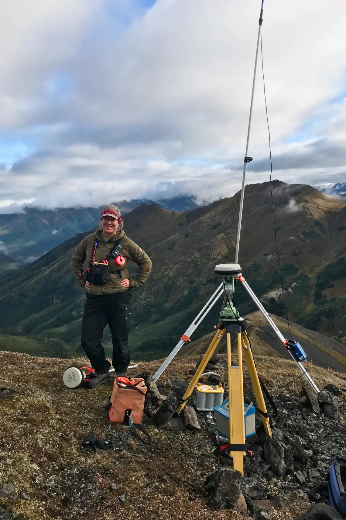
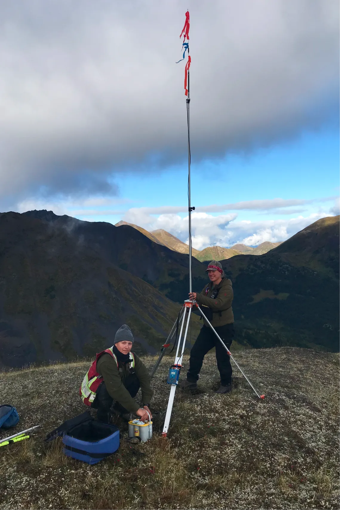
Next, we install one of the two GNSS receivers in a fixed location where the coordinates are known to within a centimeter, for example, at a geodetic point. We now have both absolute and relative accuracy of 1 cm. This technology is called RTK GNSS (Real Time Kinematics), where the static unit is called “Base Station” and the moving unit is called “Rover”.
In the same place where we measured gravity at the base station, we also installed an RTK base station. When there was not enough signal to distant profiles, to the base station, we installed additional repeaters on neighboring ridges.
Home
On average, we managed to take from 16 to 35 measurements per day. Usually we finished measuring at three o’clock in the afternoon and went to the nearest place where a helicopter could land – these were open areas in a river valley, clearings or mountain slopes. It happened that we cut down bushes for a helipad, for this we had saws or machetes in our backpacks.
Then we returned to the camp, but the work did not end there – we needed to take evening measurements from the gravimeter at the base station. Why, isn’t one measurement enough to correlate the gravimeter values with the absolute values of gravity?
The fact is that the gravimeter readings constantly change over time and the morning values will not be equal to the evening ones. This feature of the device is called the displacement of the gravimeter zero point or zero drift. This happens because, under the influence of gravity, the spring inside the gravimeter stretches and the readings “float” to 0.1–0.2 mGal per day. If you do not introduce corrections, you may miss a gravity anomaly whose values are less than the drift.
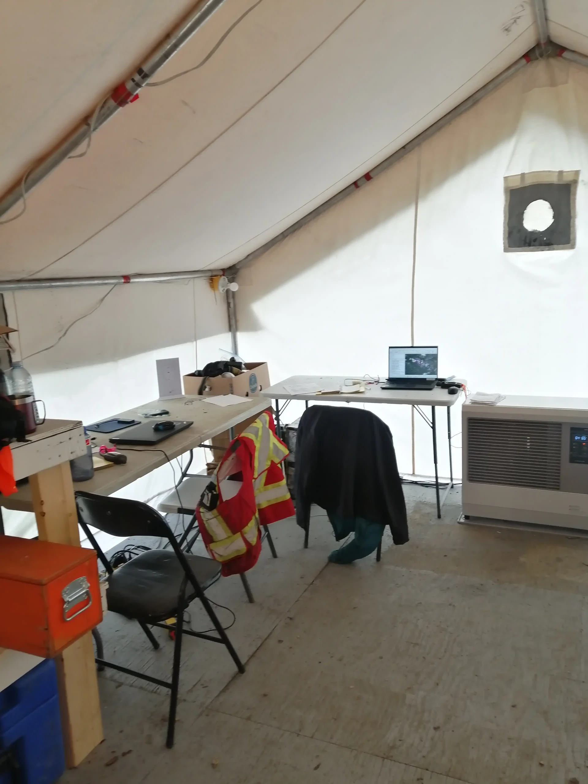
The working day ended after we downloaded the data from the gravimeter and RTK and uploaded the text files to the server for the geophysicists who process them in the office. All that remains is to charge the gravimeter, walkie-talkie, RTK batteries and GPS batteries and finally you can do personal business, for example, call your family or watch YouTube.
Grand Geophysics
Thank you for working with me on gravity reconnaissance and finding out what a typical field day is like. In a word – a boring routine. And now here’s the promised bonus: I suggest you look at our work through the eyes of an artist. If geophysics work had been filmed by Wes Anderson, the creator of The Grand Budapest? My colleagues Zach and Taylor were inspired by the great director and filmed “Grand Geophysics”.