Deposits are becoming deeper, and their geological conditions more complex, necessitating new technologies for their discovery. However, the conversation often ends there: what exactly is meant by “new technologies” is almost never explained. For instance, in geophysics, geologists and subsoil users often develop unrealistic expectations, especially when presented with a “new method” at a conference. Some begin to perceive geophysics as a magic button that will instantly solve all problems. Others, conversely, are convinced that such technologies are unsubstantiated.
In this article, I want to use examples from my work in British Columbia to demonstrate a specific methodology that allows for the investigation of depths up to 1000 meters. The method is based on established principles of electromagnetic surveys but is implemented in a way that overcomes the limitations of classic ground and airborne surveys. I will discuss its physical basis, operational organization, and provide a case study from a known deposit.
Finally, this article will focus not on marketing promises, but on specifics: what exactly lies behind the words “new technologies in geophysics” and how they work in practice.
The Physics That Helps Find Ore
Before delving into practice, let’s briefly return to “school” and recall one of the basic principles of geophysics — electromagnetic surveying. This physical law directly applies to our task: the search for and exploration of mineral deposits.
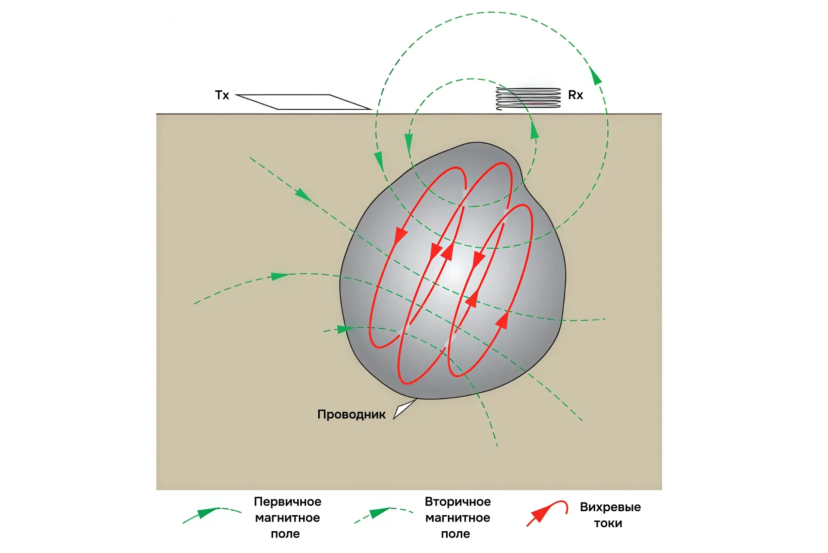
The methodology in question is based on the phenomenon of electromagnetic induction: when a magnetic field changes, an electric field arises—and vice versa. The geophysicist’s task is to orchestrate such field changes that a secondary field is generated in conductors at depth—for example, in massive sulfide bodies—which is then detectable.
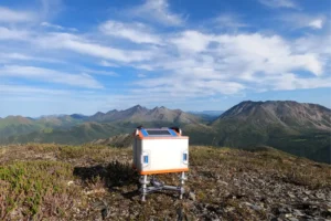
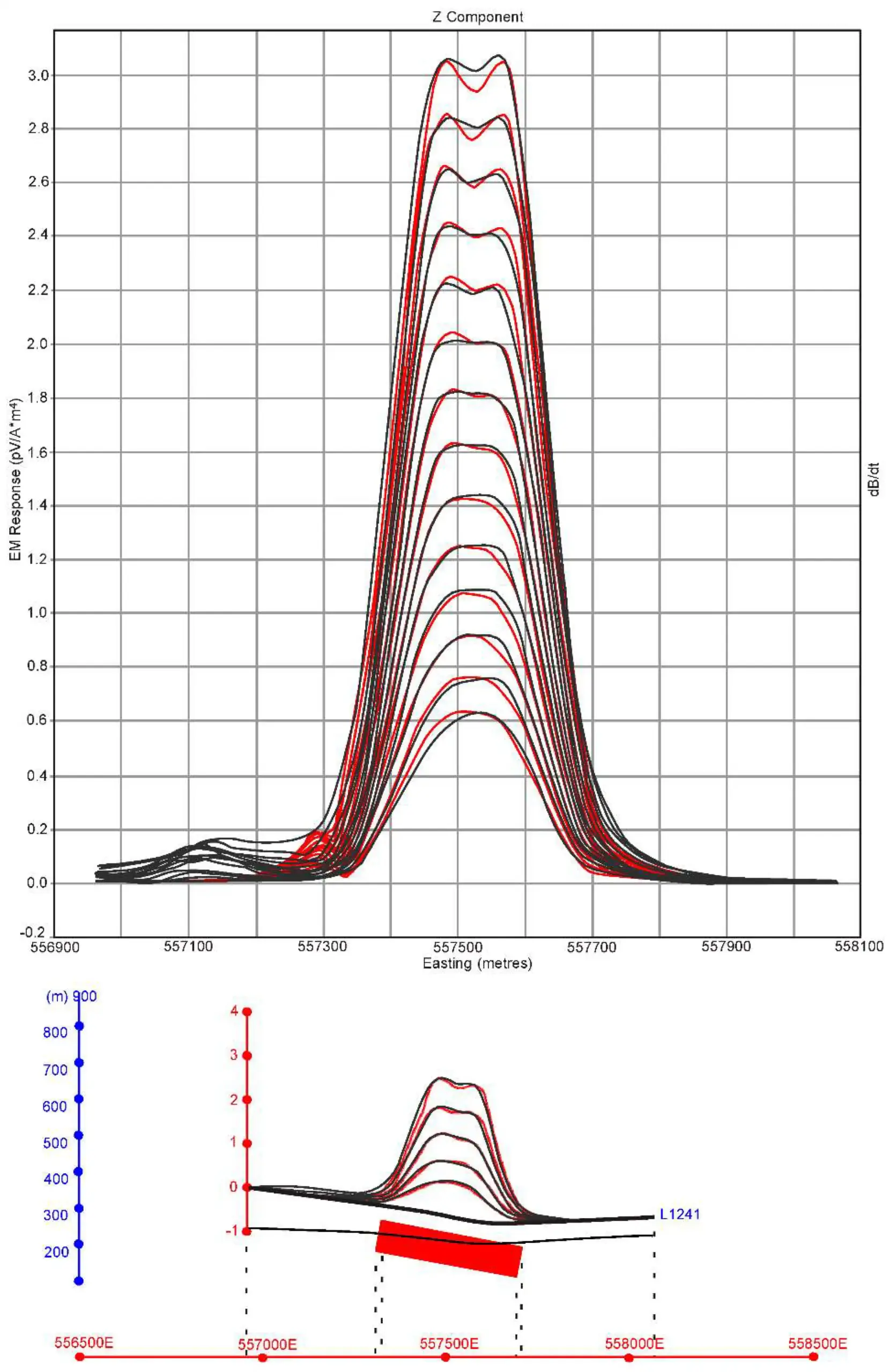
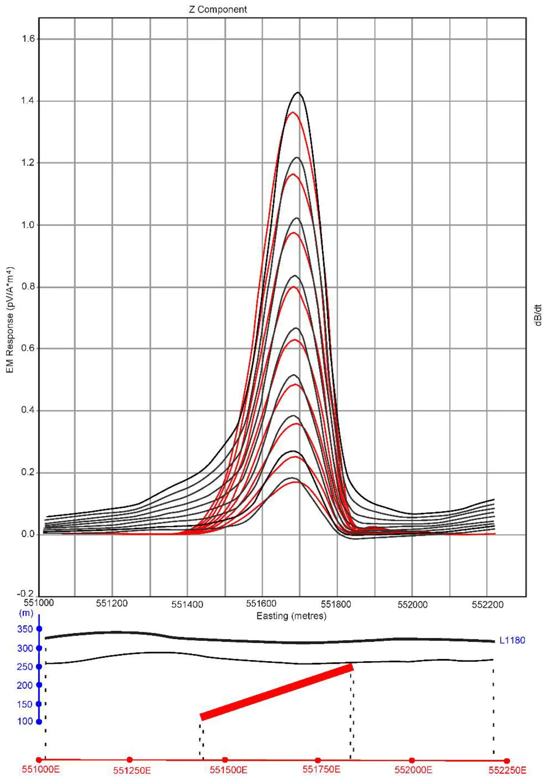
How does this work in practice? A loop is laid out on the ground and connected to a current source. When the current in the loop is abruptly switched off, a rapid change in the magnetic field occurs, inducing eddy currents in the host rocks. These currents create their own—secondary—magnetic field, which is then recorded by the receiver.
The depth of investigation in such a method is determined by several factors. Loop size: the larger it is, the deeper the primary field penetrates, and the deeper the response that can be obtained. Current strength: the higher the current, the stronger the signal and the more reliable its registration. Frequency: the pause after current shutdown determines the time during which decaying responses are recorded, thereby defining the depth of “visibility.”
What Classic Electromagnetic Methods Offer
Electromagnetic (EM) surveys are particularly in demand where other methods are difficult to apply. For example, in rocky areas, scree slopes, or during winter, when it’s impossible to properly ground electrodes for classic electrical resistivity surveys. EM surveys also work well when conductors—massive sulfide ores—are expected in the subsurface.
Two operational approaches are possible here. The first is ground-based: the loop is laid out on the surface, and measurements are taken nearby. This provides a good signal and depth of investigation but requires significant physical effort and severely limits work speed. The second is airborne: equipment is lifted by helicopter, allowing hundreds of linear kilometers to be surveyed in a single flight. However, the loop size in this case is limited to tens of meters, and the depth is usually no more than 150–200 m.
Both approaches are effective and still used today, each for its specific task. However, the main drawback of the ground-based method is its laboriousness and low productivity, while aerogeophysics suffers from limited depth penetration. This is precisely why a new method emerged, combining the advantages of both approaches while overcoming their limitations.
A New Approach: Airborne Speed and Ground-Based Depth
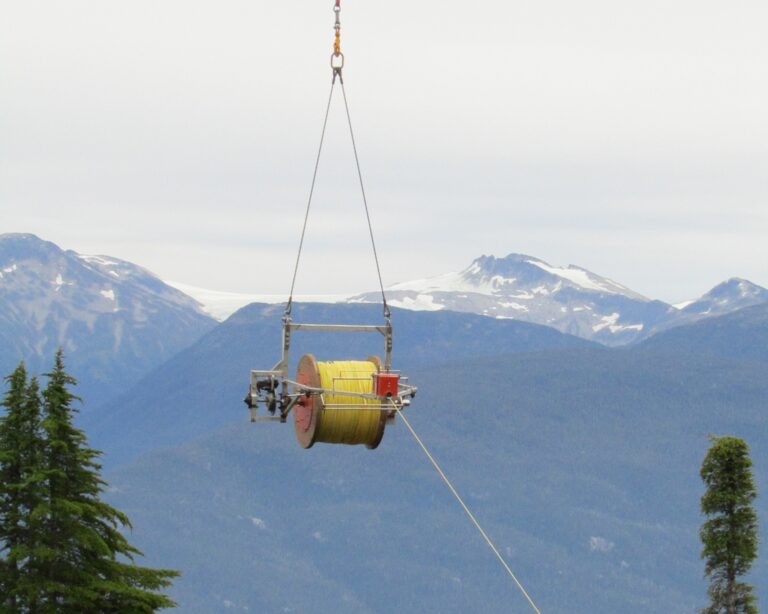
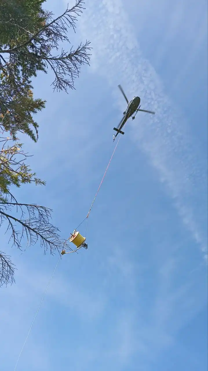
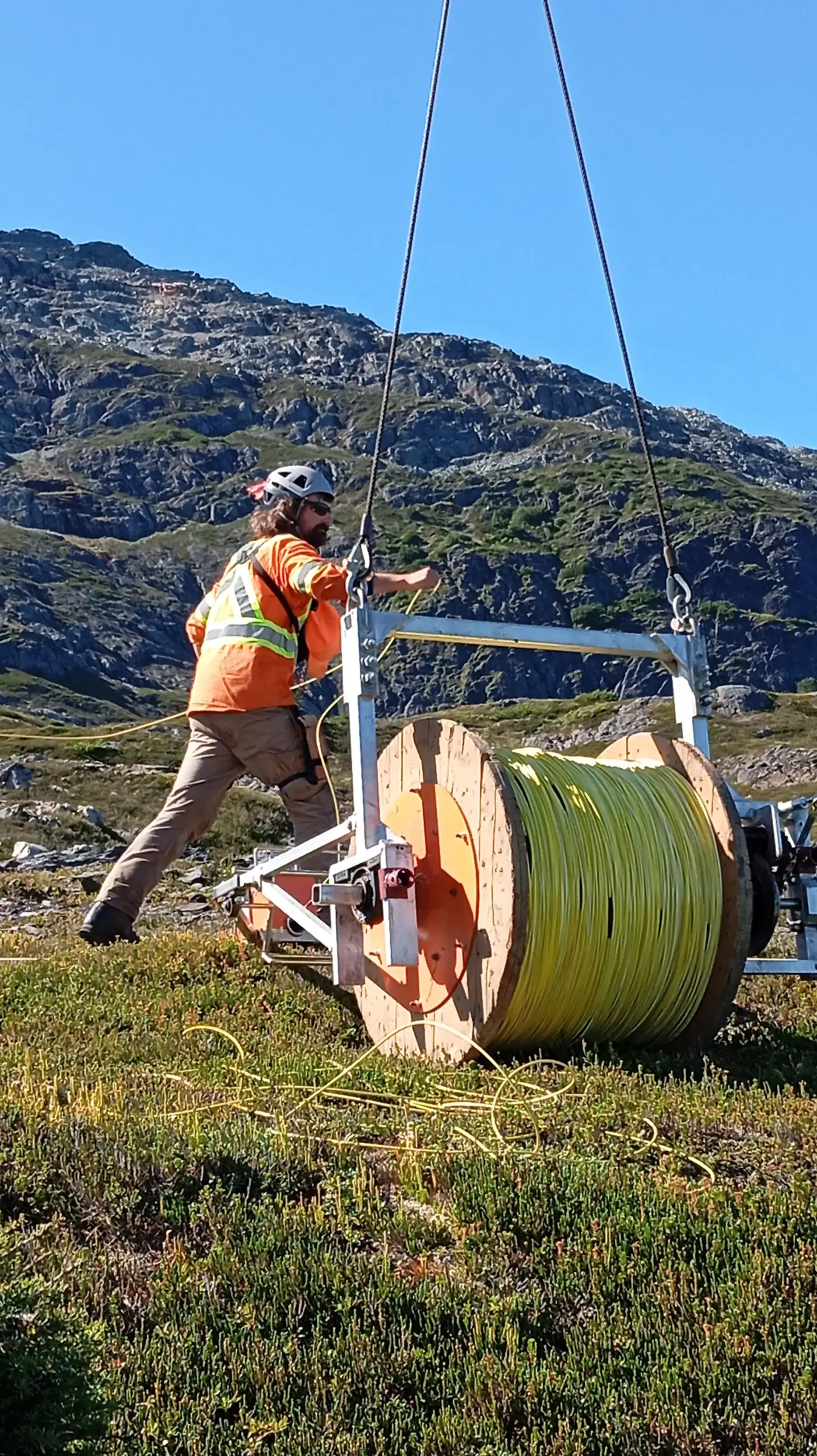
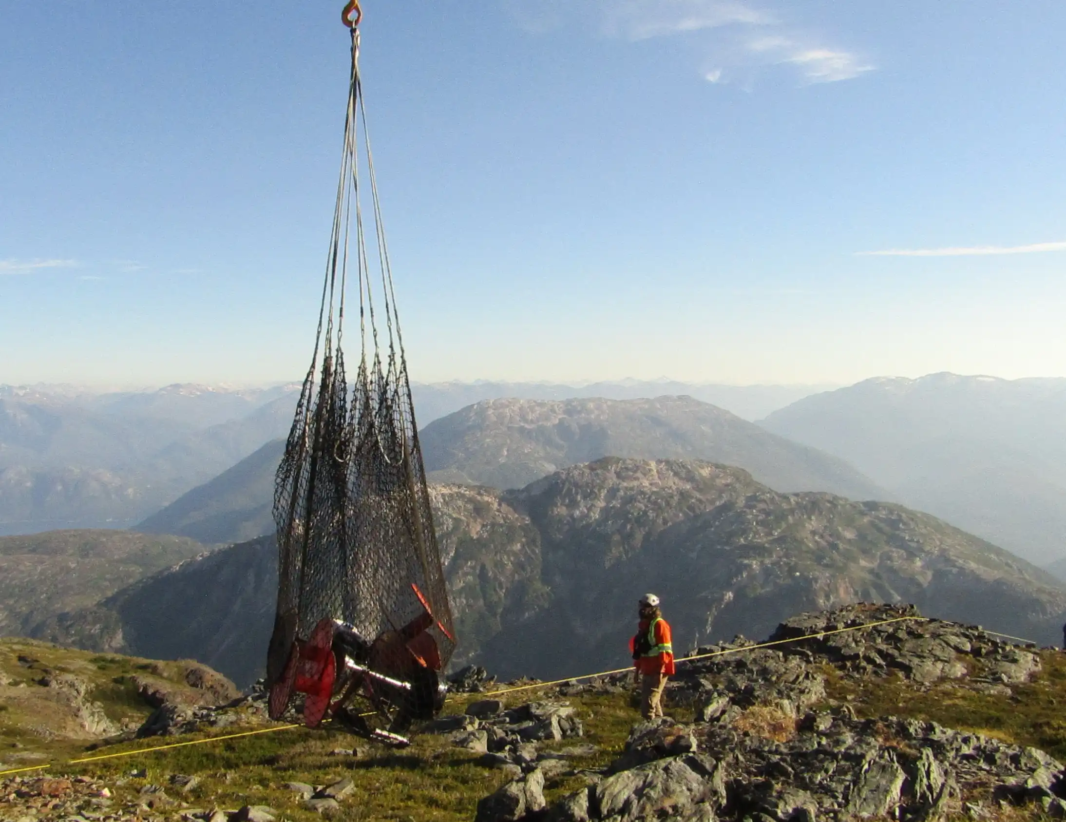
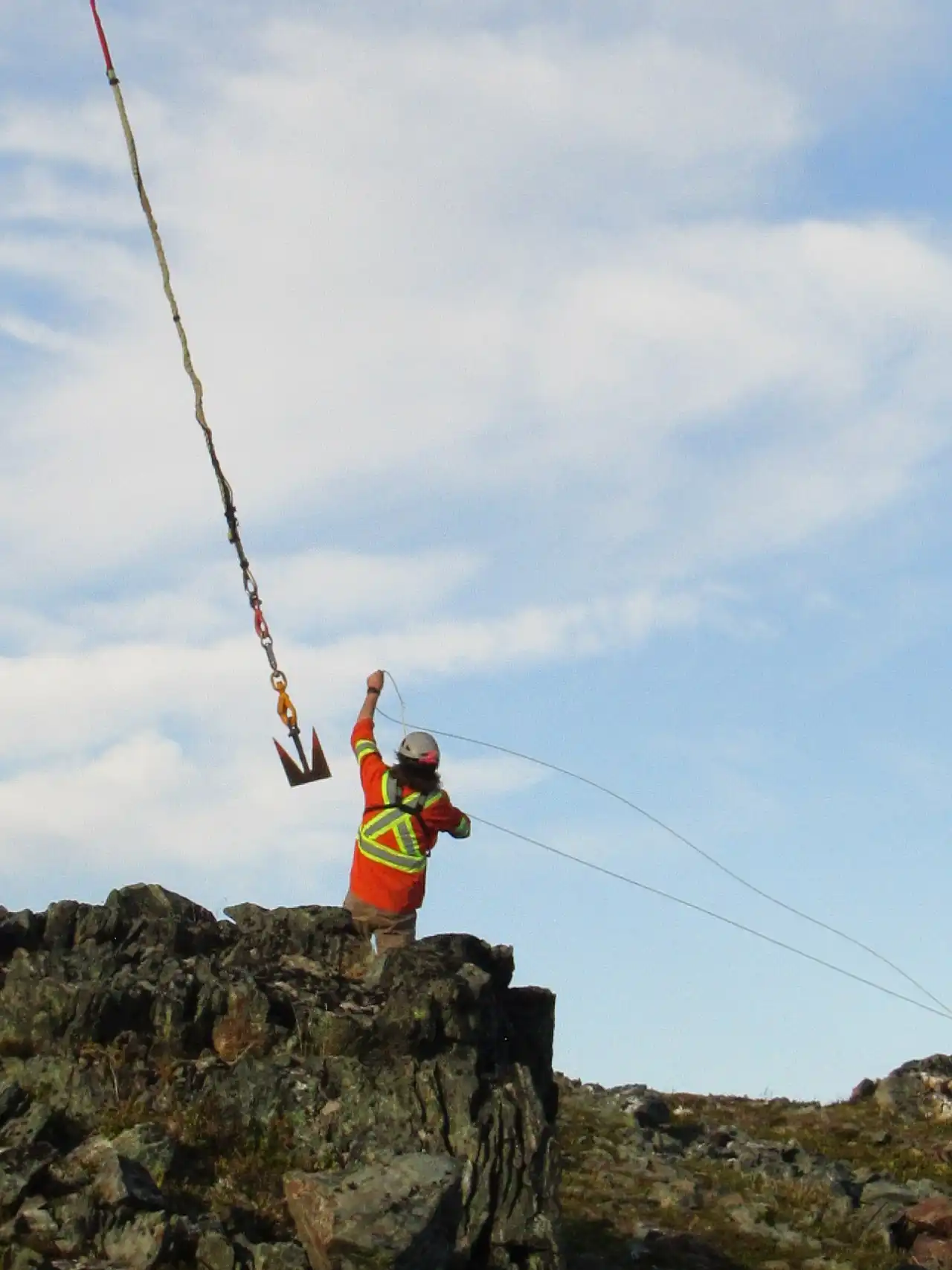
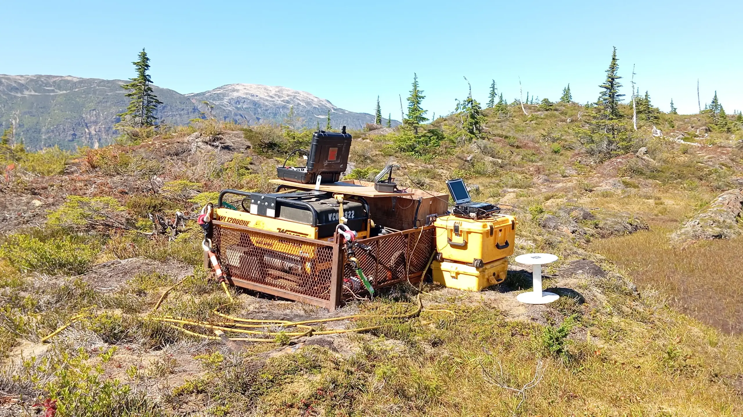
This is where the new approach—the HeliSAM method—comes in. It combines the speed of aerogeophysics with the depth of ground-based surveys, eliminating the weaknesses of each. How does it work? First, a helicopter lays out a large transmitting loop on the ground, through which current is pulsed with pauses. Unlike classic airborne electromagnetic surveys, where loop size is limited to tens of meters, here kilometer-scale loops are used—for example, 1×1 km or even 2×2 km. Laying such a loop takes about 40 minutes. After this, the helicopter takes off for the survey.
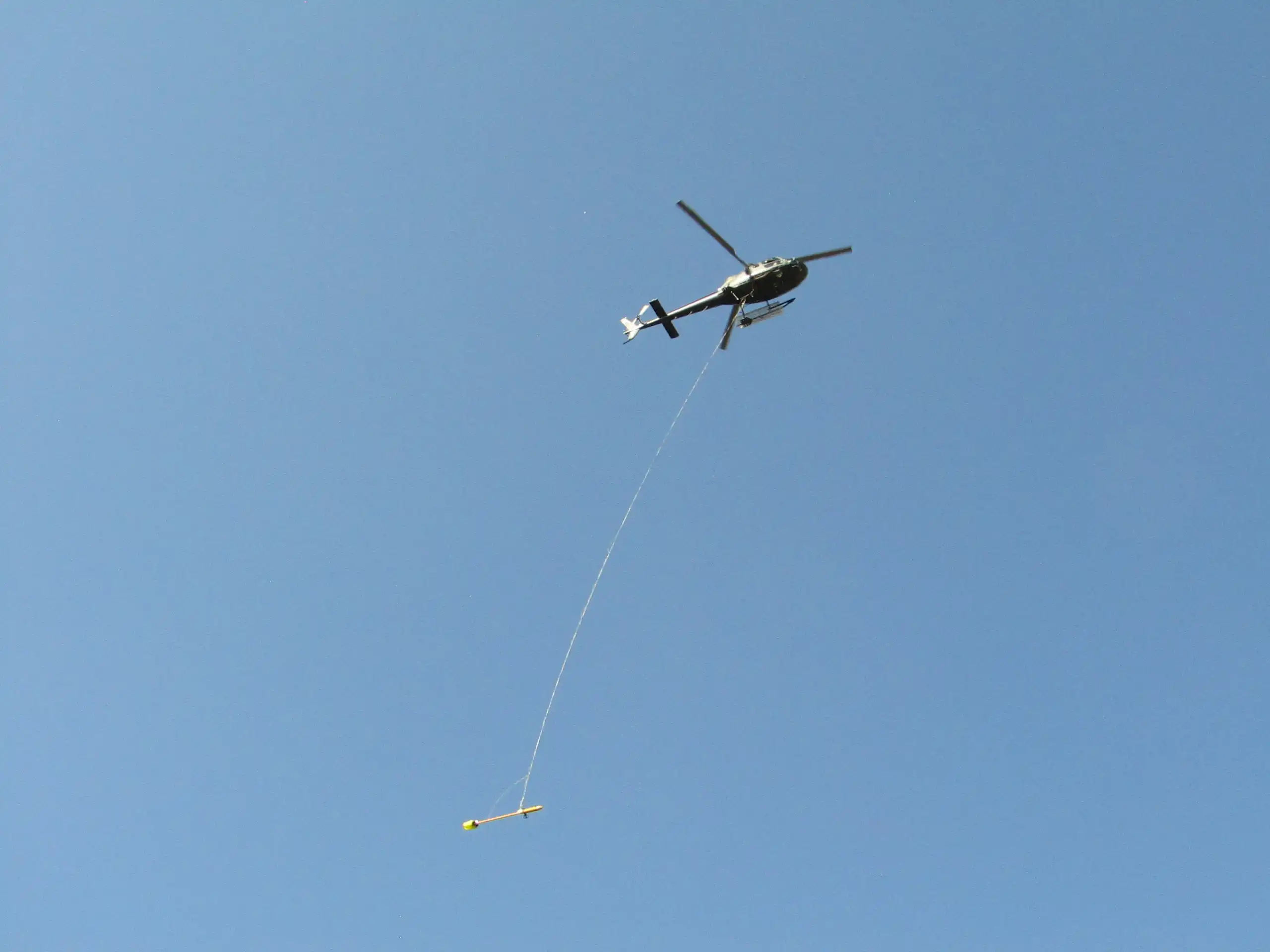
The survey is performed using a magnetic sensor suspended on a 30–50 meter cable, flying approximately 30 m above the ground. In geophysical practice, this sensor is called a “bird.” It is a quantum magnetometer that records changes in magnetic and electromagnetic fields; signals from it are transmitted via cable to a receiver installed in the helicopter itself. The magnetometer’s operation is based on the oscillations of cesium atoms, ensuring very high sensitivity.
This arrangement eliminates interference from the helicopter itself and allows measurements to be taken as close to the surface as possible. The magnetometer records tens of thousands of values per second, and then the data are averaged into uniform intervals: approximately every 5 m for magnetic measurements and about 20 m for electromagnetic channels.
For those unfamiliar with geophysics, this can be compared to a ground survey where a geophysicist manually takes measurements at the same distances. The detail of the results is comparable to “manual” work, but they are collected at helicopter flight speed and over large areas.
As a result, we achieve the productivity of aerogeophysics—tens and hundreds of kilometers of profiles per day—and the depth of ground-based systems. The method allows for mapping conductive bodies at depths of up to 1000 m.
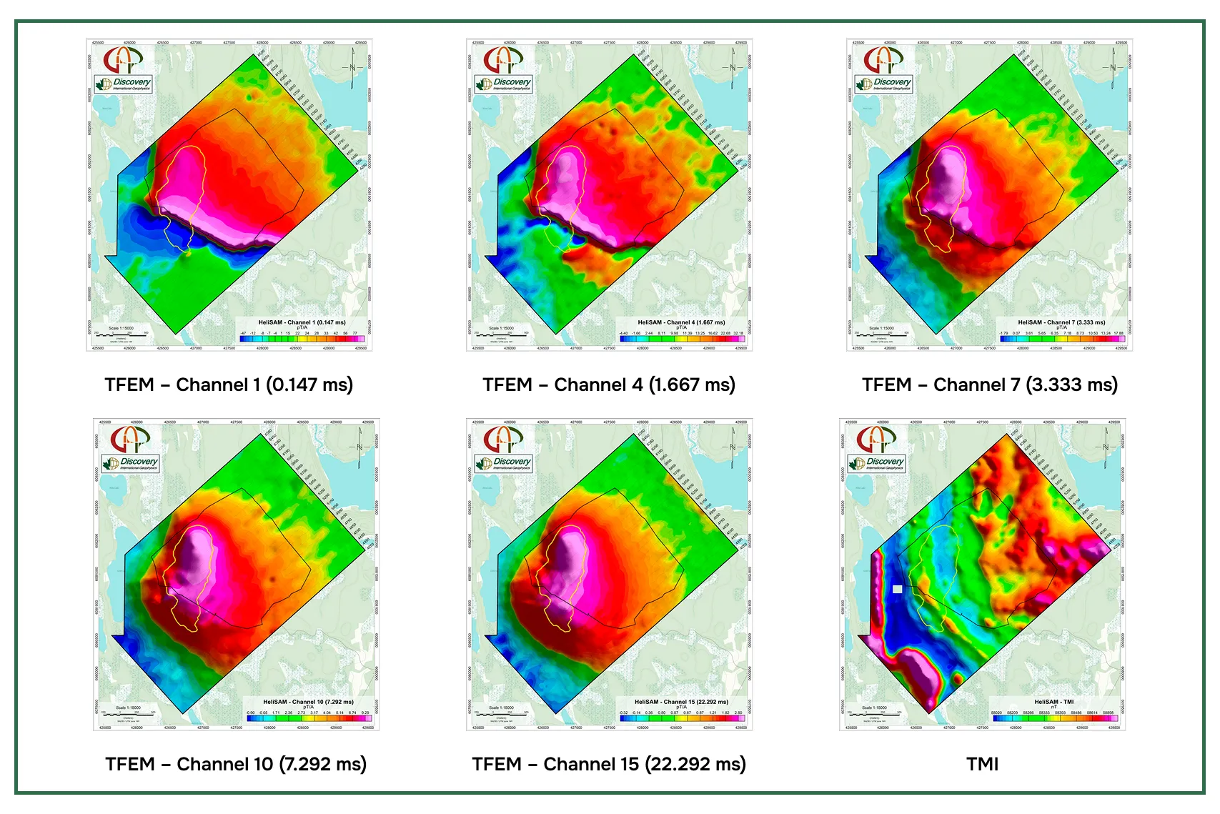
How does this work at a real deposit? Let’s look at a case study from the Lalor volcanogenic massive sulfide (VMS) deposit in Manitoba, Canada.
Case Study: Lalor VMS Deposit, Canada
The Lalor deposit is located in Manitoba and is known for its copper-zinc-gold mineralization. Its ore bodies are situated at depths of 700–1000 m and were discovered in 2007 using ground-based electromagnetic surveys.
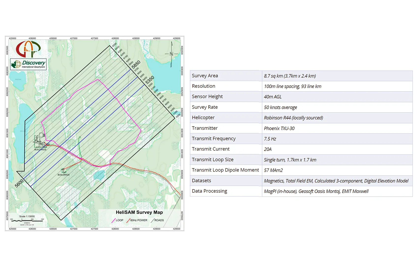
To test the HeliSAM methodology, a large transmitting loop of approximately 1.7 × 1.7 km was deployed. Deployment took less than an hour. The helicopter performed flights with a suspended sensor—the so-called “bird,” which houses a quantum magnetometer. The flight altitude was around 30–40 m above the surface, and the cable length was 30–50 m.
In a single flight, data were collected along profiles totaling approximately 93 km. The sampling interval was about 5 m for magnetic measurements and 20 m for electromagnetic measurements. This is comparable to the detail of a ground survey, but the coverage area was tens of times larger.
The results showed an anomaly coinciding with the known ore body. A response corresponding to the mineralized body at a depth of up to one kilometer was observed on the time channels. Additional modeling allowed for refining the size and orientation of the conductor, and these parameters matched the geological data.
Thus, the method confirmed its ability to map conductive bodies at depths typically considered unattainable for aerogeophysics.
How to Distinguish Promises from Working Technologies
The geophysical services market still has plenty of “magic boxes” and grand promises. It’s easy to make a mistake in such a situation—and that’s normal. Geologists and investors are not obligated to understand the intricacies of sensors or the nuances of signal processing. But precisely for this reason, it’s important to have simple guidelines for distinguishing a working method from an attractive gimmick.
New technologies in geophysics do not arise from unknown physical effects. They evolve through already proven principles—via new generations of sensors, more advanced instruments, and modern processing algorithms. Each new gravimeter detects small field changes better than the previous one. The same applies to magnetometers and electromagnetic systems: they allow for recording weaker signals or extracting useful signals from noise. Interpretation has also advanced: artificial intelligence and specialized software transform an “anomaly spot” into a body model with specific dimensions and depth.
Therefore, the main advice for those choosing a methodology is: do not expect miracles from a trendy name. Start with geology: determine the type of deposit, the conditions of ore body occurrence, and their physical properties. It is important to understand how these properties differ from the host rocks—conductivity, magnetic susceptibility, density. This should determine the choice of geophysical method. If it’s about massive sulfides at depths of 500–1000 m, as in my project in British Columbia, then it makes sense to use a deep and more expensive helicopter-borne method. But if the goal is shallow horizons, completely different solutions will be appropriate.
Another important criterion is transparency and practical application. A reputable contractor should be able to demonstrate where the method has already been applied and what results it yielded. It should be clear that the company possesses the equipment, specialists, and software for data processing and interpretation.
I would add: for me, this was a unique opportunity—to work with HeliSAM, a system that only recently entered the market in 2022. It showed how geophysics is evolving: not just in software and algorithms, but also in hardware, in the organization of field operations, and in the methodology itself. And this development opens new horizons for finding deposits that seemed unattainable just ten years ago.
The material was prepared with the support of the Russian Ministry of Education and Science within the framework of the Decade of Science and Technology.