Almost no new deposits are appearing. The state has reduced geological exploration to a minimum, and juniors have not received conditions to enter the industry. All responsibility fell on the mining companies. It is they who are looking for promising areas today – with their own money, without guarantees, without the right to even take a sample without a license. Equipment – minimum, bureaucracy – maximum. “We’ll get involved for any money, and then we’ll see” – this is no longer a joke, but a working strategy. Soon business will have to not only look for, but also train personnel, finance science and bear everything else. For now there is no other way out.
What to do about it? What solutions are possible if everything – from the first tests to specialized education – falls on the shoulders of the business? On conference “Current problems of exploratory geology” Tamara Golovina, Head of the Directorate of Technologies and Joint Projects at Polymetal Management JSC, told how the company builds exploration in such conditions: what tools they use, where they find growth points – and what needs to be changed for the industry to continue to operate and develop.
“The resource of old Soviet fields is close to complete exhaustion – and not only for oil and gas, but also for metal ores. The situation with rare earth metals is catastrophic: there are a lot of them in the depths, but we haven’t even started to develop them yet.”
Nikita Maslennikov, leading expert at the Center for Political Technologies
Source: MK, 12.09.2024
When there are no new areas: how companies build geological exploration themselves
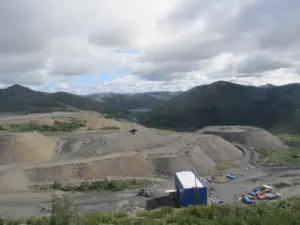
When the industry was left without support, mining companies had to take on everything from field work to analytics and training. Polymetal is one of the few that not only continues exploration, but also achieves tangible growth. Over 24 years, the company has put on its balance sheet almost 500 tons of gold and more than 3,000 tons of silver – and all this in regions that are considered to have been studied for a long time: the Urals, the Magadan region, the Far East.
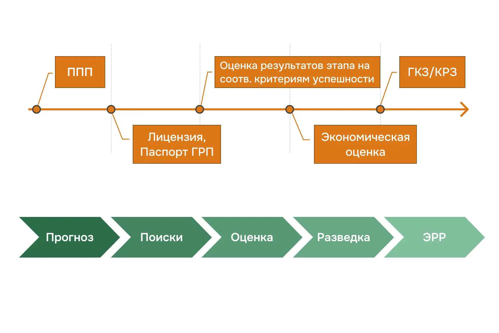
But lucky finds alone won’t get you far. The potential of the “obvious” areas is being exhausted. To be stable replenish the mineral resource base, systematic exploration is needed – not by inspiration, but by plan. Polymetal has built a portfolio forecasting and search projects (PPP) are comprehensive programs that allow you to assess the prospects of sites even before obtaining a license.
PPPs include collection and analysis of geological data, modeling, selection of target zones and preparation for further geological exploration. This approach not only reduces risks – it allows you to build a long-term strategy in conditions when there are almost no new areas for exploration.
What should such projects be like:
- a region where there is already a factory or at least infrastructure;
- favorable structure with potential for key raw materials (gold, polymetals, copper);
- and, finally, the potential of the object itself – either a unique deposit or a modest resource close to processing.
This approach requires clear planning, a team with different competencies and work with data – from stock reports to satellite images. Let’s look at how PPP works in practice: who participates in it, what problems are solved, and what role artificial intelligence (AI) plays.
How a predictive search project works: step by step
In the classical approach, geologists started from a ready-made groundwork: they found traces of old work and immediately began verification. A predictive search project works differently: not from “inheritance”, but from a hypothesis. This is a full-fledged system in which they study the territory, build a model and justify whether it is worth getting a license at all. PPP is an intelligent filter: it helps to weed out unpromising areas in advance and focus on real chances. Here’s how it works in practice:
- Collection, systematization, preparation of data (6–12 months).
Cost: 10–15 million rubles - Creating a digital foundation (6–8 months).
Cost: up to 5 million rubles - Data analysis, identification of promising areas (6–7 months).
Cost: up to 18 million rubles - Obtaining a license – only after all stages.
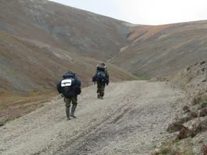
First – the team and the territory
A working group of 10–12 specialists is formed: geologists, geophysics, geochemists, IT analysts, GIS specialists. This is not one area per 10 km², but tens – sometimes hundreds – of thousands of square kilometers in regions with processing capacities and a geologically favorable structure. The team works in a single information circuit until entering the field.
Then – data
At the start, the team collects everything that can be useful: stock reports, geophysics and geochemistry, maps, satellite images, traces of previous work – ditches, pits, plumes. All this is brought into a single format and loaded into the system. There are no “little things” in this work: even one forgotten pit can change the final model.
Connecting AI
When the database is ready, the algorithms are put to work. Machine learning helps build a map of prospects: identify patterns, propose hypotheses that are not obvious at first glance.
AI does not replace a geologist, but works in tandem with him. The specialist checks the model’s proposals, compares them with the invoice, and clarifies the criteria. The output is a map with promising zones.
Site selection and feedback
Out of tens of thousands of square kilometers, a few key zones remain. Based on them, exploration passports are generated: justification, risks, initial data. Next is the licensing stage.
But the project doesn’t end there. When drilling begins, its results are returned to the system: criteria are refined, models are further trained, and approaches are revised. The PPP operates in “feedback” mode—with each cycle the system becomes more accurate.
Economies of scale
One forecasting and search project takes 1.5–3 years and costs about 30 million rubles. This is several times cheaper than field surveys. Thanks to digital tools and AI, Polymetal can launch up to 15 such PPPs per year – quickly, accurately and with minimal risks.
Geological exploration now is no longer a route with a compass. These are analytics, teamwork, digital models and point solutions. This approach makes it possible to find deposits even in places where they had previously given up.
Read more about AI in geology in the material “Intelligent geologist assistant»
What else prevents the discovery of deposits: methodology, personnel, laws
Even if a company is ready to invest in forecasting and prospecting work, this does not always lead to the discovery of new deposits. Why? There are problems at three levels: methodology, personnel, legislation. Let’s look at each of them – briefly, but to the point.
Problem No. 1 is methodological: “Everyone has already been looked for there”
When it comes to searching for new deposits, two objections are most often heard:
– “The Magadan region is well-trodden far and wide”;
– “They’ve been mining in the Urals since Catherine’s times, what should we look for there?”
In practice, it is precisely in these “studied” areas that ore clusters continue to be found. And this is done not by single enthusiasts, but by large companies that use modern analysis methods.
Even in the well-known territories of the Urals, Polymetal discovered a new deposit – Peshchernoye. This happened in 2017, in an area with developed infrastructure and a long geological history. The site was studied in a new way: we moved away from established concepts, added up-to-date data, used satellite imagery and geophysics – and got the result.
“We need to be able to abandon dogma. Often it is enough to reassemble data from different times, add new research and a fresh look to it.”
Tamara Golovina
Today you can search in two ways:
- in traditional mining areas where infrastructure already exists and work can begin quickly;
- or in the so-called “white spots” – unexplored areas where there is a chance to find a unique deposit, but you will have to start everything there from scratch.
Therefore, exploration in known regions is not a fallback, but a strategically sound choice: cheaper, faster and often more productive than starting in an open field.
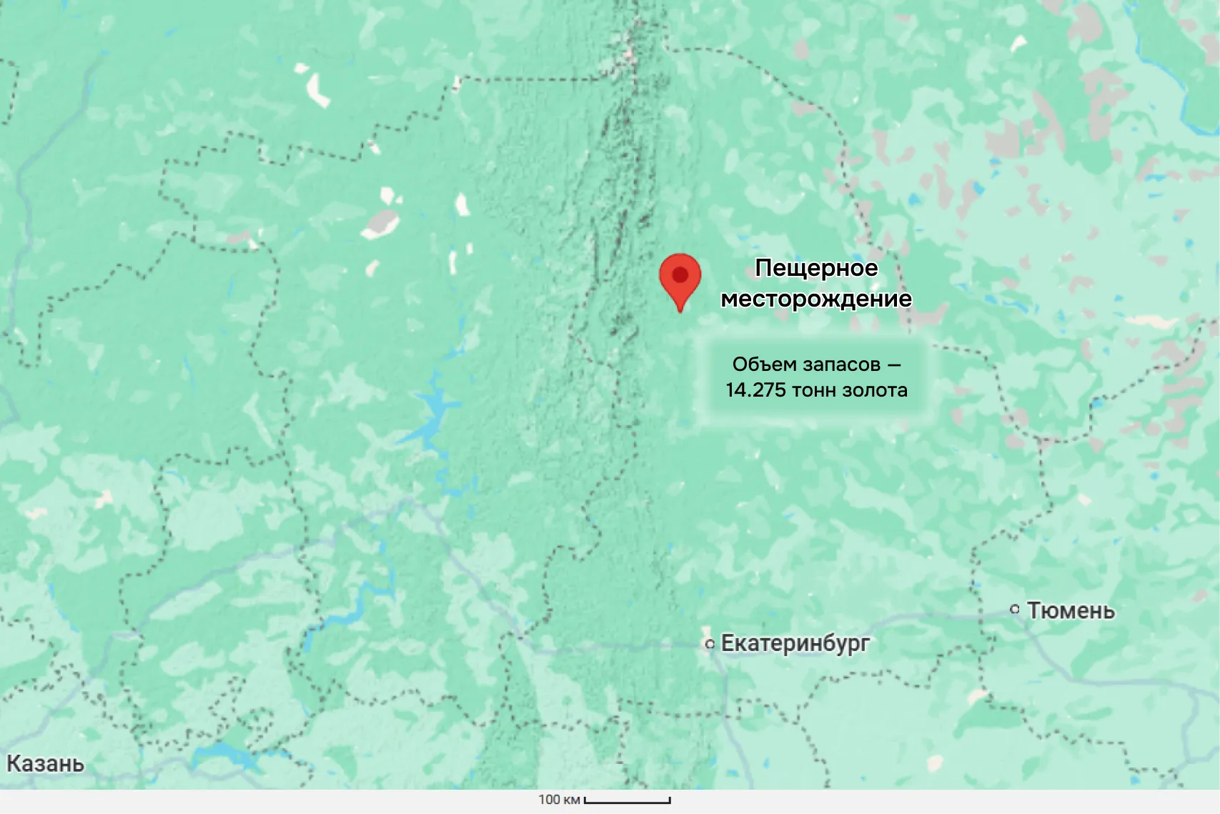
Map source: Google Maps
Search for hidden deposits
The second important methodological problem is search for covered and hidden ore bodies.
“All the methods we use now are aimed at finding what comes to the surface. Very few people know how to work with blocked deposits.”
Tamara Golovina
Polymetal uses the method of modeling mineral systems. This is not a new unique technology – it already exists, but in Russia it is poorly adapted and is almost never used in practice. Why? Science and production follow different rhythms. Even if a method is developed, it is often not designed so that it can be used in the field.
There is a solution:
- adapt the modeling methodology for applied geology;
- formalize it into working protocols and standards;
- implement through cooperation with universities and scientific institutes.
The problem is not a lack of technology – it is that there is still a huge gap between development and implementation

Problem No. 2 – personnel: “There is no one to look with”
The technology is there, the data is there, and financing is possible. But everything will come to a standstill if there are not enough people capable of doing quality work in the fields. This is the second systemic problem of the industry.
“We lack not just geologists, but specialists capable of efficiently performing field and office tasks, working with forecast information, and thinking.”
Tamara Golovina
There are few experienced personnel, and even fewer contractors. Young people are reluctant to enter the profession, and growing your own team is not a quick task. Even if a company is ready to invest in geological exploration, it will not be able to scale up the work until it resolves the issue with people.
How Polymetal deals with this:
- Forms his own teams. Trains young specialists and assembles project teams for specific tasks: geologists, IT analysts, geophysicists work together.
- Creates a pool of reliable contractors. He works with those who have already proven themselves and builds long-term partnerships.
If the team is assembled, you can even go to “white spots”: regions without roads or infrastructure. People are the main thing. Everything else (electricity, equipment, logistics) will follow.
Problem No. 3 – legislative: “You cannot research without a license”
Let’s imagine an ideal situation: geologists go to a promising site, take samples, do magnetization and geochemistry – without drilling, damage to the soil and bureaucratic barriers. Everything is logical: first make sure that the site is promising, and then go to auction.
But in practice this is impossible. Until there is a license, you cannot even legally take a sample. This is the main barrier to the development of PPP: geologists spend millions on preparation “blindly”, resort to legal tricks or do not apply for the site at all.
To solve this problem, Polymetal proposes to introduce a new type of license – short-term, only for preliminary work. Such a license will:
- act up to 500 days to be sure to capture one field season;
- work without a financing agreement;
- permit geophysics, geochemistry, and data analysis at the site;
- limit mining rights, but give a chance to prepare a project;
- will be canceled automatically if the company does not apply for the main license.
This measure would revive the search work, eliminate the “frozen” areas and give juniors a chance to enter the industry without huge costs. A license is not a relaxation, but a development tool: it allows you to open promising areas faster, more honestly and with less risk.
Through thorns to ores: how to discover deposits in new conditions
Forecasting and prospecting projects (PPP) are a new pillar of geological exploration. Without them, it is impossible to replenish the mineral resource base stably. But the introduction of PPP requires not only new data, but also new rules of the game.
Methodological dogmas, personnel shortages, and legislative barriers are what hinder the discovery of deposits. If there is no one to go into the “white spots” with and you can’t even take a sample without a license, then promising areas will remain only on paper.
What will help you move forward:
- synchronous collection and analysis of geological data,
- short-term licenses for the first stages,
- digital intelligence and AI instead of blind searches.
The future lies in technology, and Polymetal proves this in practice. Drones and satellites take on primary reconnaissance. AI and Big Data help identify anomalies and model mineral systems. The geologist becomes a data architect, not just an observer.
“Despite all the difficulties, mining companies will go to prospecting work, regional studies, public-private partnerships – anywhere, because they have factories and people behind them. We are open to cooperation with research organizations in terms of searching for methods and in terms of processing these methods. The format of interaction can be very different. The only question is who will come to whom first.”
Tamara Golovina
Forecasting and prospecting work is not about where to drill. This is about not drilling in vain. What do you think – what is stopping you from looking for new deposits? What solutions would you suggest? Write in the comments and we’ll discuss.