Most of the large and easily accessible deposits have already been explored. Simple methods – find a magnetic anomaly or ore outcropping – they are working worse and worse. To discover new deposits, one has to study vast, poorly studied territories and take into account dozens of heterogeneous characteristics: from geophysics and geochemistry to old reports. The volume of information is becoming prohibitive – such arrays can no longer be analyzed manually.
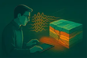
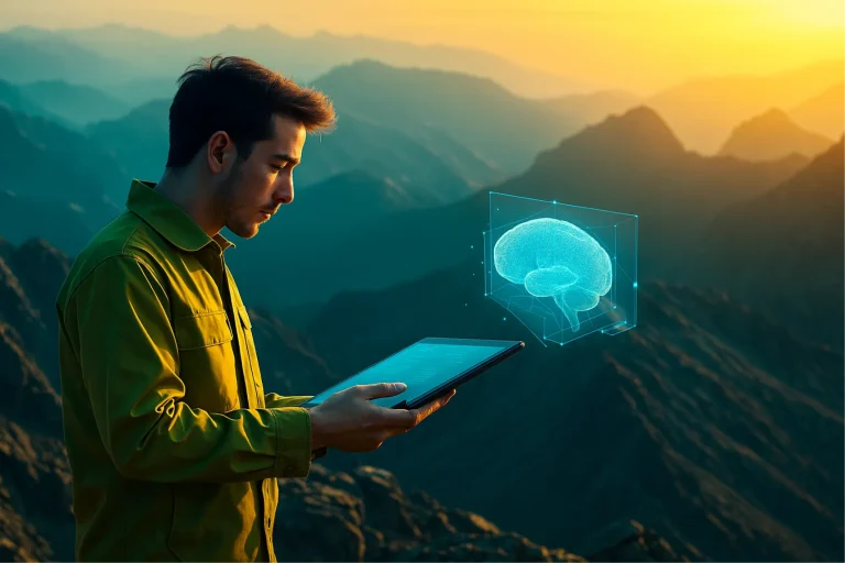
When there is too much data, the neural network takes over. Geophysicist Andrey Karamyshev explains how neural networks help search for ore. He shows how to make AI work for the geologist, rather than draw beautiful but useless maps.
Why AI can do things that humans can’t
Imagine that you are an interpretive geophysicist. Before you are dozens of maps: gravity, magnetic, geochemistry, many transformants calculated from the original fields. To find patterns, you turn on the layers one by one, try to remember what happened on the previous one, and compare where anomalies intersect, where structures are repeated. What if there are ten such cards? What if it’s a hundred? Previously, this is how they worked: on the screen there is one field, in the head there is synthesis. This was called “visual analysis” or even “optical information synthesis.” But as the volume of data grows, this approach stops working: the brain simply cannot cope. And here a new tool appears – neural network.
To highlight promising areas, the neural network needs to “explain” what exactly it should look for. In geology, this is not a specific deposit, but a set of features that may indicate its presence – faults, intrusions, lithological complexes. All these signs are expressed in geophysical and geochemical data: maps of magnetic and gravitational fields and structural elements.
Convolutional neural networks (CNNs) are a type of machine learning algorithm that is particularly suitable for analyzing such spatial data. They work with sets of layers—like maps—and use sliding filters (convolution kernels) to recognize patterns: where the desired objects are, how they are connected, and what their outlines look like. Unlike classical statistical methods that look for connections between numbers, CNNs work with “geometry” – the location, shape, relative position of features. Therefore, they are well suited for exploration tasks where spatial relationships are important.
How to train a neural network correctly
It is best to train a model on numerical data – not on pictures on paper, but on digital images from which the algorithm takes data and converts it into tables with coordinates (x, y, z) in a column and values of features: density, magnetic field, entropy, etc. The main thing is not to overload the network: you don’t need to feed a thousand parameters. 4–5 key features are enough that really reflect geological patterns.
The cleaner the input data and the clearer the statement of the problem, the clearer the result, and the greater the chance that the model will help find something that the geologist himself might have missed.
Why AI is not a black box
To prevent the result of the AI’s work from looking like a set of colored spots “about nothing” to a geologist, the model needs to not only be trained, but also checked to see whether it sees really important signs. As Andrey Karamyshev explains, first the network is trained on known objects – and only after that it is transferred to new regions.
It is important that the search object actually exists in nature, and not just as an abstraction in the head of a specialist and a certain area on the map. A field is not an object, but a model, largely economic. An ore body is an object, but a very small one, practically not reflected in the fields, at least on our scale, so we have to work with indirect signs: intrusions, faults and other parameters
Andrey Karamyshev
This transfer requires additional training. For example, Andrey adapted a model trained on data from Kolyma to the Baltic Shield – the geology there is different, but the model was able to recognize large faults that are not even on official maps. This was possible because the geologist knew exactly what the model was teaching and understood how to interpret the result.
AI can speed up interpretation and narrow the search – but only if an expert formulates the problem and verifies the result. This is not a magic button, but a tool that works in the hands of those who know what they are doing.
15 minutes instead of a month: the neural network takes over the routine
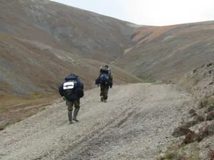
Andrey Karamyshev begins his work with ready-made geophysical data – most often this is aerial photography from recent years or old gravity data that was collected back in Soviet times.
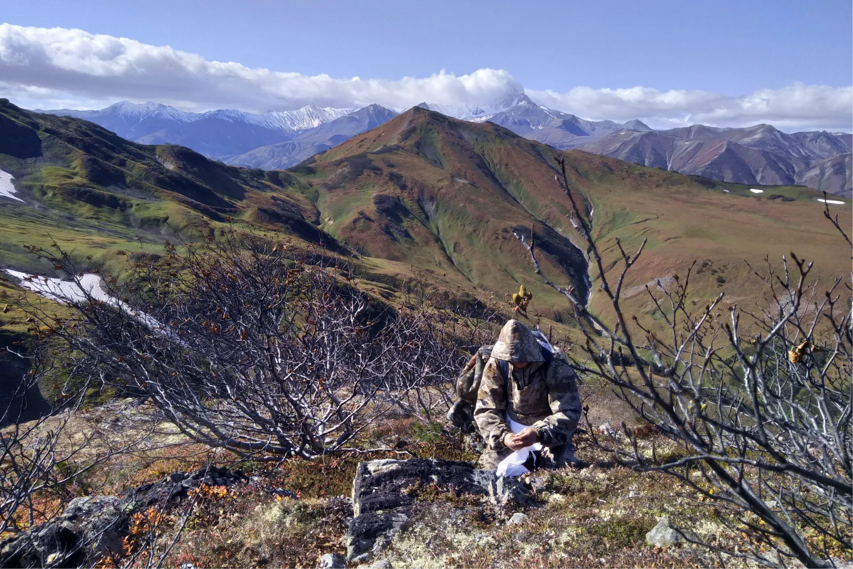
Photo: Mikhail Perebatov
Based on the results of processing, you need to prepare a set of cards and an explanatory note. Specific methods for obtaining results are not prescribed, the main thing is to justify them. You can do it manually, as before – look through the fields with your eyes, highlight anomalies and draw contours. But this takes a long time and is not always effective.
“I could sit for a month and manually trace discontinuities. Because I understand where things are reflected in the fields. But with the model, the result is obtained in 15 minutes. Of course, it still needs to be evaluated and checked to see if it makes sense. But this is a completely different level of speed,”
– says Andrey.
For the model to work meaningfully, it needs to be trained—and not in the abstract, but for a specific geological task. Andrey does this himself, in conjunction with geologists. First, they jointly determine which features are important for a given territory: for example, intrusive massifs, faults, certain lithological formations. These signs are collected from reports, literature and previous experience.
Then comes the data preparation stage. Only those parameters that really make sense are supplied to the model input:
– vertical gradient of the gravitational field,
– entropy (complexity of the field structure),
– local magnetic anomalies,
– the tilt parameter, which shows the tilt of the field,
and others. There is no need to load hundreds of meaningless layers – 4-5 indicators that truly reflect the geological situation are important.
When the model is trained, Andrey compares its results with the manual forecast: do they match? Does the neural network’s output make sense? If everything works, such a model can be saved in a bank and reused. Now he already has dozens of such models for different types of fields and regions – they are easy to load, adapt to a new task and put into operation. How exactly AI helps in the real work of a geologist – we will show in the case of Andrey Karamyshev.
Searching for gold in Kolyma using a neural network
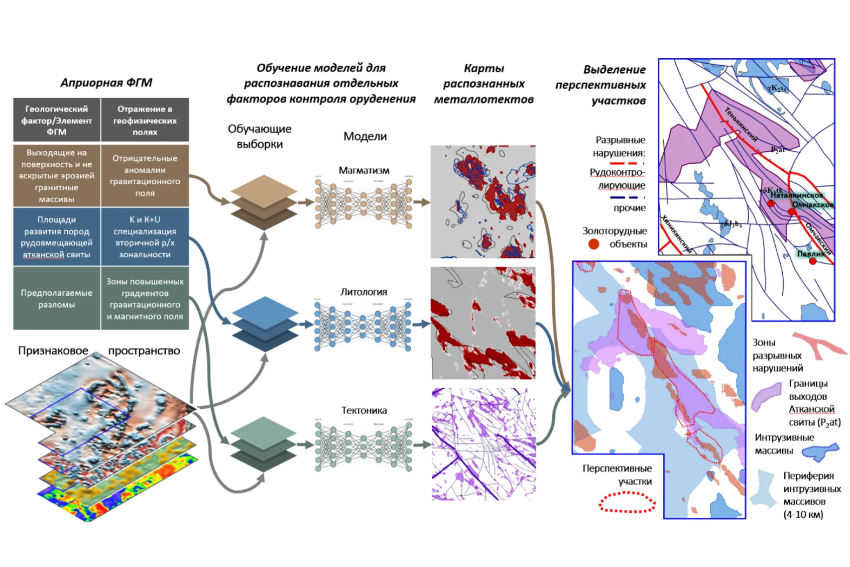
In the Magadan region it was necessary to identify promising areas where there could be gold. In fact, these were experimental and methodological works to test the technology and form a bank of trained models. For their training, a database of geophysical and geological data on the Ayan-Yuryakh and Inyali-Debinsk zones of the Central Kolyma gold mining region was used.
How we collected data and trained the model
As standards – that is, a training example with a known result, which makes it easier to verify the results – selected sections with granitoid intrusive massifs of the Kolyma belt. According to geologists, they control the localization of gold mineralization in the region. There were three classes of standards in total: intrusions, large faults and ore-hosting lithological complexes (Atkan Formation).
For took the geological basis model of the Omchak ore cluster is a conceptual diagram that describes how a node is constructed: what geological structures, rocks and features indicate the presence of gold. An a priori geological and geophysical model helps to understand exactly what features need to be “showed” to the neural network so that it can learn to recognize promising zones. The AI “looks” at what such zones look like in geophysics, geochemistry and geology, in order to then find similar areas in other regions.
In total, 15 sheets of scale 1:200,000 were processed—that’s more than 2.3 million points, described by 35 parameters. For each type of feature (faults, lithology, intrusions, etc.), a separate neural network of the U-Net architecture was used. To increase the training set, we used augmentation – artificial expansion of data using rotations, reflections and noise. This allowed us to increase the amount of training data by 10 times.
Map of promising zones: where to look, and not drill at random
At the output, the neural network generated summary maps showing where in the studied area signs characteristic of zones of possible gold mineralization converge. These areas were not taken out of thin air: they were selected based on the analysis of millions of points from real geophysical and geochemical surveys, where the model recognized similarity with a given geological image – not only in individual parameters, but in their combination.
One of the results is that the neural network “recognized” the zone coinciding with the Omchak ore cluster. This confirmed that the model was trained correctly and actually “sees” important features. But the work did not stop there: new areas were also proposed, not previously noted as promising, but visually and structurally close to the standard. An experienced geologist can evaluate these zones no longer as a random “anomaly”, but as a real hypothesis to be tested.
“This is not a map of deposits. This is a map of areas where it’s worth thinking about and checking again,”
– Andrey explains.
Such maps are not a final verdict or automatic advice on “where to drill.” It is a tool for focusing attention. Instead of work the entire territory in a row, you can focus on those areas where the likelihood of success is higher, taking into account the data and logic built into the model. In real-life projects, this saves months of manual work and millions in exploration drilling costs.
Why a neural network is not a navigator for drilling
At first glance, it may seem that everything is simple: you download the data, receive a map, and you immediately know where to drill. But in practice everything is much more complicated. For AI to truly help in geological exploration, you need to take into account three key limitations:
📌 scale,
📌 data format,
📌 semantic statement of the problem.
Let’s look at each of them with examples.
Limitation No. 1. The scale does not scale
Many subsoil users hope that if we have old regional geophysics – even with profiles 500 meters apart – we can simply load it into a neural network, and it will tell us where to drill at the exploration stage. But that’s how it is doesn’t work.
If you move from a regional forecast to the drilling stage, the scope of the study changes. And data at a scale of 1:200,000 for problems at a scale of 1:5,000 or even 1:10,000 is already don’t fit. It’s like building the foundation of a high-rise building based on a sketch from a Google map.
Andrey Karamyshev explains: the neural network can indeed be trained to a different scale – for example, move from analyzing areas of 164 km² to smaller ones – 1×1 kilometer in size. Such fragments are called tiles are square “tiles” of data on which the model searches for signs of ore objects. This is a standard approach: a large array is divided into tiles so that the neural network can record local patterns. But here’s what’s important: the data density within each tile should remain comparable with the one on which the network was trained. If in a regional survey the profile is every kilometer, and at the drilling site you need data every 100–200 m – I’ll have to do a new shoot: ground, airborne geophysical or drone. No amount of AI can compensate for the lack of data.
“The main thing is that inside each tile there are the same number of points as in the original sample. Without this, the model will not work,”
– Andrey emphasizes.
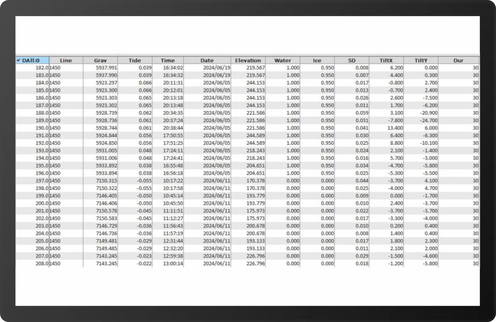
Numbers, not paper pictures: in what format to store data
Even if the shooting is done, this is not enough – it is important in what form is the data saved?. The neural network cannot work with paper; it needs digitized data, preferably .grd matrices. The main thing is that the cells store the values of the measured parameter, and not color codes for visualization.
The algorithm can only process numbers. If the data remains only in the form of rasters, the AI is practically powerless. It is very difficult to manually extract values from there: it is unclear how the interpolation was carried out, what distortions were introduced, and what this picture generally represents.
If you order geophysics or geochemistry – require primary routing data in order to be able to independently construct rasters using a method known to you. This is not a whim, but a necessity. Without databases, you won’t be able to verify that the interpolation is done correctly.
AI of the entire country: beautiful, but useless
Prospectivity maps at a scale of 1:1,000,000 often look spectacular: motley spots, large areas of “high probability”. These cards can be printed out and hung on the wall, and that may be all they are good for.
In practice these cards don’t work. An experienced geologist will look and say: “Well, yes, it’s already known here that gold Yes, we are already developing three deposits here.”
Andrey Karamyshev gives an example: in Australia they generated a map of prospects throughout the country. It showed that gold could be anywhere – including in places that had been well studied for a long time. Such cards are covered with spots, but they do not give an answer, where exactly to drill, and why you need to trust them. Color spots are difficult to evaluate from the point of view of an a priori geological concept.
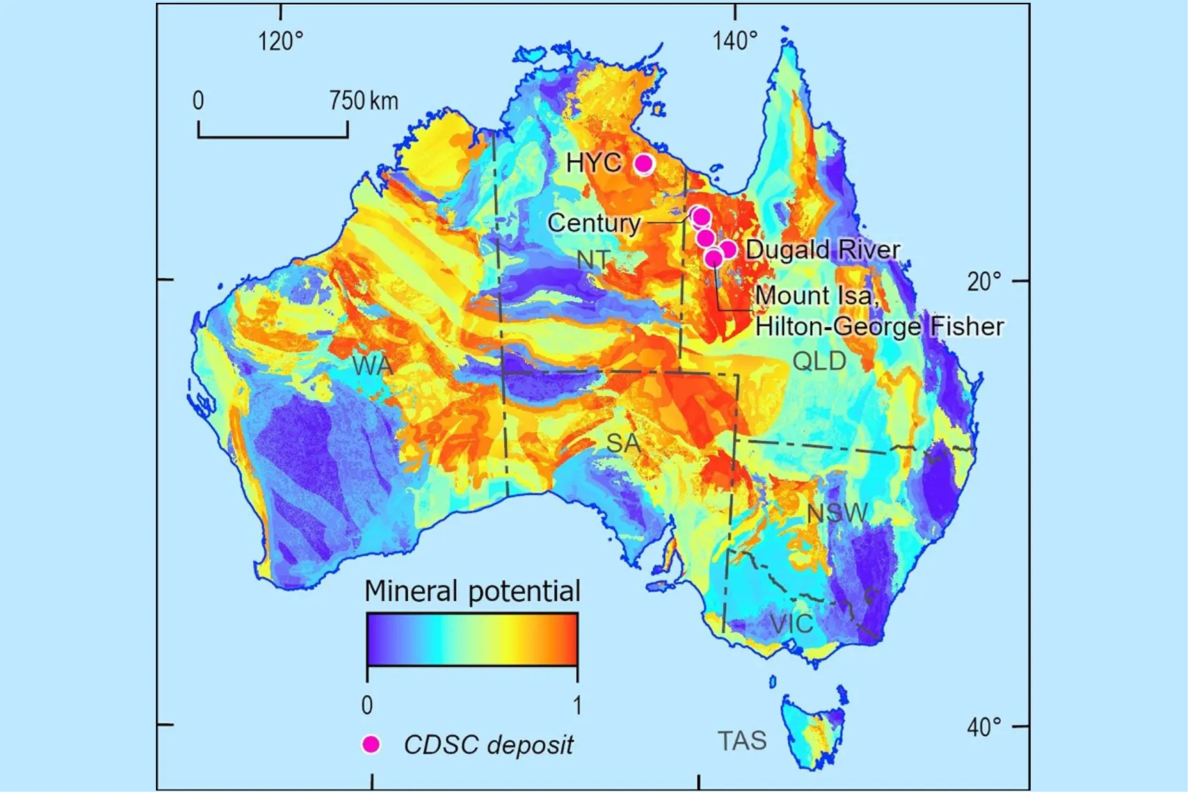
An ore node is not a physical object. This is the concept. It does not have its own reflection in geophysical fields,”
– Andrey explains.
AI cannot predict the deposit head-on. He can suggest an area where the necessary signs converge – but this is always a hypothesis that requires verification and new data on the required scale.
The scale of the map must correspond to the task. If you are planning drilling, the millionth card will not help you. This is an illustration, not a tool.
Who is working with AI in geology – and why this is just the beginning
While AI is being implemented everywhere in other industries, everything is just beginning in geological exploration. So far in Russia there are few teams that systematically implement AI in geological exploration – and impressive results that would be heard are not yet visible. Although cases are increasingly appearing on industry forums – for example, in Polymetal apply machine learning to select promising sites. But there is no common ecosystem yet.
“I started out just like this myself – I just tried it in my free time. And now it is already built into the work process: I use neural networks in projects that require a complex interpretation. Gradually I formed a bank of models that can be adapted for different tasks – not toys, but actually applicable tools.
At conferences I meet colleagues from the Center for the Forecast of Metallogenic Research, from Moscow State University, and from a couple of other institutes. Some are working with self-organizing Kohonen maps, others are trying convolutional networks. But there is no general cooperation yet. Everyone is doing something in their own corner. That is why this topic is so interesting now: there is a market, there is a demand, there are few tools, and even fewer specialists. There’s a lot to do here. We are still at the beginning of our journey.”
Why you need to know more, not less, with AI
AI does not free a geologist from work — it removes the routine: it automates the analysis of maps, finds patterns, and speeds up primary processing. But all interpretation, all decisions and responsibility remain with the person.
To use AI meaningfully, a specialist needs to do more than just be able to “push buttons.” He must understand geological concepts, be familiar with structural geology, tectonics, mineralogy, and speak the language of metallogeny and cause-and-effect relationships. Without this, the algorithm may produce a beautifully designed, but meaningless result – and the geologist will not even notice the catch.
AI is not the path to simplifying the profession. This is learning to see deeper, to think structurally and systematically. If previously you could simply circle an anomaly on the map, now you need to understand what is behind it – and why the algorithm considered it significant.
Just like 50 years ago, geology is not about automation. This is about understanding, the ability to ask the right question and see a real geological pattern in data sets.
To be in the know means to understand and try
The time for “guessing” deposits is over. Deposits become deeper, data becomes larger, errors become more expensive. Today, AI is not an option, but a geologist’s amplifier and insurance against multimillion-dollar losses. But the technology works only in the hands of those who understand what they are doing.
AI doesn’t make decisions – it helps:
- quickly test hypotheses (for example, re-evaluate old sites),
- visualize complex data (from 3D models to anomaly maps),
- focus on the main thing – interpretations, not routine.
The main thing is not to wait for the magic button. AI is not a magic wand, but a tool that requires proper configuration and verification. It will not replace a geologist, but it will make stronger those who are ready to learn and think deeper.
The finished result of interpretation in 15 minutes instead of a month – for some this is already a reality. And for some – the near future. And how do you feel about using AI to find deposits? Do you believe in the potential or do you consider it hype?
We wrote this material with the support of Dmitry Makarov. You too can help our portal and make a small donation.
The material was prepared with the support of the Russian Ministry of Education and Science as part of the Decade of Science and Technology