Deposits are getting deeper, more and more fractured, and overlain by layers of waste rock. There are fewer and fewer familiar “simple” targets, and to still find ore, we have to rely on more sophisticated technologies, including geophysics. At the same time, geophysics itself almost always looks like a black box to the customer. Beautiful sections, anomalies and 3D models appear in reports and presentations, but it is almost never clear how these data were obtained, what these “pictures” are based on and what geophysical equipment is behind them
In this piece, we look at geophysics from the “hardware” side: what are the trends in instrumentation today, and what it all means for subsoil users, geologists and geophysicists themselves. Simply put: what you are actually looking for a deposit with, what the limitations of these tools are and how they will evolve in the coming years.
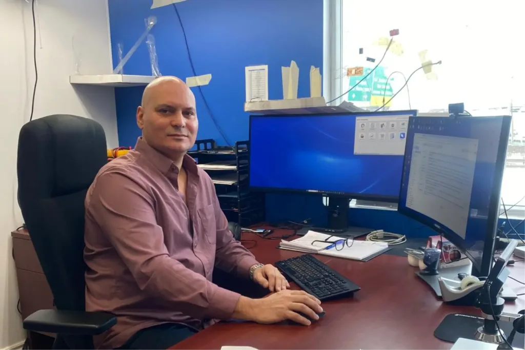
Our editor-in-chief Maria Kostina traveled to Quebec, to the “atelier of geophysical hardware” Instrumentation GDD and talked to the company’s technical director Vladislav Surin, an engineer who has been living at the intersection of physics, electronics and field geophysics for more than twenty years. Using his case study as an example, we will examine how modern geophysical hardware is organized and why it will never be the same.
How geophysical equipment is built
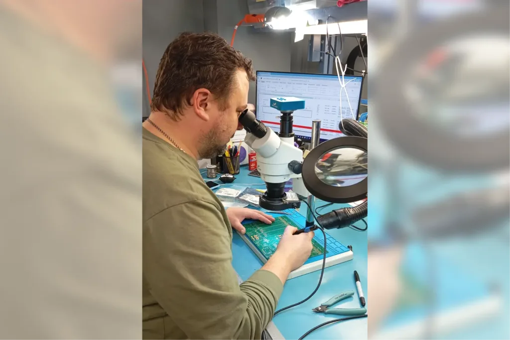
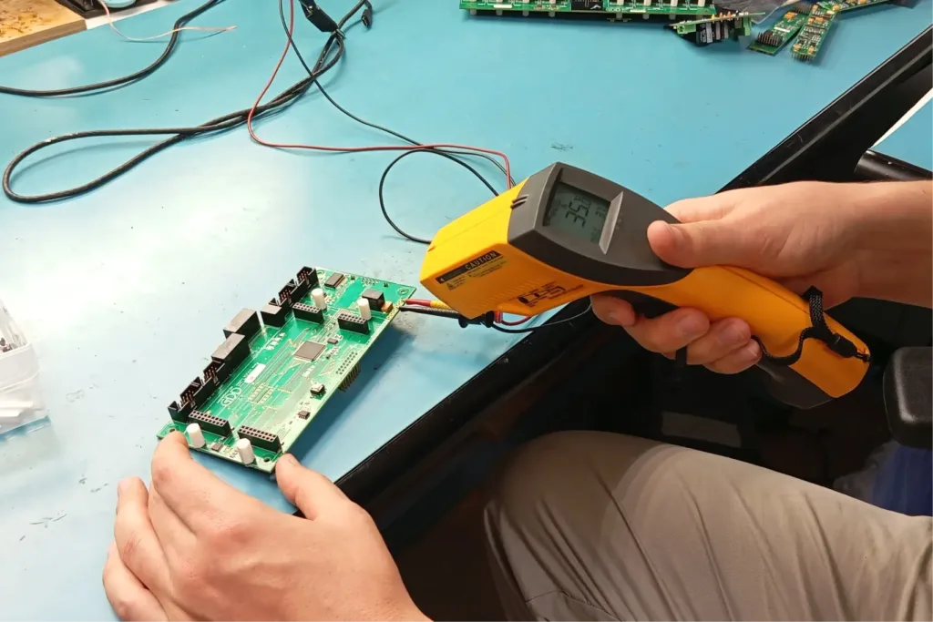
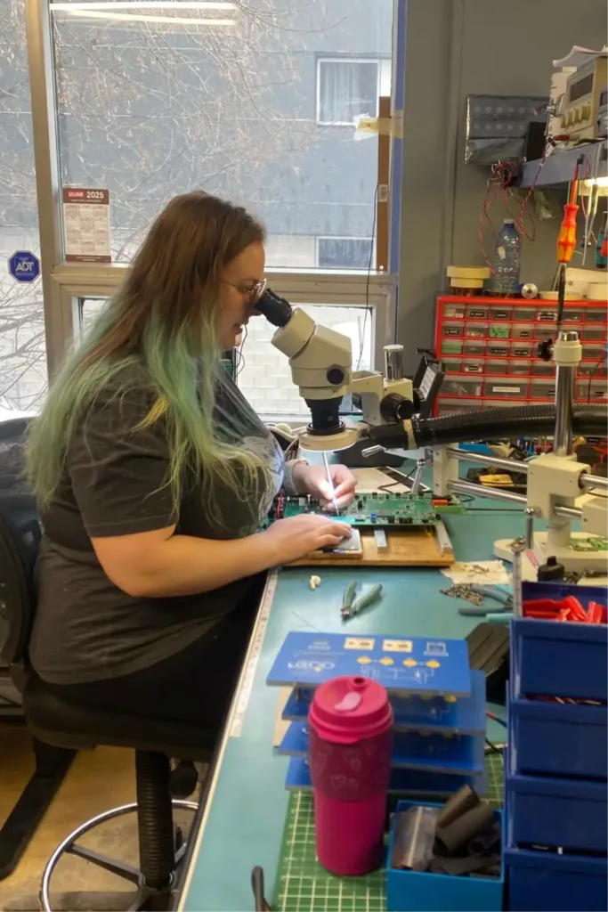
Before we talk about trends and “geophysical” technologies, let’s see how geophysical hardware is made in general. These are not workshops for hundreds of meters or conveyors, as in the automotive industry. Almost all manufacturers of geophysical equipment are small teams, where in the same rooms they invent, assemble, repair and finalize devices for the customers’ tasks.
Instrumentation GDD is just such an example of a “geophysical hardware atelier”. It is a small production facility that lives in an extremely narrow and specialized segment and deliberately does not try to “do everything”. Over the decades, the team has tried different directions – from seismic sensors to related methods – but in the end it has left behind one area in which it has developed consistently and deeply: electrical exploration for ore geology.
There are a lot of methods in geophysics,” explains GDD Technical Director Vladislav Surin. – We have touched and experimented with various things over the years, but in the end we focused on a very narrow niche. This is electrical exploration: resistive methods, electrotomography, induced polarization. And everything around this class of tasks.
In other words, GDD works where geophysics is directly related to the search for ore bodies – conductive, polarizing, often deep objects. Historically, the core of the company has been IP and resistivity systems: electrotomography, classical electrical survey, and induced polarization. On this basis GDD is known to field geophysicists: it was with these instruments that the reputation of the atelier began.
In recent years, the electromagnetic direction has also been actively added. GDD has had meters for EM research for a long time, but, as Vladislav says, for a long time the complex remained incomplete: it lacked its own generator and its own sensors. Now the company is actually assembling a turnkey electromagnetic system – with a ground-based e/p generator, a meter and a new line of sensors. A separate project of compact EM sensors, including those aimed at working with drones, will grow out of this line.
In parallel, the company is looking further towards magnetotellurics, primarily audiomagnetotellurics (AMT). This is a passive electromagnetic method that works on natural fields that arise due to thunderstorm activity and processes in the ionosphere.
“By the nature of the instrumentation, this is a very related field,” says Vladislav. – There are other frequencies there, their own difficulties with hardware, but it is still the same electromagnetic physics. We have long felt that it is close by, and we want to cover these niches as well”. So far, this direction is at the stage of plans and preliminary developments: a tight connection with academic expertise and interpretation is especially important here.
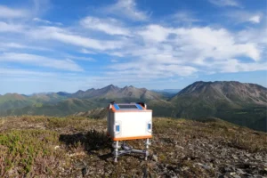
A separate line in GDD’s portfolio is Beep Mat – a device that has long had an almost legendary status within the company and among users. Roughly speaking, it is a “smart metal detector for geologists”: a compact detector that reacts not to dropped rings on the beach, but to ore mineralization, including gold mineralization.
Beep Mat is most often in the hands of geological prospectors, who wander the forest for weeks in search of the first manifestations of ore. For them, it is a personal tool: come to the site, “ping” the outcrops, catch an anomalous response – and you already understand where it makes sense to stay longer. It sounds almost like a dream: a light device that “suggests” where gold may be hiding. But like any instrument, Beep Mat has its own strict limitations – we will talk about them separately further in the text.
In essence, GDD is a small atelier that has been consistently building an ecosystem of electrical exploration tools:
- from EP and resistance to EM methods,
- from large ground-based complexes to compact sensors,
- from active systems to future work with passive fields.
It is within such small production facilities that the technological solutions and trends we will talk about next are born.
Two trends that are changing geophysical hardware
There are two major processes currently taking place in the geophysical industry, which are responsible for the development of new technologies and, consequently, our ability to explore more complex and deeper deposits. On the one hand, the widespread use of electronics in everyday life (smartphones, cars, and IoT) has made it possible to create compact, cost-effective, and field-ready sensors, allowing geophysicists to accomplish more and obtain high-quality data. On the other hand, more and more methods are switching to a passive mode, where we don’t blow up or generate strong currents, but instead listen to the Earth for a long time using sensor networks and gain new knowledge about geology.
How mass electronics “pumped” geophysical hardware
One of the key shifts in geophysical hardware has little to do with “new techniques” per se. It starts with a much more down-to-earth thing – the electronics from which these instruments are assembled. Over the last 10-15 years they have become much cheaper and mass-produced: microcontrollers, ADCs, power and communication modules. Everything that was made for smartphones, cars and IoT (ed. – Internet of Things technology) has suddenly become available to geophysicists.
Many ideas that today look like breakthroughs – drones with EM sensors, passive sensor networks, autonomous compact receivers – were possible at the physics level before. What was lacking was something else: affordable, small-sized, cost-effective, and yet sufficiently accurate hardware.
“We approached all these challenges when we started designing very compact sensors, antennas and autonomous receivers with low power consumption,” Vladislav says. – At some point it became obvious that it was already physically possible to suspend this under a drone. No one dreamed of this before – our receivers were just big boxes.
While in the past, a complex electromagnetic research complex required heavy units, separate power supplies and serious logistics, today the same sensitivity can be packaged in a small autonomous sensor. It weighs less, eats less energy, is easier to transport by helicopter or snowmobile, and, in the future, can actually be lifted into the air by drone.
But there is an important distinction here, which Vladislav separately insists on: geophysics can’t just buy mass-produced electronics at the store.
“The element base makes it possible,” he emphasizes, “but the industrial execution is a separate story.
This is not a story about “assembled from Arduino”, i.e. made a homemade kit on your knees from training boards and wires. A geophysical device lives under very different conditions than a household gadget. It is frost, heat, humidity, vibrations, unstable power supply, interference from generators and power lines, many weeks of work in a break from civilization. That is why inside there are the same class of microcontrollers and converters as in mass electronics, but in industrial version – more expensive, more stable, more reliable. The combination of mass architecture and industrial components makes it possible to make the hardware compact and at the same time field, not laboratory.
In addition to this, another layer is being added that did not exist in working form before – the infrastructure layer. Modern sensors are increasingly being designed as part of a system: with autonomous power supply, memory, communication, data transfer and cloud integration. The device is no longer a black box from which a flash drive is pulled out once a season – it becomes a node in the chain “sensor → communication channel → server → model”.
As a result, several factors coincided today:
- affordable element base, allowing to make compact and precise devices;
- miniaturization and energy conservation, paving the way for drones and autonomous sensors;
- industrial components that make these electronics field-ready, and the external infrastructure – satellites, clouds, computing platforms – into which these devices can be embedded.
That’s why many things suddenly became possible. Not because geophysics suddenly invented new physics – but because technology finally caught up with ideas.
Passive seismics and the era of big data
Speaking about the future of instrumentation, Vlad moves quite quickly away from individual instruments to how surveying is organized in general. More and more geophysical methods are starting to “move” to passive mode – not because it’s fashionable, but because only now the right sensors, batteries and computing power are available for it.
In classical active geophysics, everything looks clearer: we create a powerful signal ourselves – blasting, vibrating, passing currents. The equipment for this was also made “under the source”: one large transmitter, one or several receivers.
In passive methods the configuration is fundamentally different. Here, no one “turns anything on” – you just need to listen to the Earth’s natural background for a very long time and very carefully. For this purpose, not one powerful complex is placed in the field, but dozens and hundreds of small autonomous sensors: seismometers or electromagnetic sensors, each with its own power supply, memory, synchronization and data transmission method. They spend weeks and months recording weak environmental fluctuations: microseisms from the oceans, tectonics, volcanic activity, anthropogenic noise, and transportation.
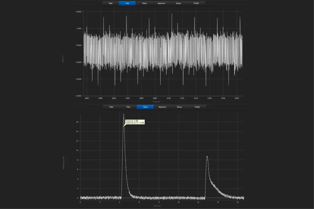
One illustrative example is Ambient Noise Tomography (ANT). This is essentially the same seismic, but without the explosions and vibrators. We set up a network of autonomous seismic sensors that write the noise. And then we reconstruct the section by “following” this noise through correlations of multiple points and wave propagation models. Logically, this is very similar to magnetotellurics: there, too, no one “turns on” the field – we take natural electromagnetic variations and use them to build a model.
The physics of all this has been known for a long time. The ideas of passive methods have been discussed for decades. But there was no practical mass realization for a simple reason: there was not enough hardware or computing power. For a network of hundreds of sensors to work in the field for months, you need compact, energy-efficient sensors, reliable batteries, autonomous recorders, and stable housings. And to get a meaningful picture out of weeks of noise records, you need servers and heavy processing algorithms.
“The signal is weak, chaotic,” Vladislav explains. – You don’t know where the source is and when it originated. So the task is to write for a long time, and then through correlations pull useful information out of it.”
In fact, modern geophysics has a new technological pillar – computing infrastructure: cheap autonomous sensors on the surface + weeks of recording + cloud servers + complex processing algorithms. Without this bundle, passive methods would have remained academic exotica.
Hence the sharp interest of the market. Companies are emerging that are betting on passive seismics, on their own correlation models, on machine learning and recognition of complex wave patterns. Some companies are investing in sensor networks and logistics for their deployment, others in correlation and inversion algorithms, and others in data storage and transmission infrastructure. But in all cases, it’s about the same turnaround: we stop “hitting the ground with one big hammer” and move to distributed, time-length measurements.
For Vladislav Surin, it is the combination of hardware and computing that is important in this story. On the one hand – compact, energy-efficient, relatively inexpensive sensors that can be left in the field for a long time. On the other hand – access to powerful computing resources and modern processing models, up to and including neural networks.
Next, we’ll look at specific examples of such GDD hardware and see what geologic problems they help solve in a real field search.
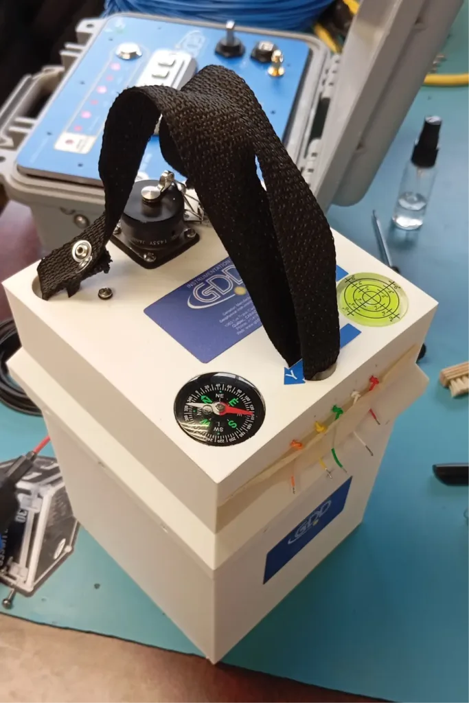
Beep Mat: the “metal detector for gold” that juniors love
“Every spring, we see the same thing,” says Vladislav Surin. “As soon as the season starts, junior companies literally take Beep Mat apart: the devices go into the fields, and all summer, people walk through the Canadian forests with our ‘sleds’. One guy later wrote that he heard a distinctive response, dug, and pulled out a small nugget of gold. It’s clear that this doesn’t happen every day, but such cases greatly increase interest in the device.”
Beep Mat in this environment is the workhorse of first prospecting: it is taken by those who spend weeks wandering through the woods and outcrops looking for any sign of ore.
It feels like ametal detector for gold: Beep Mat’s task is to quickly find areas where ore mineralization may be hidden in the bedrock and give a simple answer “there is an anomaly here” / “there is nothing here” to the field device. Only instead of rings and earrings on the beach, it responds to conductive and magnetic ores.
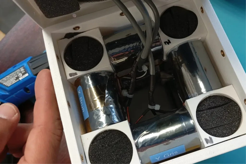
How it works inside
Inside, everything is noticeably trickier than in an ordinary household metal detector. At the heart of Beep Mat is a coil and an electronic circuit, which together work as a self-tuning “bell”. As long as the environment is “clean”, this electronic tuning fork vibrates at its stable frequency.
As soon as the coil is near conductive or magnetic rocks, the picture changes. The electromagnetic field of the device induces weak currents in the rock, the rock starts to respond and as if interferes with the work of this “bell”. The medium becomes part of the coil – and its natural frequency goes away.
“To put it quite simply,” explains GDD Technical Director Vladislav Surin, “the environment becomes part of our coil. We are not looking for an external signal – we are watching how the behavior of the device itself changes”.
Beep Mat detects this frequency change in two modes at once. One is more sensitive to conductive objects, such as sulfide mineralization. The other is more sensitive to magnetic minerals. Therefore, the device reacts differently to different types of ore environment.
For the user, everything is extremely down-to-earth: the instrument beeps and/or writes a profile with coordinates. The geologist walks along the terrain and sees where the response changes dramatically, i.e. where. “something is wrong with the rock”, and there is a reason to stop, look at the outcrop, take a sample.
Where Beep Mat works – and where it’s useless
It is important to mention the limitations, which are not usually mentioned in marketing brochures. Beep Mat does not “penetrate” the ground for tens of meters. It is a short-range tool, it works at depths of the first meters.
If there are thick sedimentary strata, clays, moraines or anthropogenic mounds on top, the device quickly loses sensitivity: the signal from overlapping rocks “clogs” everything else. Its element is shield areas and areas where bedrock comes close to the surface. This is why Beep Mat is especially popular in Canada and other regions with similar geology, while it is almost useless in provinces with 20-30 meters of overlying strata.
Beep Mat’s role is not a substitute for geophysics and drilling, but a gas pedal of initial prospecting. In the North American subsurface system, this stage often falls on the shoulders of junior companies: people who spend months walking over vast areas and literally combing through the forest. When hundreds of such people with a simple detector walk the shield, the chance of “catching” the first manifestations of mineralization increases dramatically.
Further on, classical methods – geochemistry, geophysics and drilling – are still involved. But it is precisely such “metal detectors for ore” that allow juniors to find a place faster, where it makes sense to deploy serious geophysics and expensive drilling. Sounds tempting – but only as long as we keep in mind its real depth and geologic limitations.
Electromagnetic research from a drone: where the fiction ends
After magnetosurveys have massively “taken to the wing”, the question of drones in electromagnetic surveys has become almost inevitable. Field engineers see UAV-based magnetic surveys closing hundreds of kilometers of profiles in a day and legitimately ask: why are we still walking around with electromagnetic sensors? GDD hears this query directly from customers. And it was the starting point for the new development.
It’s important to set the stage right away: it’s not about getting everything up in the air.
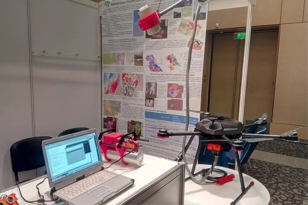
“The methodology is almost classical,” explains Vladislav Surin. – The loop remains ground-based, the generator is ground-based. Only the sensor flies.
The scheme looks like this: a large current loop is laid out on the surface and a generator is placed. And then a drone with a light electromagnetic sensor – a three-component coil that measures the field response along the X, Y and Z axes – starts moving along the points where a person with a receiver used to walk.
GDD initially developed this sensor as a compact ground-based device: smaller, lighter, autonomous, low-power consumption. And in the process it became clear that such a sensor could be physically suspended under a drone. But there is a huge distance between “can be suspended” and “can work properly”.
The main problem is noise. In ground-based EM photography, the sensor is placed, fixed, oriented, and one tries not to breathe near it: any movement of the coil in the magnetic field generates noise. By definition, a drone vibrates, changes position, motors and propellers work.
“Just the movement of the sensor will already get in the way,” Vlad says honestly. – So we are even considering the scenario that the drone will not fly during the measurement, but land on the ground”.
From here, a whole chain of questions stretches out. How do you land in the woods? On what surface? Can I shoot in hover mode? How critical is altitude? What happens to the signal quality if the sensor is five or ten meters above the ground?
There is cautious optimism: with large generator loops, the geometry of the field is such that a difference of a few meters may not be fundamental. But this is not a theory, but something that has yet to be proven by field tests. The second set of challenges is the real-world environment. The forest, the undergrowth, the terrain, the mountains. This is not a walk in the park, but dense thickets where it is difficult to walk even on foot, let alone land a drone. Added to this are the issues of routing, flight stability, repeatability of measurements.
That is why GDD emphasizes that this is now an engineering task with an unknown outcome. There are prototypes, there are the first “home” experiments, but there is no industrial production yet. This is where it is important not to succumb to the illusion that the drone will “replace the field”. Even if the sensor starts flying stably, the drone will not remove the main piece of work – the layout of the generator loop. It still has to be brought in and laid out at coordinates. Depending on the size, that’s hours of work for several people – and in mountains and complex terrain, much more.
What a drone can really speed up is the process of surveying by station and logistics by profile. Where previously the operator physically waded through the thicket from point to point, aligned the sensor, waited, and recorded – this part of the work can be transferred to a flying platform. That’s saving days of work, less physical work, more dense shooting in the same amount of time. But not an evolution of the “man is no longer needed” format.
This is what makes EM surveys fundamentally different from drone-based magnetic surveying. In magnetic survey, the entire complex is lifted into the air. Therefore, everything really “flies” there – and the coverage of territories grows by multiples. In ground-based EM, the source remains on the ground. The drone here is not a replacement, but an add-on. Nevertheless, the market is very much waiting for it. Not because it’s “trendy” but because the field is hard, expensive and slow work. And if you can remove at least some of the manual labor, customers are ready to invest in it.
“It was the users’ initiative,” Vlad emphasizes. – They saw what happened with the magnet and they want the same thing. Quicker, easier, with a drone”.
GDD looks at the task without euphoria. Rather as a long engineering experiment, where a negative result will also be a result. But the very fact that compact EM sensors can be discussed in conjunction with drones today is a direct consequence of how hardware has changed in recent years: the element base, power consumption, size, and autonomy.
Why geophysical hardware can’t be cheap
It is worth talking separately about money. Prices for geophysical hardware often seem prohibitive: one set can cost upwards of 100,000 dollars, and you need three or four for a project. On the outside there is nothing “cosmic”: a couple of transistors, an inductive coil and an electronic board. The natural question of people who sign invoices is: why does it all cost so much, and what does the price of the device consist of?
The first reason is volume. Geophysical instruments are not produced in thousands or hundreds of thousands of copies. This is a boutique market. Even a successful model is sold in dozens, at best, hundreds of units.
“We make very compact, specialized sensors, receivers, antennas,” Vlad explains. – This is not mass electronics. Here everything starts with small series.
Small series automatically means expensive boards, higher component prices and no economies of scale. Where in consumer electronics cost is driven down by the assembly line, here each component is bought almost “piece by piece”.
Vladislav gives the following example: a conventional microchip for the iPhone with millions of devices may cost 10 dollars, but if the same complexity of the microchip is made for a very narrow, “piece” device, its cost will easily fly into the thousands – simply because it is necessary to set up a separate production line for it and produce a tiny batch.
The second reason is the requirements of the parts themselves. On a diagram, it might look like “one transistor and a capacitor,” and it seems like this kind of hardware should be cheap. But as soon as we step out of the cozy world of consumer electronics and into the industrial world, everything changes. The device must operate at −50 and +50 °C, withstand humidity, vibration, shock, and sometimes water pressure on the ocean floor or near mine explosions.
Such conditions require not “ordinary” components, but industrial versions of the same transistors, capacitors, and microcircuits, with extended tolerances, quality control, and lifetime. As a result, even a simple-looking circuit becomes dramatically more expensive, simply because each of its elements must survive where an iPhone would have been turned off long ago.
The third reason is the long and expensive development cycle. When you buy a set of equipment, you’re not just paying for the hardware in the box. The price includes years of work by engineers, programmers, and technicians: from the first sketches and rough prototypes to a stable production version. Between an idea and a device that can actually be used in the field there is a chain of iterations, failed tests, rework and frozen versions. And all these hours are then spread out not into thousands of devices, as in consumer electronics, but into dozens.
Another layer is added to this – constant refinement. Niche high-tech production cannot “make a device and rest”: the element base is changing, noise and accuracy requirements are growing, and new geological tasks are emerging. To keep up, companies have to keep a team of developers and constantly invest in R&D. Therefore, the price of a geophysical complex is not the sum of the parts, but the economics of a small market, salaries of specialists and long technological cycles. “Expensive” here is not about greed or marketing hype, but about trying to survive in a place where mass electronics earns millions of units, while geophysics earns dozens.
If you look at it through the eyes of a field geophysicist or an ordinary person, the price tag of $100,000 for a set looks wild – Vladislav himself honestly says that as a private individual he would never buy such a device. But on the scale of the mining industry, where project budgets are measured in hundreds of millions and billions of dollars, geophysical equipment is already in a different “coordinate system”: it is a small part of capital and operating costs, which pays off if it helps to find a deposit or to show in time where it is not worth spending money on drilling.
When the world needs metals: geophysicists and geologists won’t be out of work
Today in geophysical hardware, several intersections, which we have discussed in this material, converge at once. On the one hand, solid mineral deposits are going deeper, becoming more “jagged” and overlapped – it is more and more difficult to find them using old schemes. On the other hand, due to the development of electronics, passive methods and distributed sensor networks, geophysicists have many more tools to “reach” these complex objects and honestly say: it makes sense to drill here, and here – not.
This technological shift is not happening in a vacuum. The world is simultaneously asking for more and more metals and raw materials for the energy transition, infrastructure, and electronics. The growing demand for solid minerals triggers new projects in exploration, and with them the development of geophysics and geophysical equipment. In this sense, hardware is not a side character, but a necessary link in the chain: without it, there will be no data, no models, and no new deposits.
Looking out 10-20 years, this is where one of the most sustainable growth points can be seen: specialized geophysical equipment tailored to specific solid minerals applications. More sensitive EM sensors, passive seismic networks, compact “handheld” detectors, and drones are no longer experiments, but the answer to the industry’s request “show us where to look for complex deposits and how not to spend millions on empty wells.
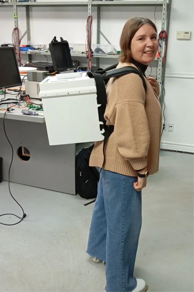
The question remains: what will happen to people in the field. “Will robots replace field workers?” asked Maria Kostina. Vladislav replied with a smile that people who work in the fields are usually very fond of it. Why you should be replaced. If the field workers are expecting anything, it’s exoskeletons.
What do you see as the most promising direction for geophysics in the next 10 years – drones, passive methods, autonomous sensor networks or something else entirely?