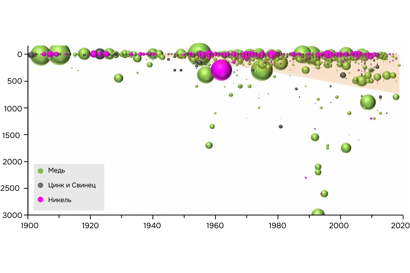
Deposits near the surface of the earth have already been found and mined or are being mined. This means it’s time to look for them at great depths. Geophysics will help us here. Read our material about what geophysical methods to include in geological exploration.
Geophysicists look for anomalies
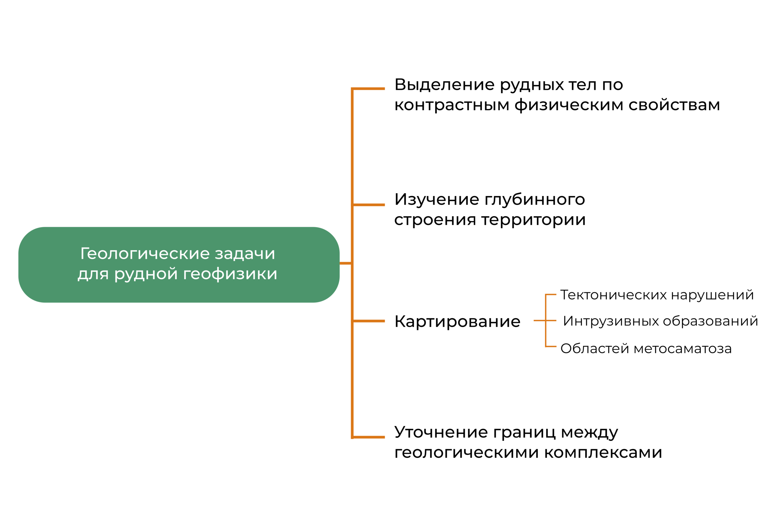
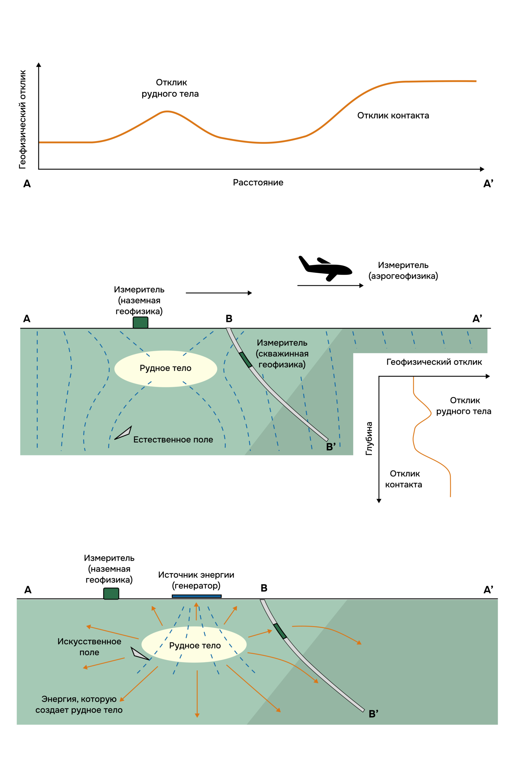
The task of geophysics is to record physical anomalies. Specialists measure the Earth’s natural fields (gravitational and magnetic) or create artificial fields using generators and vibration installations (electric fields, elastic vibration fields). This is done to find deviations from the average values.
These deviations – anomalies – are created by various properties of rocks and ores: density, magnetic susceptibility, radioactivity, seismic and electrical properties. If there is an anomaly, then perhaps an ore body lies at depth.
I talk about my working day as a geophysicist and about 3D electrotomography in the note “One of my days on the other side of the Arctic».
From a general to an accurate picture of the field
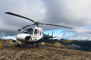
To get general data on the physical properties of rocks from areas of hundreds and thousands of square kilometers, we explore the area from an airplane or helicopter. This is airborne geophysics.
In the aerial version, we carry out gravity surveys, magnetic surveys, gamma spectrometry, frequency and pulsed (electromagnetic) electrical surveys. We will talk about some of them further.
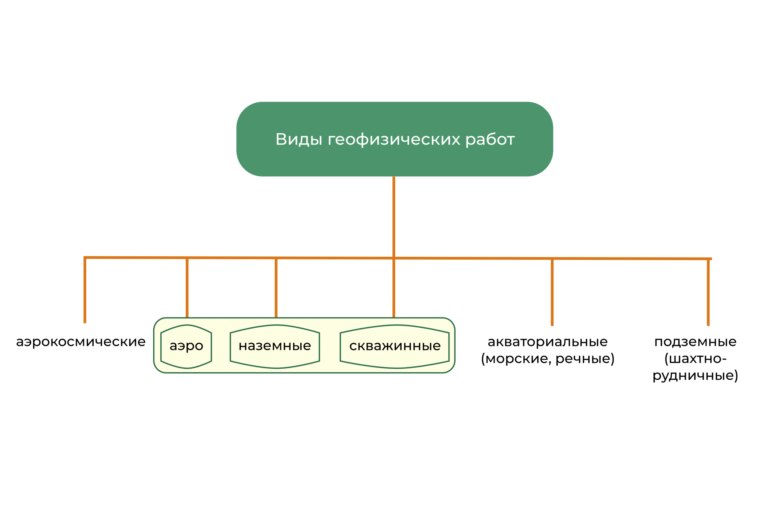
To get more detailed picture of the field and to distinguish smaller anomalies, equipment is placed on the surface. This is terrestrial geophysics.
More devices can be lowered into the well. If we study the space between several wells with a distance of 50 m or more, this is borehole geophysics. Not to be confused with logging, where we place the tool inside one well and obtain data only around it.
Aerogeophysics is carried out at the regional stage of geological exploration, and ground and borehole physics is carried out at the prospecting and exploration stage. Anomalies of hundreds of meters are visible during aerial photography, and ground and borehole geophysics reveal the position and dimensions of a potential ore body.
Source: Geophysics for the mineral exploration scientist, Dentith, 2014
Deciding whether to turn to geophysics
Before moving on to the selection of geophysical methods, it is necessary to understand whether it is even possible to solve a geological problem using geophysics. To do this, answer two questions:
- Do the physical properties of the search object differ from the host rocks? The section may be composed of different rocks, but if their physical properties are the same, then it will not be possible to separate these rocks using geophysical methods.
- Will the search object create an anomaly that can be registered and isolated from the noise? Perform mathematical calculations (modeling) in a special program before going into the field. Determine what type of anomaly an orebody might create using knowledge of the physical properties of rocks, the size of the orebody, and the expected depth of the orebody.
Choosing geophysical methods
If you answered yes to both questions, then we next select methods for searching for ore bodies.
We are looking for magnetic anomalies: magnetic prospecting method
You can search for iron ore deposits, identify and map intrusive bodies (dykes and batholiths), and trace faults using magnetic prospecting. It records deviations from the Earth’s normal magnetic field—magnetic anomalies. They are the ones who carry information about the magnetization of geological bodies.
An abnormal magnetic field occurs regional And local:
- Regional anomalies (for example, Kursk) extend over large areas. They are caused by large structures composed of rocks and iron ores with high magnetic properties.
- Local anomalies appear due to different magnetization of geological structures or ore deposits. These anomalies are created by small ore bodies up to a few hundred meters thick, which are also noticeable in the regional magnetic field trend.
We see an example of a local magnetic anomaly over ore bodies in a profile through the Qian’an deposit in China. The deeper the iron ore, the less distinct the magnetic anomaly becomes.
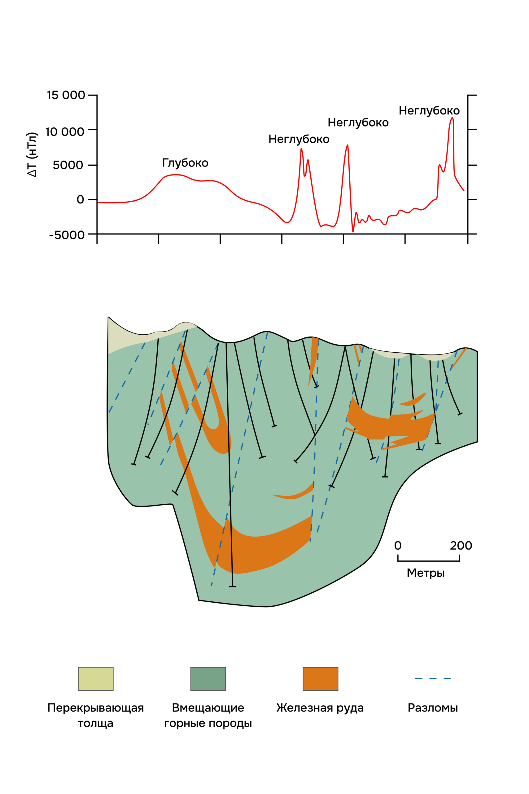
Source: Geophysics for the mineral exploration scientist, Dentith, 2014
We look at deviations in gravity: gravity survey method
Helps identify intrusions, faults, folds of sedimentary cover, ore bodies, oil and gas deposits and other local density heterogeneities gravity survey.
Gravity survey measures the change in gravitational acceleration that occurs due to different densities of rocks. But we are not interested in the force of gravity on the Earth’s surface, but its variations are many orders of magnitude smaller, so in gravimetry they use the fractional unit milligal (mGal), 1 mGal = 10–5 m/s2 or 9.8 m/s2 = 980,000 mGal.
In the gravity field at the Elazig deposit in Turkey, chromite bodies with increased density values stand out as positive anomalies.
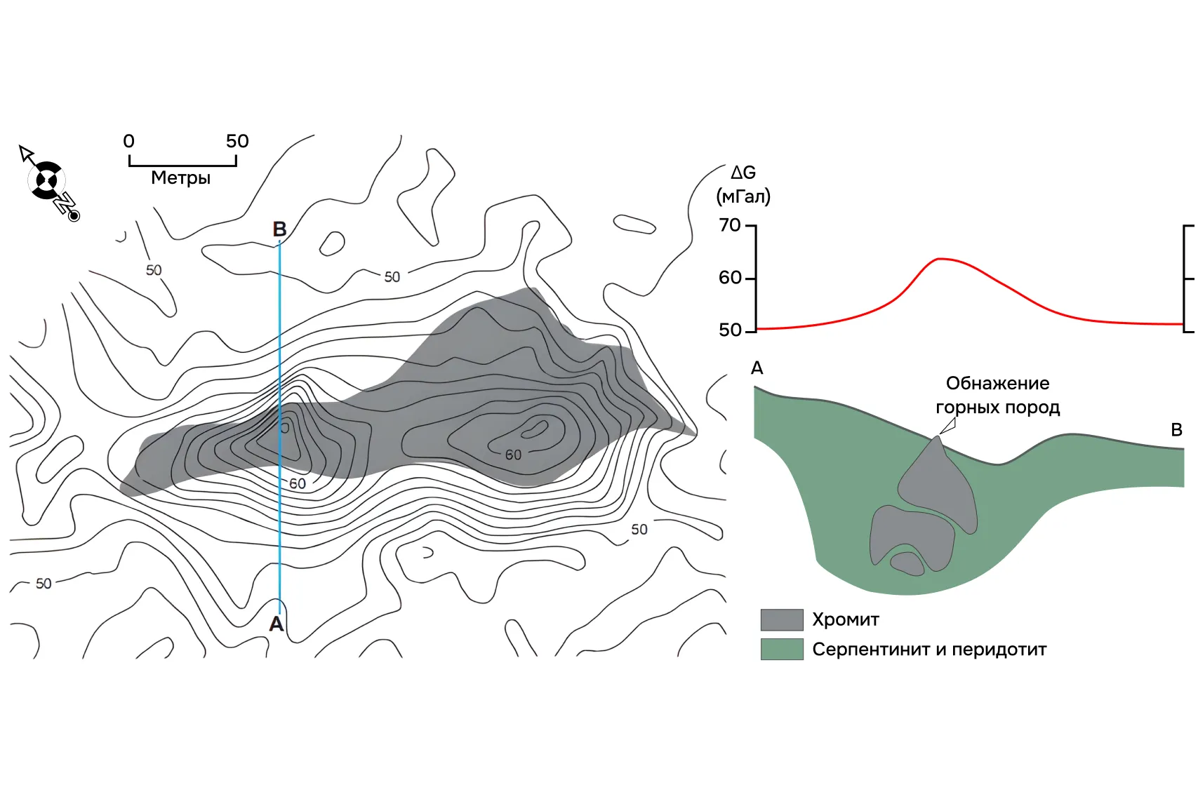
Source: Geophysics for the mineral exploration scientist, Dentith, 2014
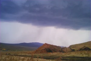
Thunderstorms in the service of a geophysicist
To study deep horizons they use magnetotelluric sensing. It registers the Earth’s magnetotelluric field (MT field), which consists of oscillations of various frequencies. High-frequency oscillations of the MT field quickly attenuate with depth, while low-frequency oscillations, on the contrary, penetrate very deeply. High frequencies carry information about the near-surface part of the section, and low frequencies – about deep horizons. This is how we obtain data on the electrical properties of the entire mountain range – a geoelectric section.
MT fields are called:
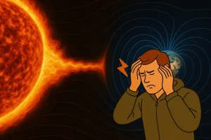
- The interaction of the solar wind with the magnetosphere and ionosphere of the Earth (frequencies less than 1 Hz).
- Magnetic storms – intense changes in the field (in magnetic components – up to many hundreds of nT), when the intensity increases sharply in the first hours, and then decreases for several days.
- Fields of distant thunderstorms (especially in the tropical region). These fields are called atmospherics. They are most intense in the range from the first Hz to the first kHz.
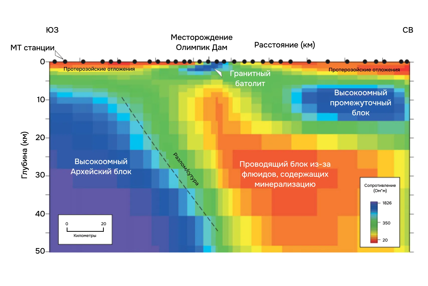
Source: Geophysics for the mineral exploration scientist, Dentith, 2014
Different types of MT sounding methods (they can be easily distinguished by how long the MT station collects data) make it possible to conduct research in a wide range of depths – from the first tens of meters to the first hundreds of kilometers.
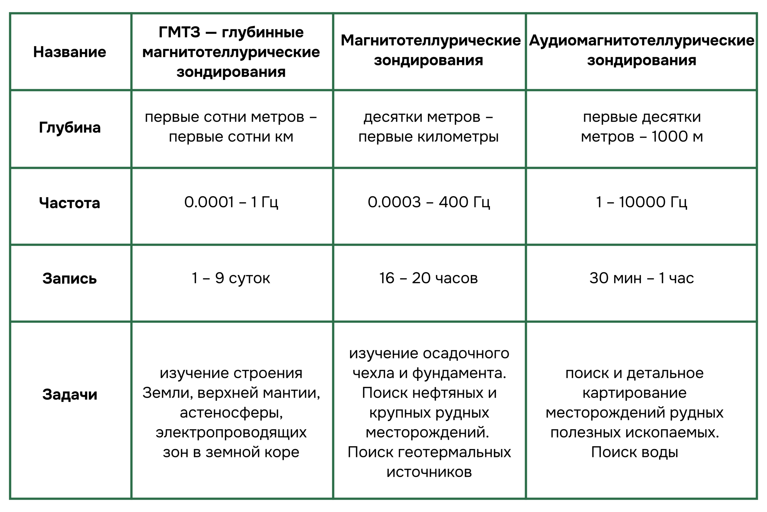
Source: https://nw-geo.ru/
Looking for sulfide conductors
Ore bodies that conduct current well are easy to find resistance method. It works on the difference in current conductivity. Ore minerals (native metals, sulfides and oxides) and graphite are good conductors and semiconductors, while rock-forming minerals are poor. Therefore, ore bodies are clearly visible against the background of the host rocks.
The electrical conductivity of rocks is also affected by solutions in the pores: the more water and the higher the concentration of ions in it, the higher the electrical conductivity, so it is important to obtain data on the mineralization of groundwater.
Looking for disseminated ores
For the search and exploration of disseminated ores, the resistivity method is not enough – their electrical conductivity does not differ from the electrical conductivity of the host rocks. But disseminated ores are polarized. To find them, the resistance method is complemented by the method induced polarization. It measures the ability of rocks to retain an electrical charge when passing an electric current.
Often disseminated sulfide minerals (pyrite, pyrrhotite) accompany the formation of a gold deposit. The gold particles themselves, even in deposits, are too small and scattered for us to “see” them in the field of induced polarization. And accumulations of pyrite or pyrrhotite, with which gold may be associated, can be seen by VP anomalies.
Source: Geophysics for the mineral exploration scientist, Dentith, 2014
We look for anomalies in plan and section
To study the electrical and polarization properties of rocks and ores, various installations are used – profiling, probing and electrical tomography.
It allows you to see anomalies of increased or decreased resistivity electrical profiling. It is performed with a fixed position of the current source and receiver relative to each other, so the depth of research remains the same. For example, with a feed line length of 200 m, we get a response from a depth of 30-40 m. This method is inexpensive and suitable for the search stage.
You can study how the electrical resistivity of rocks changes with depth electrical soundings. To get a response from a greater depth, we change the distance between the current source and the receiver: then the current lines penetrate deeper.
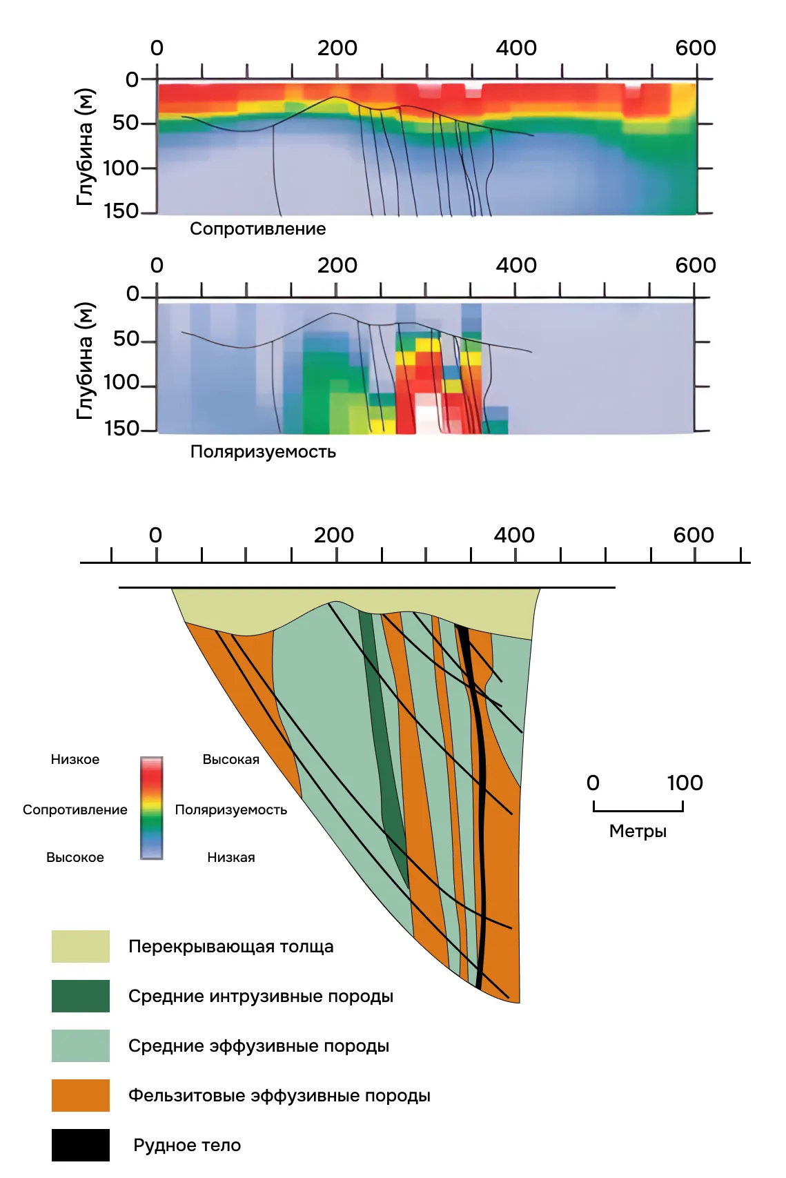
Electrical sounding is used to study horizontally layered media, but they are not suitable for studying subvertical ore bodies or bodies with steeply dipping boundaries. For such cuts it is better to use ore electrical tomography — it allows you to identify heterogeneities in the section both horizontally and vertically.
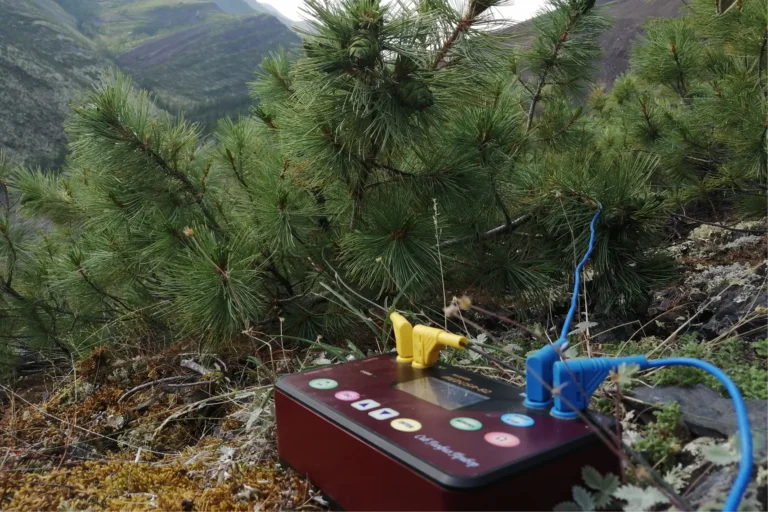
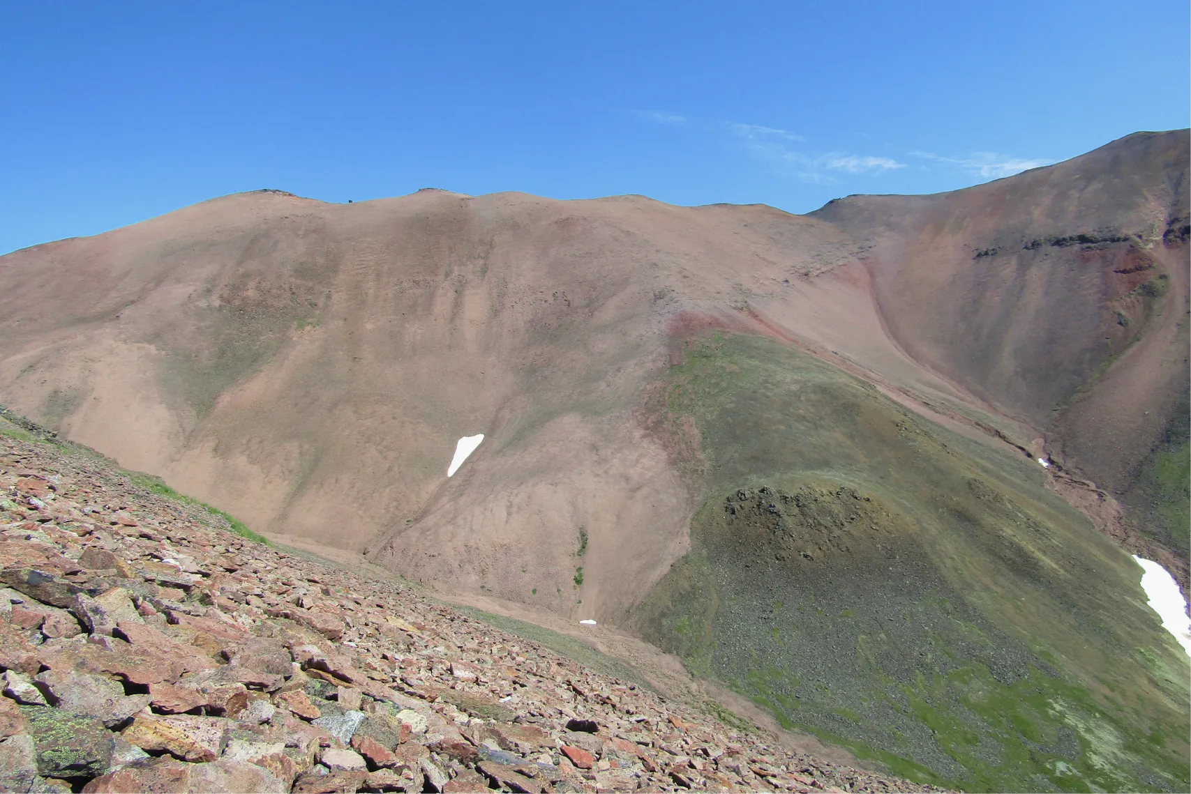
Exploring rocky areas
When there are no good conditions for grounding the electrodes—the area is covered with scree or kurum—electromagnetic research comes to the rescue. They are based on electromagnetic induction and allow shooting without grounding the electrodes.
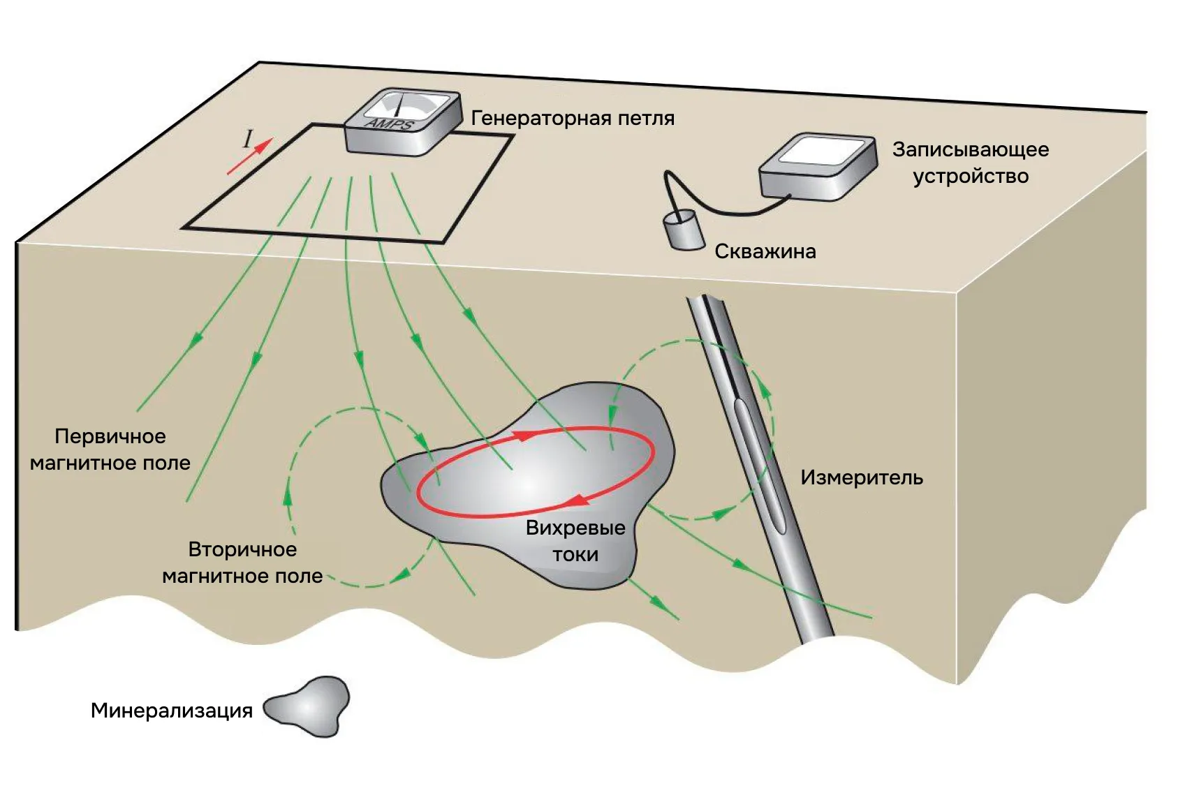
Here’s how the measurements are taken:
- We place a loop on the ground and connect an alternating current source to it.
- When the current in the loop is turned on and off, the magnetic field changes.
- An alternating magnetic field creates a secondary electric field.
- The secondary electric field causes a secondary magnetic field.
- The time after turning off the electric current in the loop determines the depth of penetration of the electromagnetic field; the longer the time, the greater the depth.
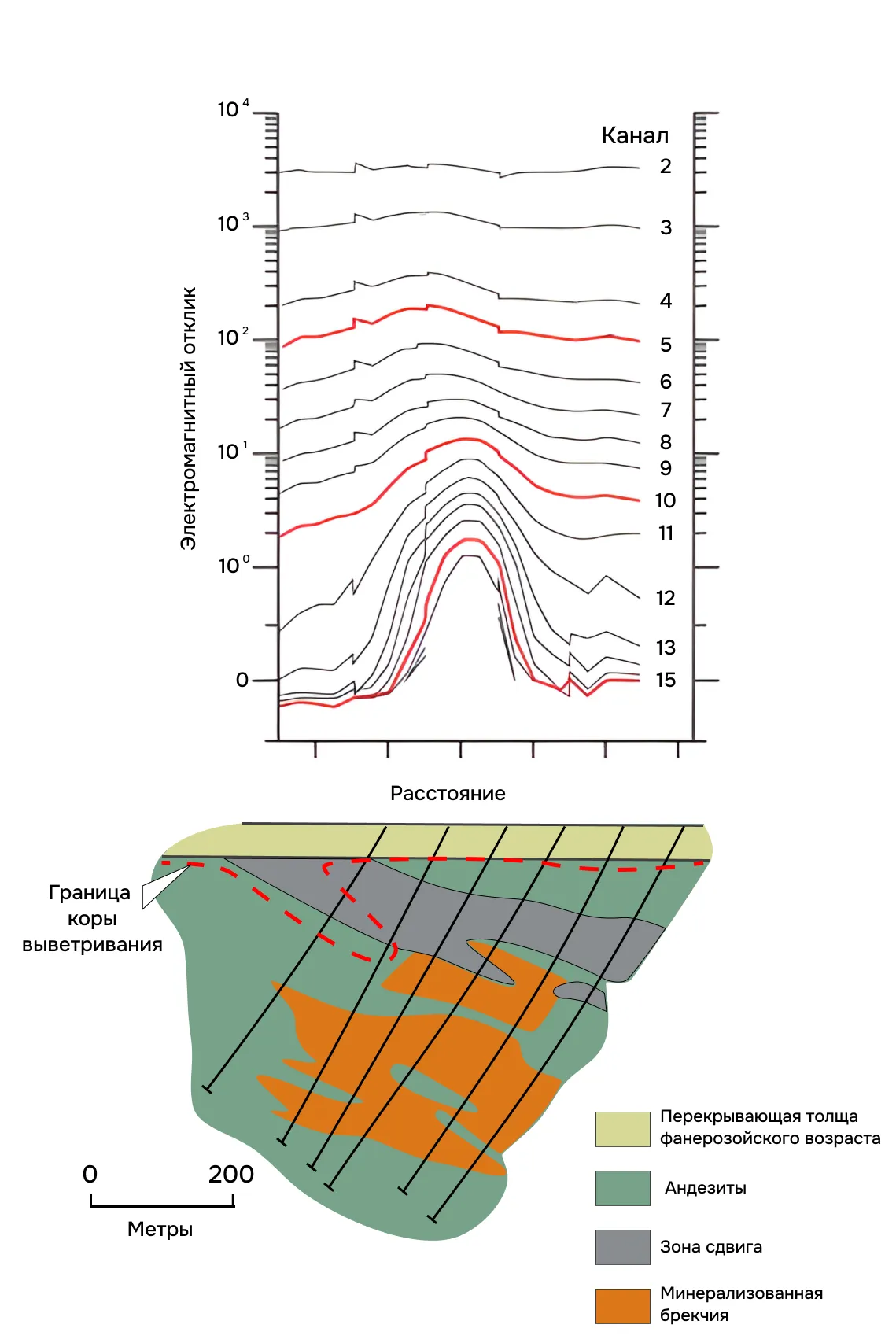
In areas where there are electrical conductors, such as massive sulfide ore, an electrical current (Ohm’s Law) is generated from the secondary electric field, resulting in an intense EM anomaly.
Source: Geophysics for the mineral exploration scientist, Dentith
Source: Geophysics for the mineral exploration scientist, Dentith
Don’t forget to consult
It is possible to get by with only one geophysical method only in very rare cases, for example, when searching for ferruginous quartzites – then one magnetic survey is enough.
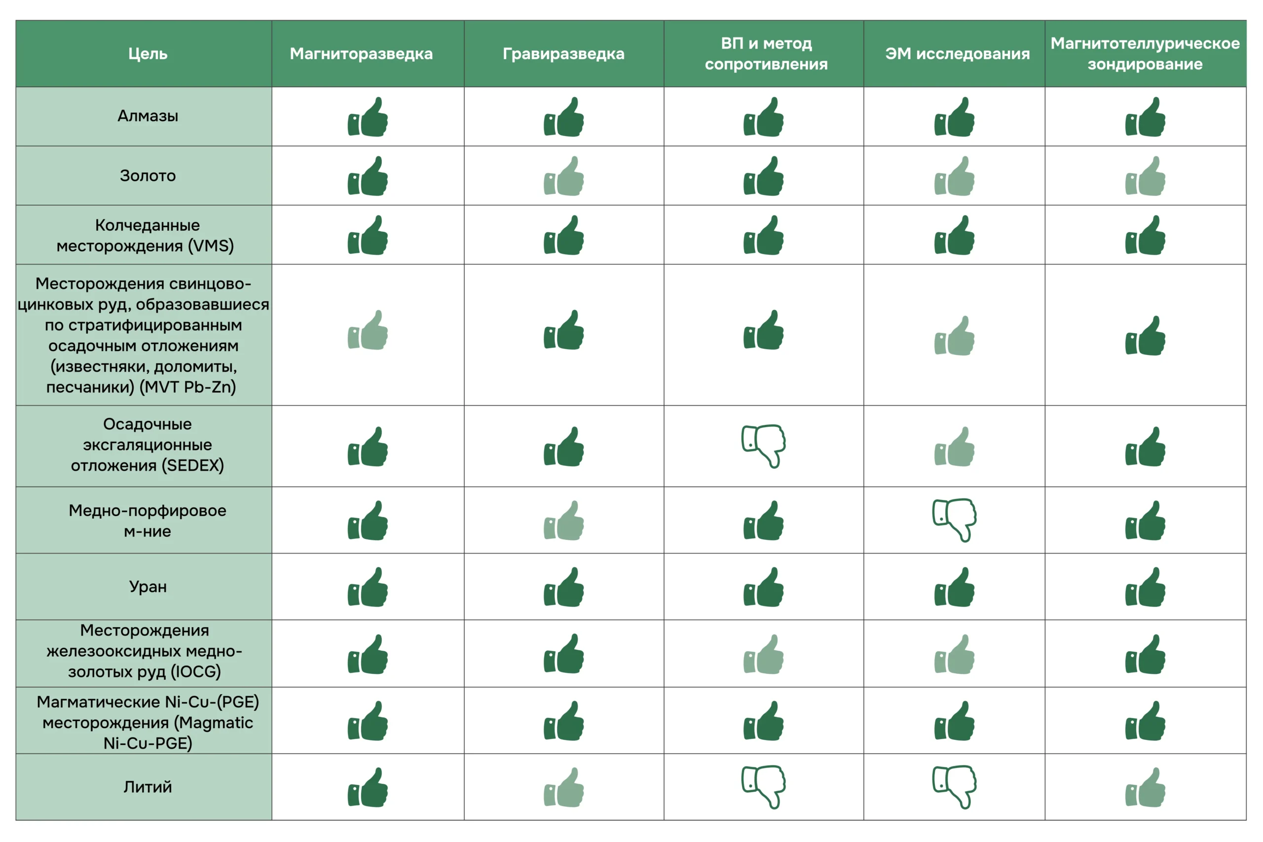
Here is a summary table where geophysical methods are selected for each type of deposit. And before finalizing the complex, seek advice from a geophysicist.
Source https://www.ageophysics.com