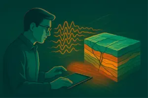
One of the tasks of a geologist is documenting the core. And while some companies already describe a core using artificial intelligence (AI) from photographs in 40 minutes, others still work manually and spend hours on the same tasks. Often the reason is not that, for example, technologies are expensive (they are not), but because of human fears: what if it will be too difficult for me to learn something new? What if the AI is wrong? Or, on the contrary, will it turn out to be too good and leave me without a job?
Let’s figure it out how artificial intelligence helps describe cores, can he be trusted and why the geologist still remains an integral part of the process. We spoke with Evgeniy Baraboshkin, geologist and AI tools developer at Digital Petroleum, to explain how it works in practice.
How can AI even “see” the core?
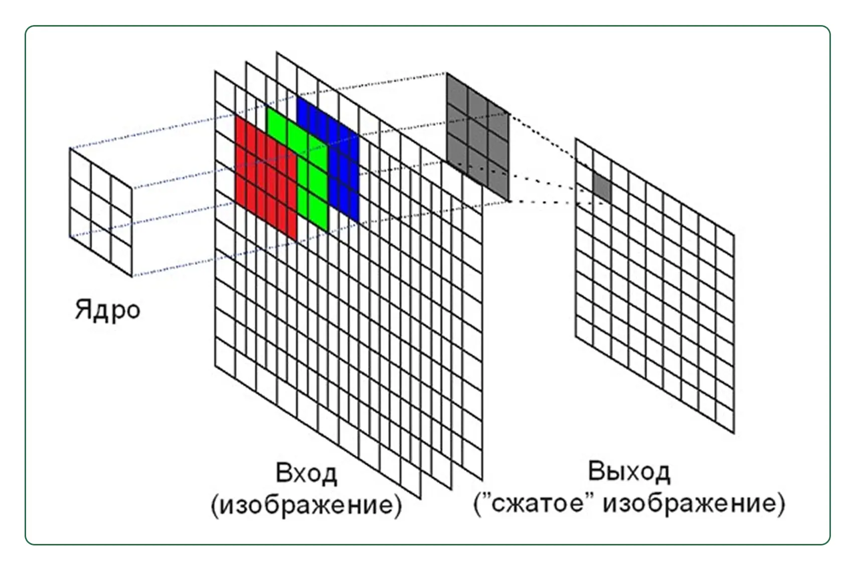
AI is a fairly new technology and for many it seems like a “black box” that does not understand how it produces information. In fact, everything is not as complicated as it seems at first glance. The program, which can recognize a core from a photo, is based on machine learning algorithms, in particular convolutional neural networks.
We talked in detail about the principles of AI in geological problems and types of neural networks here: “Intellectual assistant to the geologist. How artificial intelligence is making mining smarter."
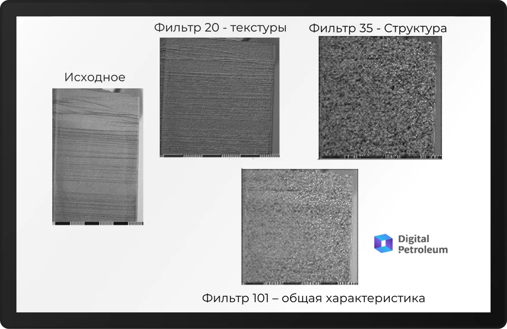
The developers chose convolution technology because it does an excellent job of extracting information from images using various filters and highlighting patterns.
What does AI see in the photo?
- Color and mineral composition, for example, red is iron oxides, gray is clay, dark brown is organic matter.
- Texture and layering, that is, it recognizes thin-layered, massive, cross-layered, cross-layered textures, and also highlights the boundaries of layers and lithological transitions.
- Cracks and breaks: the algorithm records natural cracks (open, mineralized), man-made damage and evaluates their orientation, density, and morphology.
- Porosity and cavities, for example, AI identifies voids (by contrast in the image), estimates their size and distribution.
- Inclusions and anomalies, that is, he sees nodules, kerogen, pyrite, carbonate veinlets, etc.
Trust, but verify. Who teaches and is responsible for the neural network?
When a customer company applies for the implementation of AI, it usually already has a database of core images and preliminary descriptions of rocks. The developer begins by analyzing this data: he carries out pre-sizing, associates photographs with depth, and identifies inconsistencies. Then an expert from the company – a geologist familiar with the site – checks and corrects this data. Only after this they turn into a training sample for the algorithm.
Next, the algorithm undergoes additional training again. The fact is that when automatically describing a core, it is necessary not only to determine some parameters, but to take into account their variations. Because at each site the core has its own characteristics: somewhere it is grayer, somewhere darker, and there may be various deviations. Anyway, Without the experience of a geologist, the algorithm cannot be trained.
“When describing rocks, there is a certain database, there is a core image, and then this information is initially transmitted to us. We are pre-posting it. We have algorithms for automatically studying and linking images by depth. And then the process of additional data verification by geological experts begins. And after that we check it again to prepare the training set.”
Evgenith Baraboshkin
So, in most cases, the system is pre-trained and then adapted to a specific field. Each facility has its own nuances, two different enterprises can call the same breed differently, and all discrepancies and specific parameters must be taken into account. Terms and classes can be reconfigured in the program to match those accepted in the field. Therefore, the system is additionally “fed” with data based on the classification of a specific customer
“Often companies ask us to teach the system to determine fracturing and calculate RQD (the degree of fracturing of the rock) – these parameters are found in both oil and ore cores, and work approximately the same. But if the task is to recognize, for example, pyrite, then additional adjustments are needed: what the algorithm learned from oil samples may not work in the ore industry, and the model will have to be retrained on new data. That is, some characteristics are common, and to detect them it is enough to train the algorithm once.”
Evgenith Baraboshkin
What if the AI is wrong? Who controls the car?
AI is considered a reliable tool for data analysis, but even the most advanced algorithms can make mistakes – just like humans. However, unlike a geologist at the end of a shift, the machine does not get tired, is not in a hurry, and has no the eye blurs. The neural network does not work blindly, it depends on the expert. System errors are checked manually at start, geologist makes corrections, And the system learns from these adjustments. The longer she works on site, the more accurate it becomes.
“The algorithm internally forms filters that, with each training cycle, extract the necessary information more accurately. It can take into account dozens, hundreds and even millions of factors – more than one person can keep in mind.”
Evgenith Baraboshkin
It must be taken into account that AI makes forecasts based on the past. But what if something unexpected happens? Geologists are constantly receiving new data, and there may always be another class of rock that has not been taken into account. The earthly “laboratory” behaves unpredictably. A crack may occur, and there rocks will be found in a different state and under different pressure. Therefore, the system regularly requires updating and adjustment under the supervision of an experienced geologist.
It was 5 o’clock, now it’s 40 minutes
Previously, a detailed description of 50 meters of core on a scale of 1:10 for sedimentological problems took several hours of handmade work. With the help of AI it now takes only 40 minutes. The machine analyzes 16 boxes per minute, and the rate of sample classification is 4.2 meters of core per second, that is, the machine produces a result in about 2 minutes, the remaining time is spent by the specialist on a detailed check of the results. Thanks to the joint work of a specialist and a machine, the detail and accuracy of the description improves, and the quality of the description also increases if a young specialist is working.
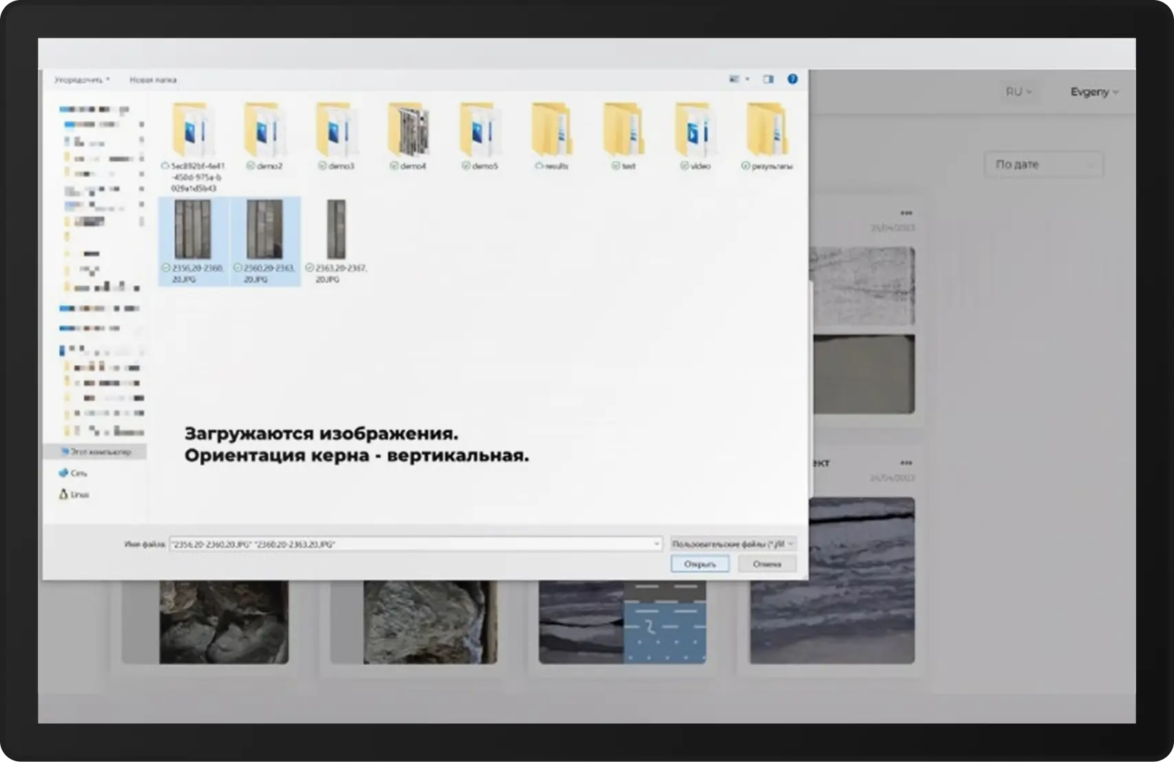
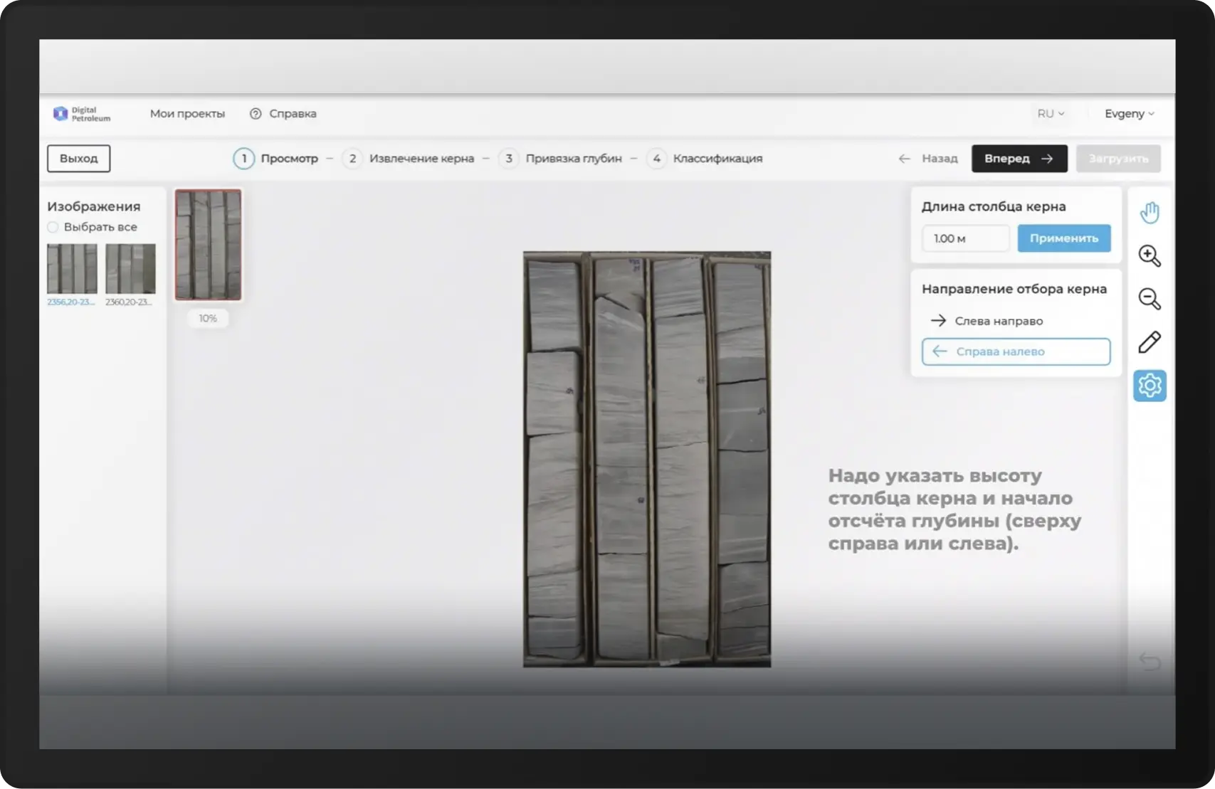
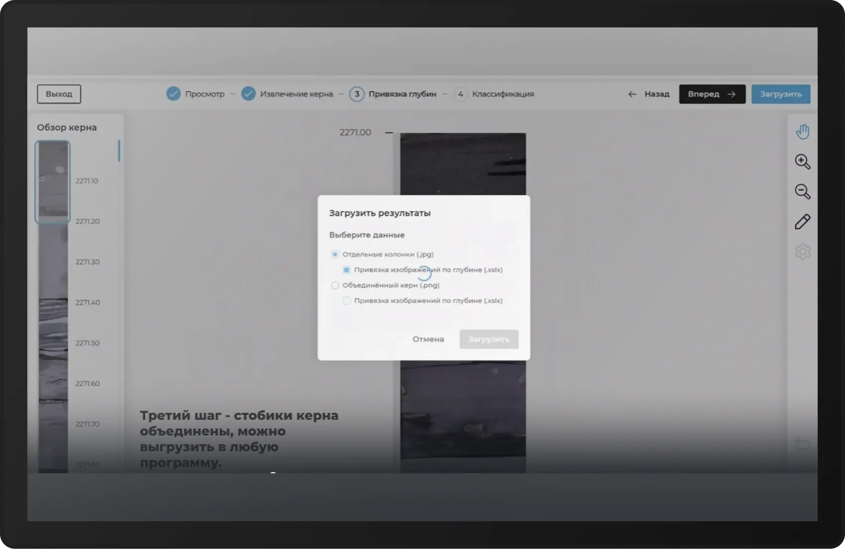
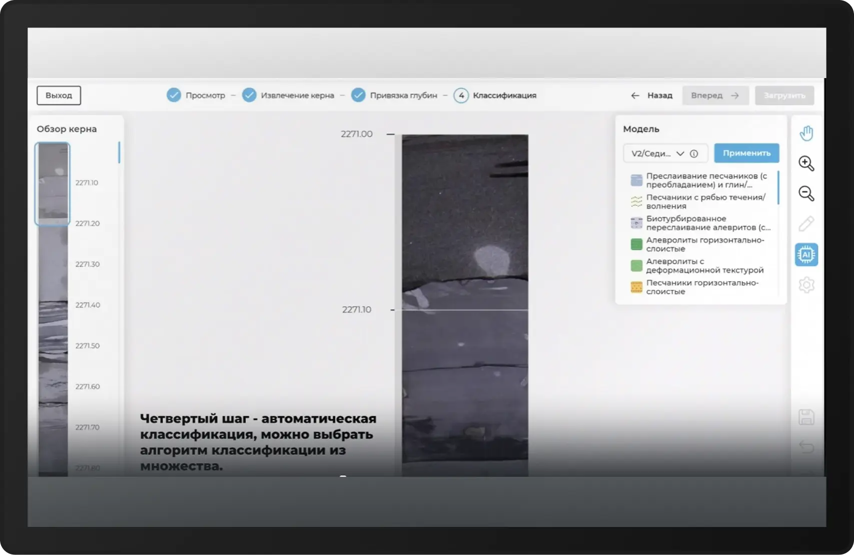
How does this happen? In the DeepCore program, the geologist uploads photographs of the core – just specify the parameters of the depth and height of the samples, and the system automatically selects the core in the image. Then it combines it into a single column, which can be uploaded to the desired format or immediately classified. The specialist selects an algorithm, views the result and, if necessary, adjusts the classification manually. Not only the neural network, but also the specialist who trained it is responsible for accuracy.
To see how automatic core classification occurs in practice, we “cut” screenshots directly from the program.
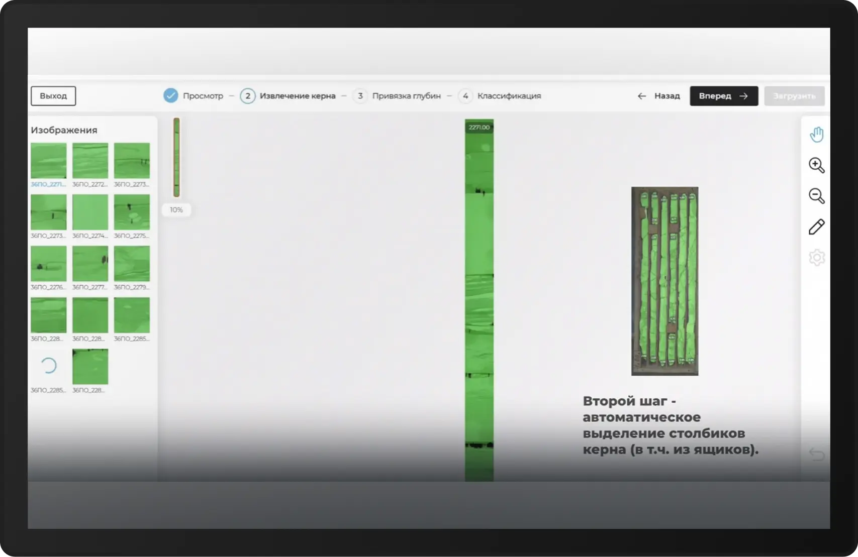
10 meters of core before the start: how long does it take to implement an automatic core description system based on AI
Implementing an AI tool for core characterization is not a multi-month IT project. According to Evgeny Baraboshkin, with good communication between the customer and the developer and the availability of initial data, implementation takes just a month. Of these:
- 2 weeks spends on preparing and adapting data together with the customer,
- 2 more weeks — for additional training of the model and testing in real conditions.
Sometimes the period extends to 2–3 months, but this is only if problems arise with the quality of the source data or their linkage. Therefore, at this stage it is very important to work with the information that the developer will pour into the system. And if the core images are of the same type, with the same rocks, the algorithm will not be able to learn to distinguish between complex variations.
For an accurate start, you need 10 meters of core for 1 rock class
“We are constantly in touch with colleagues to resolve certain issues. Our process is optimized – we usually complete it within a month, sometimes a little more. But a basic launch is not something complicated.”
Evgenith Baraboshkin
Geologists and AI: competitors or allies
One of the main concerns of experts is that AI will put them out of work. This is especially true documenting geologists, who manually describe the core and load the data into the system.
This is a vain prejudice. AI does not replace a smart, educated geologist with a huge amount of knowledge in his head, but it works in conjunction and under the strict guidance of an expert.
The core description model is trained on a database manually labeled by a specialist. The geologist transfers his experience, knowledge and analysis logic to the system. Without this, AI will not be able to work. Moreover, after the automatic description the expert still checks the result, corrects errors, and these edits are used to further train the model. Without constant control from an expert, the algorithm will degrade over time and begin to produce errors.
That’s why no need to expect AI to do everything for you. But it can already solve a number of problems when working with core:
- Eliminate routine tasks. For example, automatic marking of fractures based on photos eliminates the need to manually calculate RQD for each meter of core. The algorithm itself counts and identifies cracks, and the geologist only checks.
- Accelerate the pace of documentation. Instead of several hours, a specialist completes the task in 40 minutes and manages to do 5–7 times more.
- Simplify re-documentation procedures. The archives still contain thousands of core boxes photographed 10–20 years ago. Previously, their revision took weeks, now it is enough to upload a photo and start the classification.
- Reduce the influence of the human factor. When the geologist is tired, he can review the details.
Why is AI adoption slow despite its effectiveness?
Projects for the implementation of AI are still being carried out by companies on a targeted basis. Documentation geologists shared with us that when describing a core, they still do everything with their hands and eyes, and the expert will not delegate any of his tasks to AI.
3 reasons that slow down the implementation of AI:
- “It works like this”: Many companies, especially those with state participation, have been using the same methods (paper reports, manual core analysis) for decades. Management does not see the urgent need for implementation and not everyone can calculate the ROI.
- Fear of mistakes: Geologists fear that AI will “break the woods” in interpreting data, and responsibility for errors will fall on them.
- The Myth of People Replacement: Some specialists believe that automation threatens their work, although in fact AI only eliminates routine.
If routine tasks go to AI, then what will a geologist do?
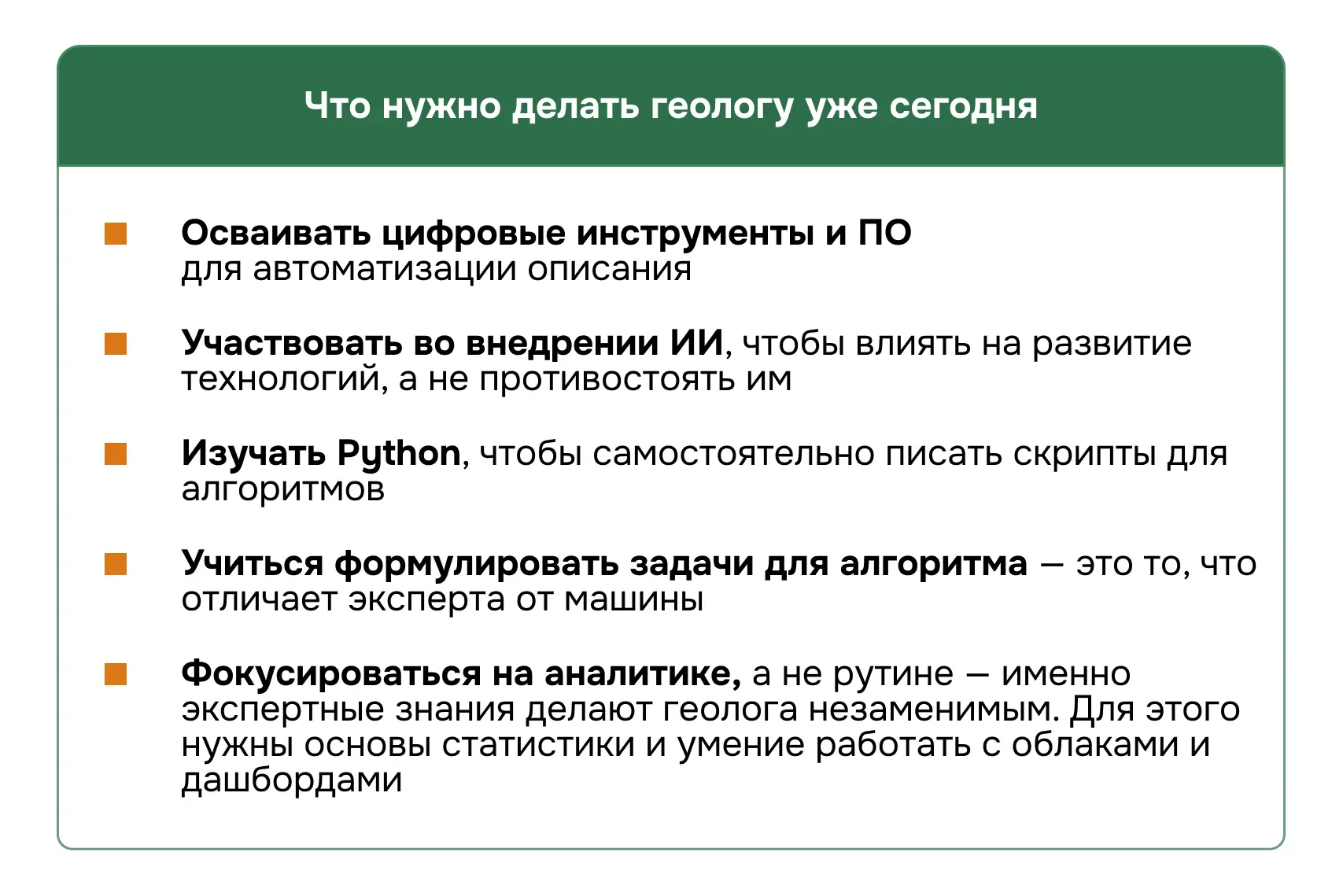
Documenters are still needed, but their role is gradually changing. More and more processes are being transferred to “digital”, therefore, in order to grow, geologists need to develop their IT competencies. There is a demand for specialists who can connect geology and machine learning, such as geologist-programmer, data geologist, and geodata analyst. So now it’s time to study work with programs, scripts, understand the logic of algorithms, understand how to further train a neural network. Some universities are already introducing relevant courses, for example, at Moscow State University and St. Petersburg State University, and large companies are conducting corporate courses on digitalization. Without IT skills, a specialist risks being left out of the profession in a few years, like surveyors with theodolites after the advent of GPS.
“According to my feelings, and I went from a geologist to a geologist-programmer, learning programming languages makes life much easier, in very different directions. That is, connecting the conditional database you are working with with a programming language, the same Python, allows you to write scripts. There is always a certain set of actions that you do with data in one way or another that can be automated. Knowledge of a programming language helps you to create such a script yourself.”
Evgenith Baraboshkin
How will AI develop in geology next?
AI in geology is a natural evolution of the industry. He will not leave you without work, but will change its essence. Those who learn to work with algorithms will gain an advantage – both in efficiency and in their careers. For example, companies such as Rosneft, Norilsk Nickel, Alrosa are already looking for geologists who know GIS, the basics of programming and machine learning. The salaries of such specialists are 30–50% higher.
The development of IT competencies for geologists is no longer optional – it is necessity, dictated by time. But professions based on repetitive manual routine, will be reduced.
As Evgeny Baraboshkin noted, “the connecting links between science, AI and production are those who understand both the field and the code,” these are the geologists of the new generation.
AI in Russian geology is not a question of the presence or absence of technology, but a problem of management and conservative thinking. Companies that overcome the fear of change and invest in digitalization will gain an advantage in the next 5 years, while those lagging behind risk becoming uncompetitive in 2-3 years.
For those still in doubt: AI will not “replace geologists,” but geologists who use AI will replace those who ignore it.
Tell us, are you already using digital tools or are you still documenting the core manually? Share in the comments.