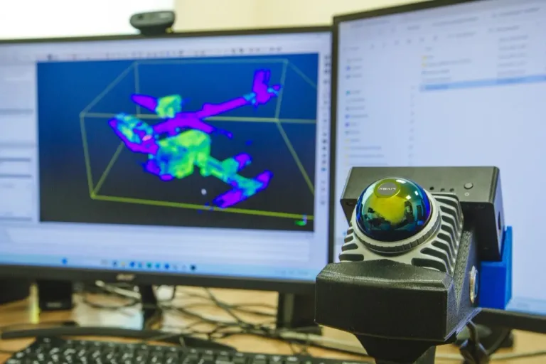
Russian mining company KMAruda has begun testing a mobile laser scanning system developed in-house. The new technology enables the rapid creation of highly accurate 3D models of underground workings and industrial facilities, helping improve measurement accuracy while reducing the time required for mine surveying.
The laser scanner was designed by the company’s IT specialists. During operation, the system generates a real-time three-dimensional model of the mine and other production facilities across the site.
The resulting digital models can be used to monitor the condition of underground workings, calculate extracted ore volumes more accurately, and improve inventory management for quartzite and iron ore concentrate. The technology provides engineers with faster access to up-to-date information, supporting more informed operational decisions.
One of the system’s main advantages is its ability to reduce labor requirements. Traditional surveying with a total station typically requires two specialists, whereas the new mobile laser scanner can be operated by a single employee. The company also notes that the equipment does not require specialized training.
Field trials have already been conducted on the mine’s lower levels, as well as at the crushing and processing plant and the tailings management facility. Engineers are currently evaluating the scanner’s measurement accuracy and its suitability for use across different production areas.
According to Alexey Lunin, Chief Engineer of KMAruda, the laser scanner could significantly change the way mine surveying is performed. He said the technology has the potential to increase workforce efficiency while substantially reducing the time needed for surveying operations.
Once testing is complete, the company will decide whether to deploy the mobile laser scanning system on a permanent basis. If the trials confirm its effectiveness, the technology will become a standard tool for generating 3D mine models and monitoring underground operations.
Source: @CarierNews
Image: KMAruda