Magnetic prospecting remains one of the key methods of geophysics and is still included in the complex geological exploration work. Most often, specialists or customers return to this topic, who need to understand what problems the method solves today, what its varieties and instruments exist, and how to choose the appropriate option for specific shooting conditions. Let’s look at the main approaches and capabilities of modern magnetic exploration.
What is magnetic prospecting based on?
The essence of the method is simple: the Earth has its own magnetic field. It consists of two parts:
- main field — is created by deep processes in the planet’s core and is relatively homogeneous;
- anomalous field — arises due to the magnetic properties of rocks and reflects their distribution in the earth’s crust.
It is the anomalous component that carries geological information. Different rocks and ore bodies have different magnetization, and therefore “distort” the overall field. These deviations are recorded by instruments and turned into maps of magnetic anomalies. Based on the nature of these anomalies, geologists can identify faults, the contours of ore bodies, and determine the depth and shape of deposits.
If you are interested in reading more about how the Earth’s magnetic field works and why magnetic storms occur, take a look at our material: How magnetic storms affect people and equipment.
Types of magnetic prospecting
Today, three main magnetic survey formats are used, which differ in scale, accuracy and speed.
Ground magnetic survey
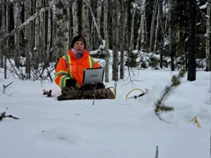
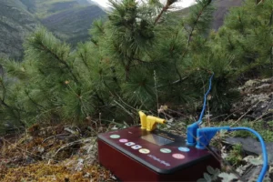
Classic method: an operator with a magnetometer walks a route or network of profiles, recording changes in the magnetic field. The most accurate option, but labor-intensive: you have to work step by step, especially in difficult terrain.
Aeromagnetic reconnaissance
Photography from airplanes or helicopters allows you to quickly cover huge areas. But the higher the carrier flies, the weaker the signals from anomalous bodies become—the accuracy decreases. Therefore, the method is good for regional studies and the construction of large-scale maps, but not for detailed exploration.
Magnetic prospecting from drones
A modern approach that combines the speed of aerial photography with ground accuracy. The drone flies low and can repeat routes in high detail without requiring an operator to be physically present at each point. As a result, the intensity of anomalies is maintained (unlike aerial surveys) and at the same time quickly covers large areas.
Magnetometer sensors: which one to choose?
When choosing a magnetic survey method, it is important to consider not only the carrier (ground, drone or aircraft), but also the magnetometer sensor. It is the sensor that detects the magnetic field, and the speed and accuracy of measurements depends on its operating principle.
Proton magnetometer
The simplest and slowest device. Based on nuclear magnetic resonance: protons in a liquid (usually kerosene or alcohol) line up in a field and produce a measurable signal. Good for regional studies, but limited in speed – most often 1 measurement per second.
Overhauser magnetometer (Heinrich Overhauser effect)
Faster and more sensitive sensor. Well suited for terrestrial geophysics: provides high accuracy and can perform dozens of measurements per second. Used where a detailed map and high data repeatability are needed.
Quantum magnetometer
The most modern and fastest type, based on the interaction of atoms (for example, cesium or rubidium) with a magnetic field. It provides maximum sensitivity and high measurement frequency, which is why it is used in aerial magnetic exploration and on drones. Allows you to obtain stable data even on the move and at high speeds.
When choosing a sensor, do not forget: magnetometers are calibrated are not subject to. For them it is carried out only calibration — testing in a reference magnetic field, which confirms the accuracy of the device. In Russia, calibration is done in specialized centers (VNIIM and VNIGRI, St. Petersburg).
Geological tasks of magnetic prospecting
Magnetic prospecting is not just measuring the magnetic field. It is important for a geologist to understand what specific problems she can solve in the field and when interpreting data. Some tasks are related to direct searching for minerals, others – highlighting the structures and conditions where such deposits can form.
Direct tasks
- Identification and mapping of iron ore deposits (magnetite, titanomagnetite, etc.).
- Search for other minerals with pronounced magnetic properties.
- Identification of zones with high magnetization that are directly related to minerals.
Indirect tasks
- Identification of faults and tectonic disturbances that control the placement of ore bodies.
- Determination of the boundaries and shape of intrusions (for example, gabbro, granitoids) with which deposits of copper, nickel, and platinum group metals are associated.
- Search and clarification of the deep structure of the sedimentary cover for problems of oil and gas geology.
- Mapping igneous complexes that can serve as “landmarks” for mineralization.
What other geological problems are solved by geophysical methods? Read more in our article: Geophysical methods for searching for gold, silver and base metals
Magnetic prospecting in the complex of geophysical work
Magnetic prospecting remains one of the basic and accessible methods of geophysics. It helps geologists both directly identify iron ore deposits and indirectly identify structures associated with other minerals.
The method is inexpensive, universal and is used in different formats – from ground surveys to drones and aviation. But the main thing is that magnetic prospecting is almost always used in conjunction with other geophysical methods to obtain a complete picture of the subsurface.
Have you encountered magnetic prospecting in your work or study? Share your experience in the comments
A photo from the website was used for the cover. Geoscan.