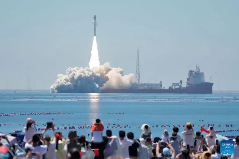
China has successfully launched two next-generation hyperspectral satellites capable of identifying minerals and analyzing geological data directly in space. Lifted into orbit aboard a Smart Dragon-3 rocket from a sea-based launch platform off Shandong Province, the satellites can do far more than capture images—they determine the chemical composition of the Earth’s surface in real time, from soil moisture to mineral deposits, while performing much of the data processing onboard instead of relying on ground stations.
The mission lifted off at 10:38 a.m. Beijing time near the city of Haiyang. The two satellites, Oriental Smart Eye 01 and Oriental Smart Eye 02, each weigh approximately 300 kilograms. They carry hyperspectral imaging systems with 22 calibrated spectral bands, 5-meter spatial resolution, and a 300-kilometer swath width. Operating together, the pair can provide complete global coverage every five days.
Unlike conventional optical satellites, hyperspectral sensors record a detailed spectral signature for every pixel in an image. These unique spectral fingerprints enable scientists to distinguish materials and measure characteristics such as chlorophyll and moisture levels in vegetation, water quality, soil organic content, and the mineral composition of rocks. Rather than simply capturing a green field, the satellites can determine what it contains and assess its condition.
The mission’s most significant innovation is its onboard artificial intelligence. Each satellite is equipped with a computing system capable of 400 trillion operations per second (400 TOPS)—roughly equivalent to the processing power of about twenty high-performance laptops. This allows the spacecraft to perform much of the analysis directly in orbit. They can detect anomalies, identify surface features, compress datasets, and extract critical information before transmitting results to Earth, reducing processing times from days to just minutes.
Each satellite serves a distinct mission. Oriental Smart Eye 01 supports a joint China–Indonesia space partnership, monitoring agricultural land, tracking crop development, and assessing natural disaster risks. Oriental Smart Eye 02 is part of a China–Uzbekistan collaboration focused on monitoring cotton production throughout the entire growing season, from planting to harvest.
The two spacecraft will eventually operate alongside an existing high-resolution Earth observation satellite already in orbit. Together, the constellation will combine wide-area hyperspectral mapping with detailed high-resolution imagery.
China’s new hyperspectral satellites represent a major step forward in Earth observation. Instead of simply imaging the planet, they interpret what they see—and they do much of that analysis directly in orbit, dramatically accelerating the delivery of actionable geological, agricultural, and environmental intelligence.
Source: XINHUANET.com
Image: Zhang Chao / Xinhua