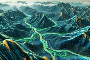
Specialists at the IT university have patented a method for automatically detecting fractures, faults, and other structures in photographs of rock samples. The neural network independently identifies key geological features in core images — samples extracted from boreholes during drilling. The technology will accelerate deposit exploration and improve the accuracy of geological models.
The application extends beyond mining. It will also benefit the construction industry — for example, when building tunnels or high-rise structures where knowledge of rock strength is critical. Today, geologists spend hours manually describing every metre of core, and their assessments are often subjective. A computer works fast and without fatigue.
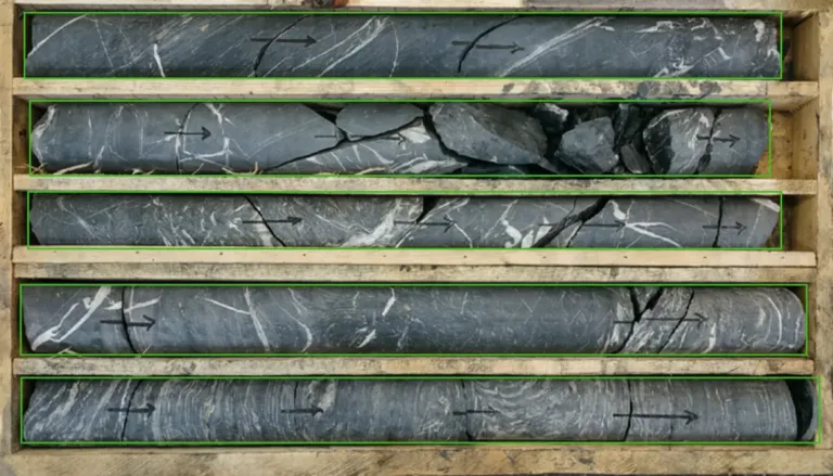
The system operates in two stages. First, a transformer neural network analyses an overview photograph of a core tray containing one-metre sections. It automatically identifies the boundaries of each section and accurately assigns them to their depth of origin. A second model then takes over — trained on thousands of samples, it performs semantic segmentation, colouring different structural types in different shades.
To improve recognition quality, the researchers employed a clever technique: each image is processed multiple times with slight variations, and the results are averaged. Dedicated algorithms then clean the output, removing noise and eliminating false fractures that may have appeared during core extraction. The system ultimately produces precise geometric parameters for each identified structure: area, coordinates, and length along the sample axis.
For each core section, the AI generates what the team calls a digital fingerprint — an array of 2,780 numerical values encoding texture, colour, contrast, fracture count, and other characteristics. An algorithm groups similar vectors together, helping to identify complex faults, breccias, and anomalous zones that affect the stability of open pits and boreholes.
The developers report that in 70% of cases the system classifies photographs in the same way as an experienced geologist — and they plan to push accuracy even higher. The patent for the core image data clustering method was granted to staff at the Interdisciplinary Centre for Technology Transfer at Innopolis University.
Artificial intelligence is taking on the most labour-intensive part of geological investigation. Geologists will be left to verify and interpret results, rather than spending days with a ruler and a magnifying glass.
Source: Innopolis University
Image: Innopolis University