Geophysics is sometimes considered a magic wand: wave it and it will find ore. But that’s not true. Even before exploration, we need a search model – we must know the type of deposit or type of ore we are looking for. How to pose a problem so that geophysics gives results – read the material.
The material is written based on the case of the Canadian company Abitibi Geophysics.
Pegmatites in a gabbroic sill
The Cancet lithium deposit is located in the province of Quebec. There are also platinum-copper-nickel and porphyry deposits, disseminated gold-uranium ores and iron ore formations of volcanic origin. The area is almost entirely covered with moraine deposits. Here they found and explored an outcrop of white pegmatite, and later, in the gabbroic sill and ultrabasic rocks (peridotites, pyroxenites), pegmatites rich in spodumene were found.
Selection of geophysical methods
It is unlikely that it will be possible to directly identify pegmatites using geophysical methods – based on magnetic susceptibility, density and conductivity they are barely distinguishable from the host rock. How can this be? This is what geologists decided after studying the materials👇
In the host gabbroic sill, pegmatites are firmly associated with ultramafic rocks. A large amount of magnetite (mainly in peridotite) will give a strong magnetic anomaly in the gabbroid. This anomaly is likely to be correlated with peridotite-rich ultramafic rocks.
The density difference between ultramafic rocks and pegmatites is large, so surface gravity surveys can play a key role in mapping spodumene dikes and pegmatites among ultramafic rocks. If the dike or mineralized pegmatites are thick enough, the gravity anomaly will be clearly negative.
In 2022, Abitibi Geophysics was commissioned to conduct a detailed, high-precision ground gravity survey of this field. Previously, ground magnetic exploration was carried out here, the results of which resulted in anomalies that identified ultramafic rocks with a high content of peridotite. The company laid out gravity survey profiles based on the identified magnetic anomalies.
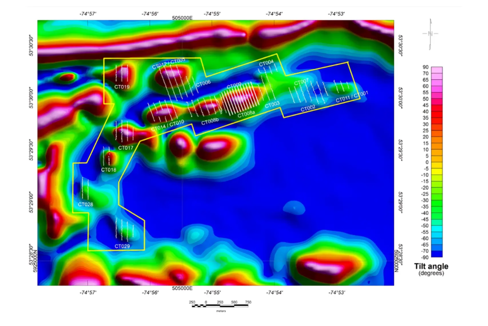
Gravity survey results
Based on ground-based gravity survey data, a low-gravity zone was mapped. It coincided with the contours of the Cancet pegmatite deposit and went beyond its boundaries – the deposits probably extend beyond the already known boundaries.

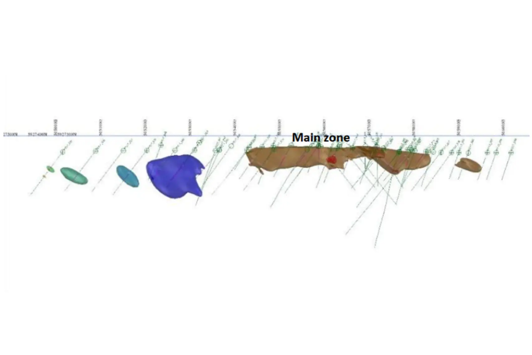
It was possible to establish over 1800 m of vein strike and increase the exploration area by more than 250%.
Geophysics is rarely used for exploration of pegmatite deposits, but it is logical to resort to when basement rocks lie beneath the overlying strata and geological mapping and sampling have been unsuccessful.
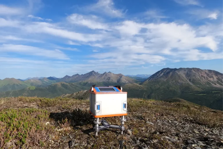
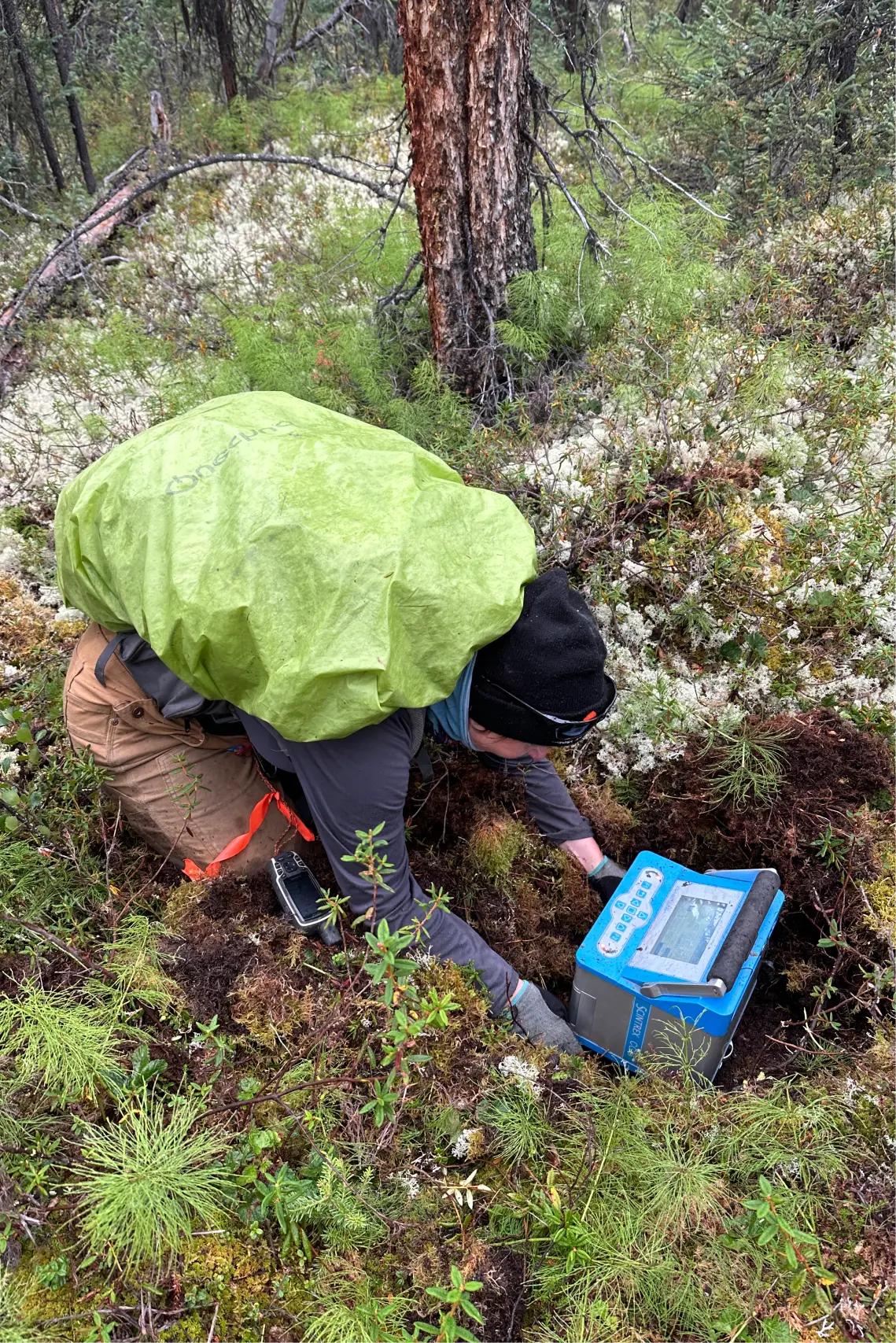
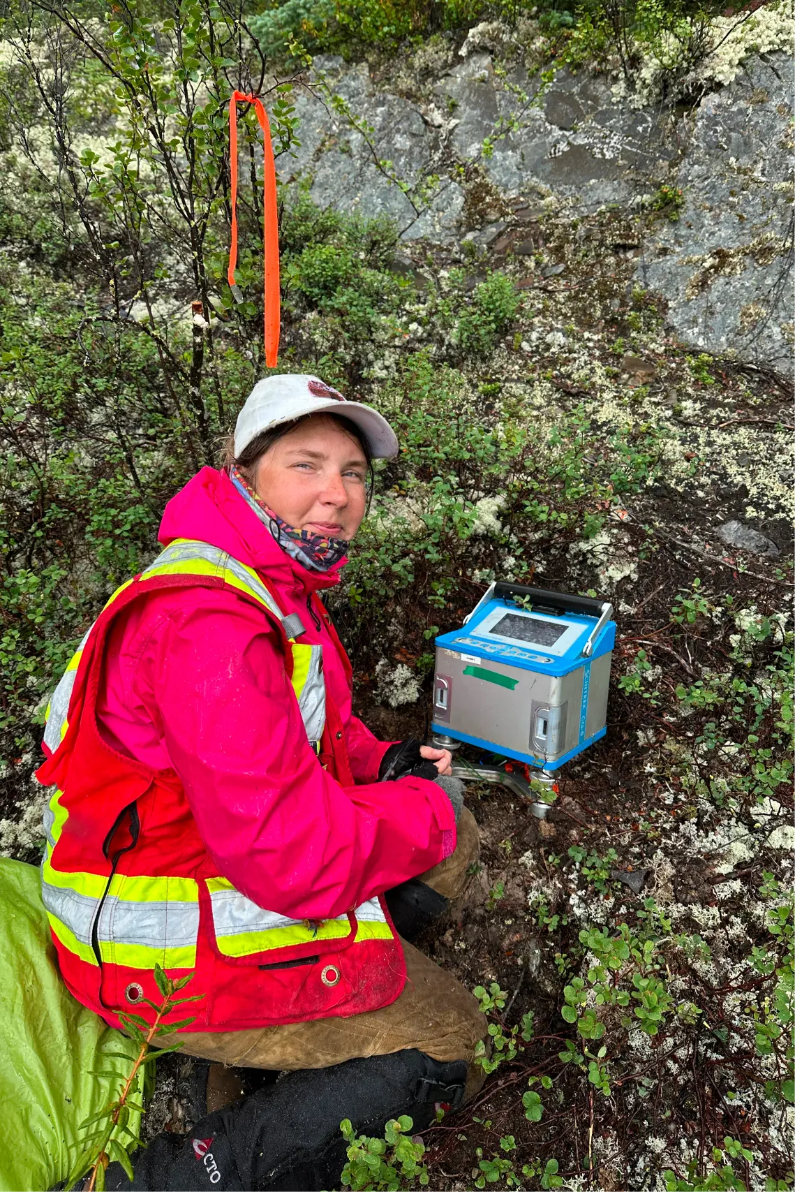
Here is an example from the field of how a gravimeter measurement is carried out. To get an accurate result, you need to place the device on a flat surface. To do this, we dig a hole in the moss and look for stones.
What geophysical methods are there and how to choose them for searching for solid minerals - read the article “Geophysical methods for searching for gold, silver and base metals».