You are a geology student, and you want to go into the fields to get your first real experience. But this is a little scary: how to get into the field detachment? Will they hire me without experience? Will I cope physically? How is everything organized there in general – where do they live, what do they eat, how does the team work? And most importantly, what to take with you so as not to freeze and not be left without the necessary things?
In this article we will tell you how they work geochemists’ fields using the example of work in Kamchatka – from the first day to the packaging of samples in the laboratory. We will explain how adaptation takes place, what newcomers do, how they grow to become managers, and what qualities are especially valued in a team. We’ll also give you a checklist of things you need to take with you to feel confident in the field.
Mikhail Perebatov, leading geologist of the Arjaysi company, head of field work in Kumroch, Kamchatka, will talk about the work of geochemists.
What is geochemistry and what are the search methods?
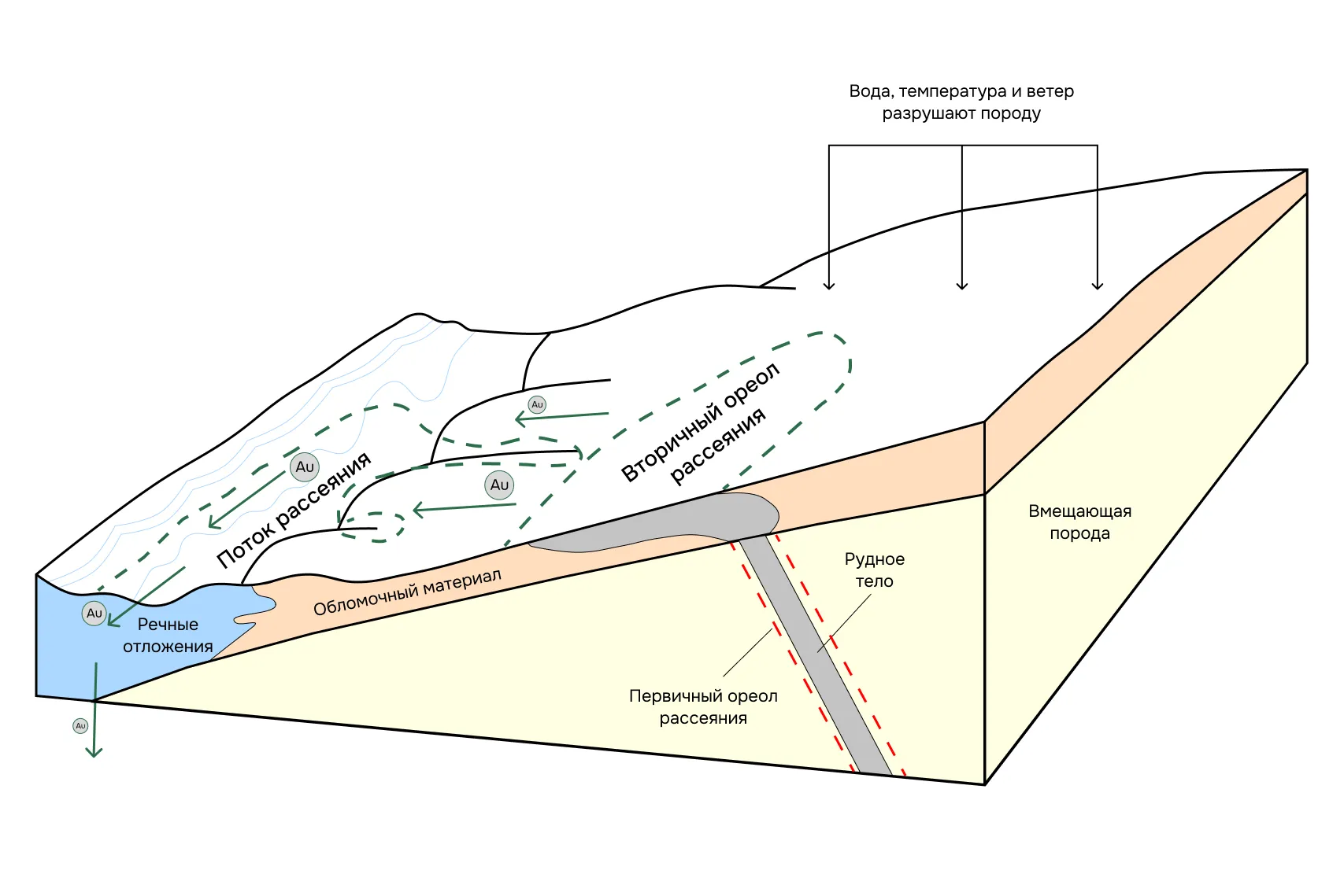
Geochemistry is the study of how chemical elements distribute and migrate in nature. Its mission is to find, predict and evaluate ore bodies based on their chemical “cues” in the surrounding rocks. Most often, geochemists work with the so-called dispersion halos – zones where the concentrations of the necessary elements deviate from the norm. Such deviations are called anomalies – they are the ones who suggest that an ore body may be hiding somewhere nearby.
Primary halos are formed simultaneously with the ore body – these are rocks in which the content of useful and associated elements has already been noticeably increased, but they are still not enough to consider such a rock as ore. Over time, the ore body is destroyed – and the primary halos are eroded along with it. Then they appear secondary halos – they form in soil and loose sediments and become the main landmark when searching on the surface.
A simple example: a gold mine has formed on a slope. It is gradually destroyed by the action of water, a universal solvent. A primary halo is formed around the vein, and a secondary halo is formed lower down the slope. And streams erode these deposits and carry gold particles kilometers down. If you take samples of concentrate—heavy minerals washed out of rock—and find gold in them, it means there is a source somewhere in the catchment area.
On Kumroch we also looked for gold using scattering halos. But not with concentrates – this method is used when the search area is vast and little is known about it. We took soil samples, analyzed them and built an anomaly map based on the results. Anomalies just suggest where the deposit may be hiding,
Mikhail says
All this is the theory that underlies the geochemical method. Now let’s see how it works in practice – in real field conditions.
Geochemistry sounds complicated. Will they take me?
If you are just finishing your 2nd or 3rd year and doubt whether you can handle it, you are not alone. Students make up 80–90% of all teams on geochemical field projects. Sometimes they also hire those who return to the profession after a break. But the main thing is that they will really take you.
“They took everyone, as long as they agreed. Now there is simply a shortage of personnel for such work,”
– says Mikhail Perebatov.
It is not necessary to know geochemistry thoroughly – the base will be explained on the spot. The main thing is to be attentive, responsible and ready to join in team work. Geochemistry is a real start in the profession, accessible even to those who are just studying.
What will help you cope in the first field:
- accuracy and conscientiousness,
- desire to learn and work in a team,
- psychological flexibility and readiness to live without amenities,
- basic physical endurance.
In addition to geologists and the manager, the team also includes workers – most often local residents. They help dig, carry loads, and set up a camp. The team is formed according to the objectives of the route, and everyone is helped to adapt.
Many beginners are afraid that they won’t be able to physically cope. But Mikhail recalls:
“The main thing is not strength, but endurance. In my experience, athletic guys did not perform better physically in the mountains. Often, village men who were accustomed to discomfort coped better, since they were psychologically more resistant to dangers and daily hard work.”

Coming soon to the field: what to take with you and what to expect
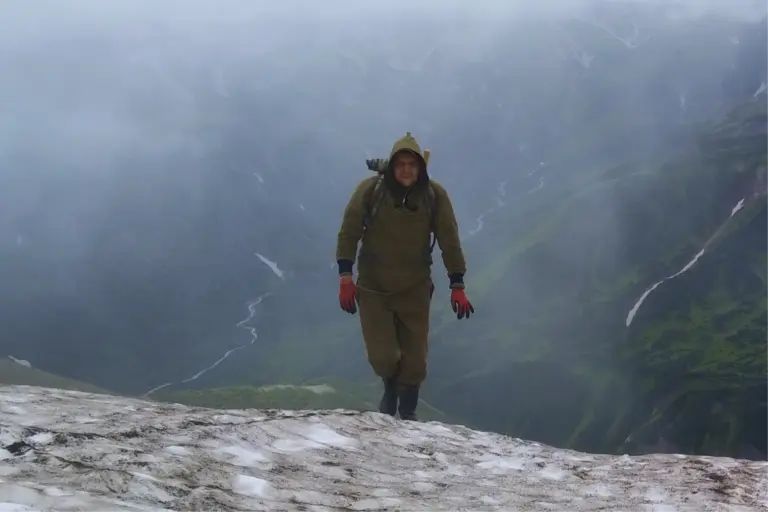
The first and most important thing is to prepare. The field is not a weekend hike. You will work in the mountains, live in a tent, carry equipment, get wet, freeze, get up early and get tired – and all this for several weeks in a row. If you don’t have the necessary clothes or shoes, you simply won’t be able to go out on the route. In Kamchatka, for example, it was very damp, and because of this, the clothes did not dry out. To avoid freezing, it was necessary to constantly move, even in summer.
What to take with you:
- Socks, thermal underwear, warm clothes – so as not to freeze.
- Sleeping bag is better warm, tested, at -5°C and below.
- Shoes – durable trekking boots (it’s better to bring your own, don’t rely on the ones issued).
- A backpack of 30-40 liters – for food and water.
- Gloves, hat, buff – even in summer it can be cold.
- First aid kit (personal), sunglasses and cream – the sun in the mountains can be very hot.
- A knife will be useful at all stages.
What the employer usually gives:
- Clothing and footwear: combat boots, boots, peacoat, raincoat, encephalitis.
- Equipment and tools: backpack for samples, GPS navigator, shovel, sampling bags.
Comment from Maria Kostina, geophysicist and founder of GeoConversation:
From experience, it’s better to have your own shoes, a sleeping bag and a 30-40 liter backpack. The employer will give you something, but it’s not always comfortable or the right size. For example, in field units they often give everyone the same ankle boots – without trying them on and without taking into account the characteristics of the legs. Even if you have named your size in advance, it is not a fact that the shoes will fit: 40 may turn out to be either too small or two sizes larger. And if you have a small size (for example, 36-37), especially if you are a girl, there is a high probability that your pair will simply not be available – at best, they will give you a 38-39, which will dangle.
In addition, ankle boots may be of poor quality – they rub, get wet or fall apart. That’s why You should definitely take your trusted shoes This can be critical to your ability to perform well in the field.
How to get to the site and work begins
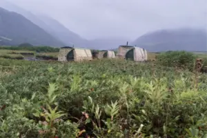
The road to the deposit takes several stages. First, the whole team flies to Petropavlovsk-Kamchatsky, from there on a rotational bus to the village of Maisky. And only then – by helicopter to the site. This last flight is especially impressive: along the way you fly over the entire volcanic ridge, including Klyuchevskaya Sopka – people pay money to see this, and you fly to work.
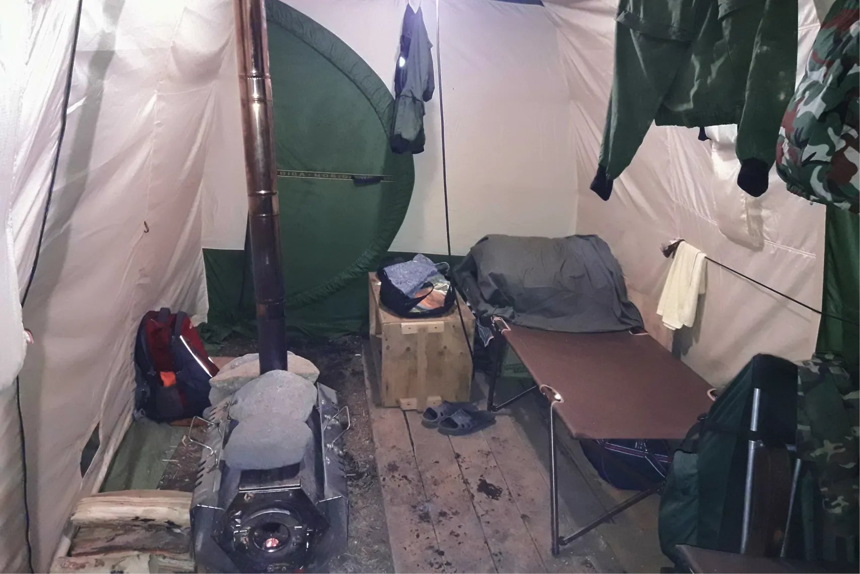
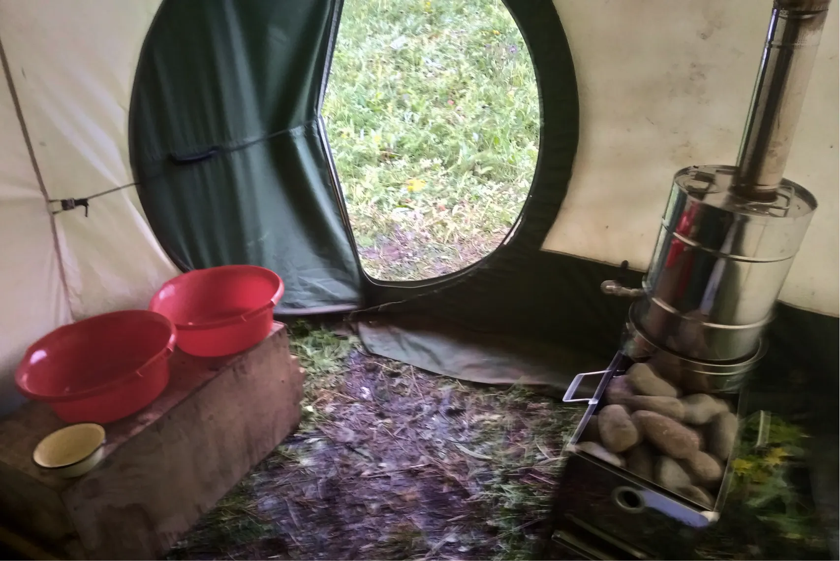
Having arrived at the site, the first thing the team does is unload the helicopter and set up camp. This is a common task: someone sets up tents, someone starts preparing food, someone checks equipment. This takes one or two days – the main thing is that already on the first night you have somewhere to sleep and something to eat for dinner.
The first days are spent not only on settling in, but also on adapting to physical activity. The team trains its legs and develops its muscular frame. At first everyone walks very slowly, and then they begin to speed up – after a week or two, the whole team develops a confident pace.
What did you eat in the camp and on the routes?
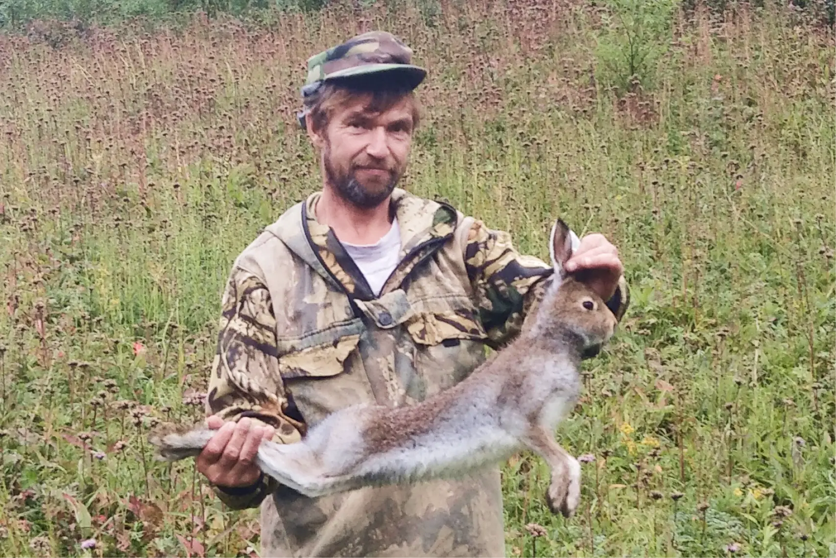
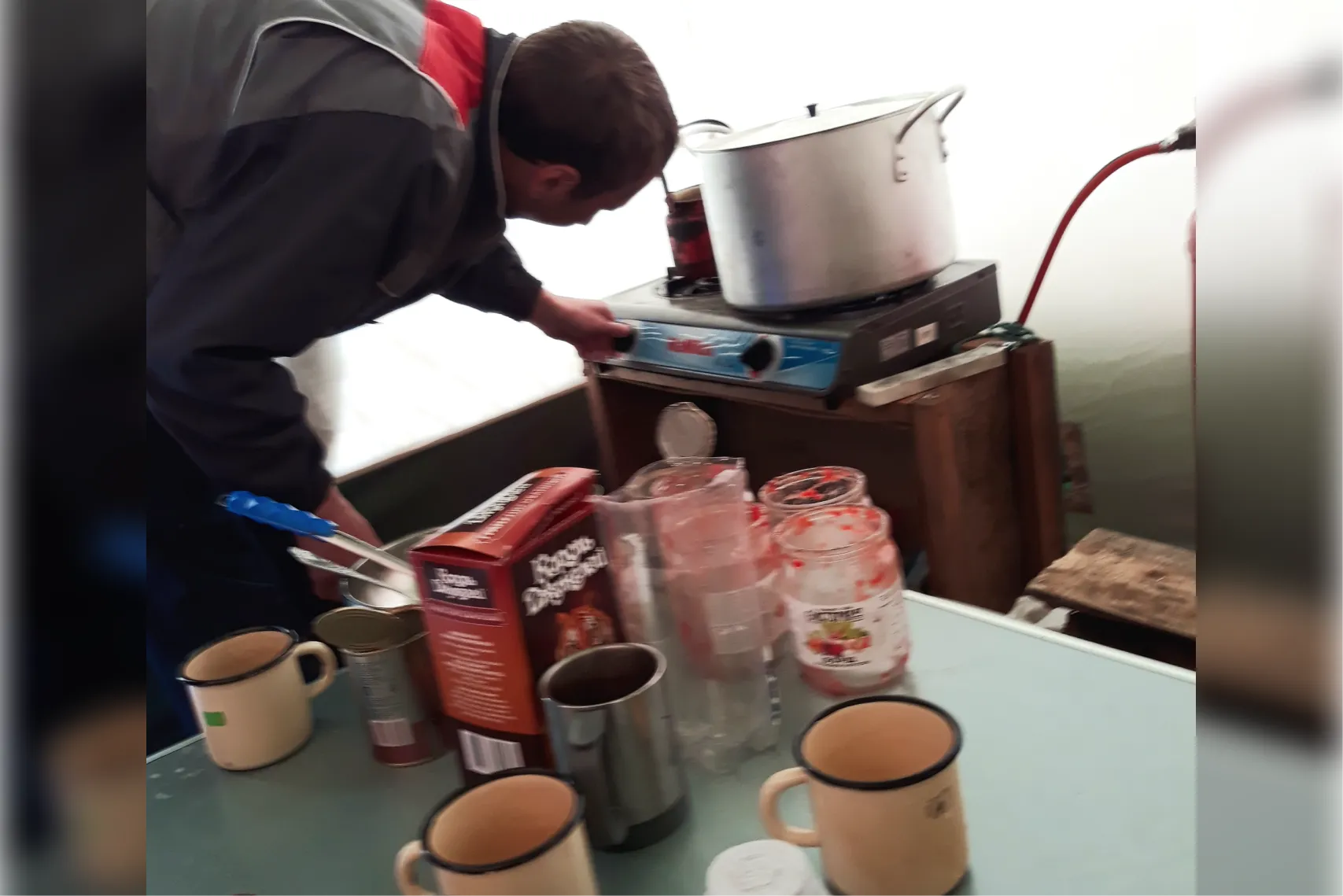
They cook it themselves in the field. The cook became the one who did not walk the routes well or was afraid of the mountains – this is how the load was distributed. The food was a standard camp set: stew, cereals, pasta, soups, red fish and caviar. They didn’t take meat – at most they could get a hare or duck somewhere, but this happened rarely.
On the routes they took what was easy to carry and quick to prepare: doshirak, stewed meat, condensed milk. Bring with you a mug and a gas burner to boil water for doshirak and make tea. Condensed milk was used both as a dessert and as a means of maintaining spirit on difficult days. These are fast carbohydrates that are easy to recharge when you are tired.
wp:premium/video-box {“blockId”:”premium-video-box-878ae4608188″,”videoURL”:”https://plvideo.ru/watch?v=TLUX-xJCVqjD”,”overlay”:true,”classMigrate”:true,”overlayStyles”:[{ “overlayImgID”:19081,”overlayImgURL”:”https://geoconversation.org/wp-content/uploads/2025/06/obed-geologa.mp4_snapshot_00.23.958.jpg”}],”caption”:”Obed geologist on the route: stew, doshirak and boiling water in a mug – fast, simple and satisfying”,”hoverEffect”:”zoomin”,”thumbnailSrc”:”https://i.ytimg.com/vi/TLUX-xJCVqjD/maxresdefault.jpg”,”className”:””}What about medical care?
You will not be left without help – there was always a first aid kit and… a veterinarian in the camp. But not an ordinary one, but a surgeon: if necessary, he could provide assistance to people. If a serious injury occurred, you contacted a doctor online or called the Ministry of Emergency Situations.
Once our colleague was hit in the eye by a branch, and he began to see poorly. We consulted with a doctor online, discussed the situation, and the next day my vision was restored. I stayed to work further.
Is there internet in the fields?
Yes, and this is now an important part of both life and work. They try to put the Internet first in the camp. This allows you not only to communicate with family and friends, but also to solve work problems. For example, Mikhail sent the customer daily reports on the work done – with photos, routes, results.
In addition, using the Internet, you can consult a doctor in case of an emergency – this is what they did when one of the participants had problems with his eye. The Internet helps you feel connected to the world and makes your work more manageable.
We’ve sorted out everyday life – now it’s time to go on a route and see how geochemists work in practice in the mountains of Kamchatka.
How was the working day: to the mountains for samples
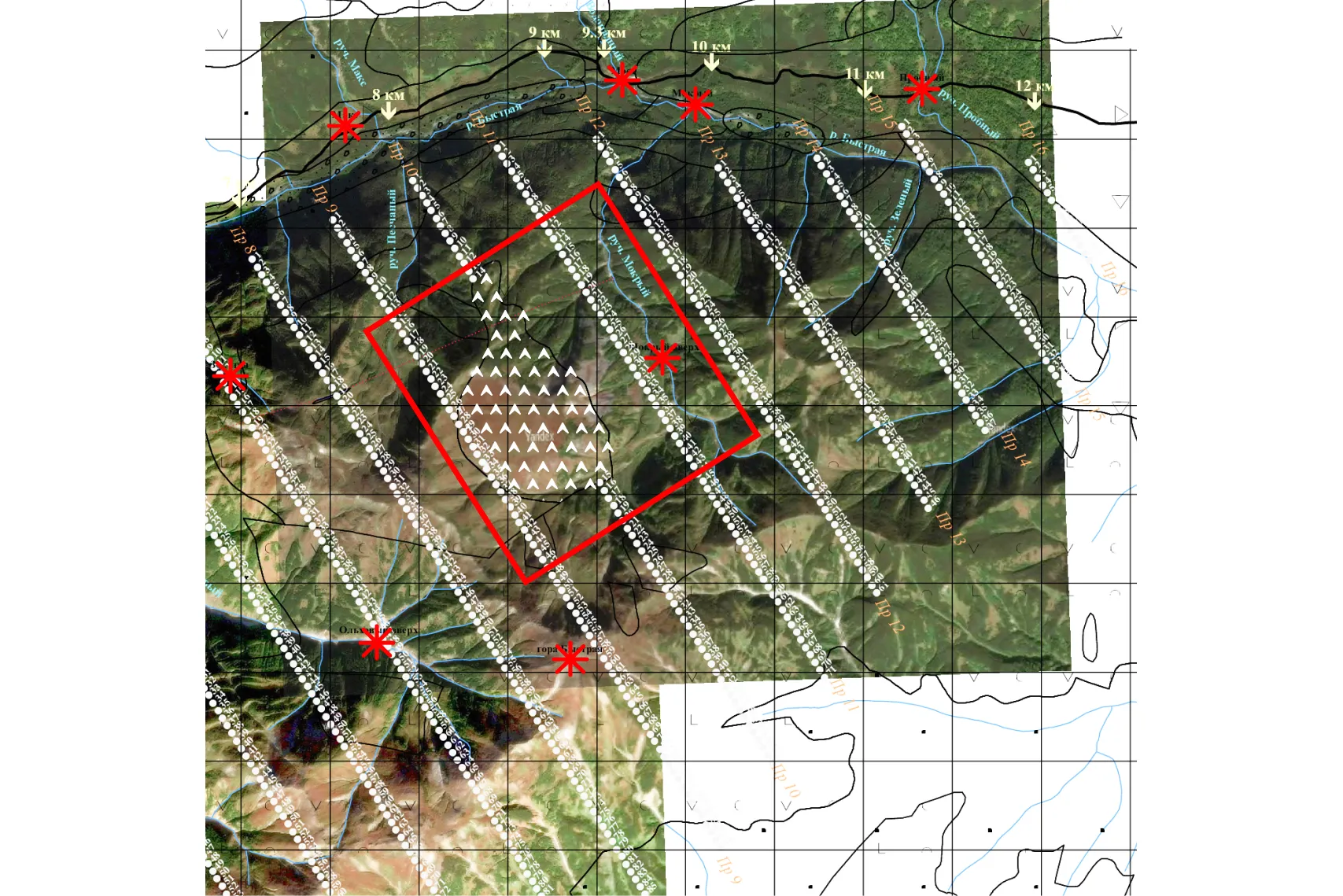
After setting up the camp, the main work began – daily routes for samples. They were selected to then build a map of anomalies – areas with deviations in the content of chemical elements. These anomalies suggest where gold may be and where to direct further searches.
Morning – we set out on the route
Every morning, a team of geochemists traveled together to the starting point of the routes. Sometimes it was possible to drive up by car, but more often I had to walk – and sometimes the path to the beginning of the profile took longer than the work itself.
“Approaching a profile could take half a day. This is fine. You can work for three hours on a profile, and for eight hours you can just come up and walk away from it,” recalls Mikhail.
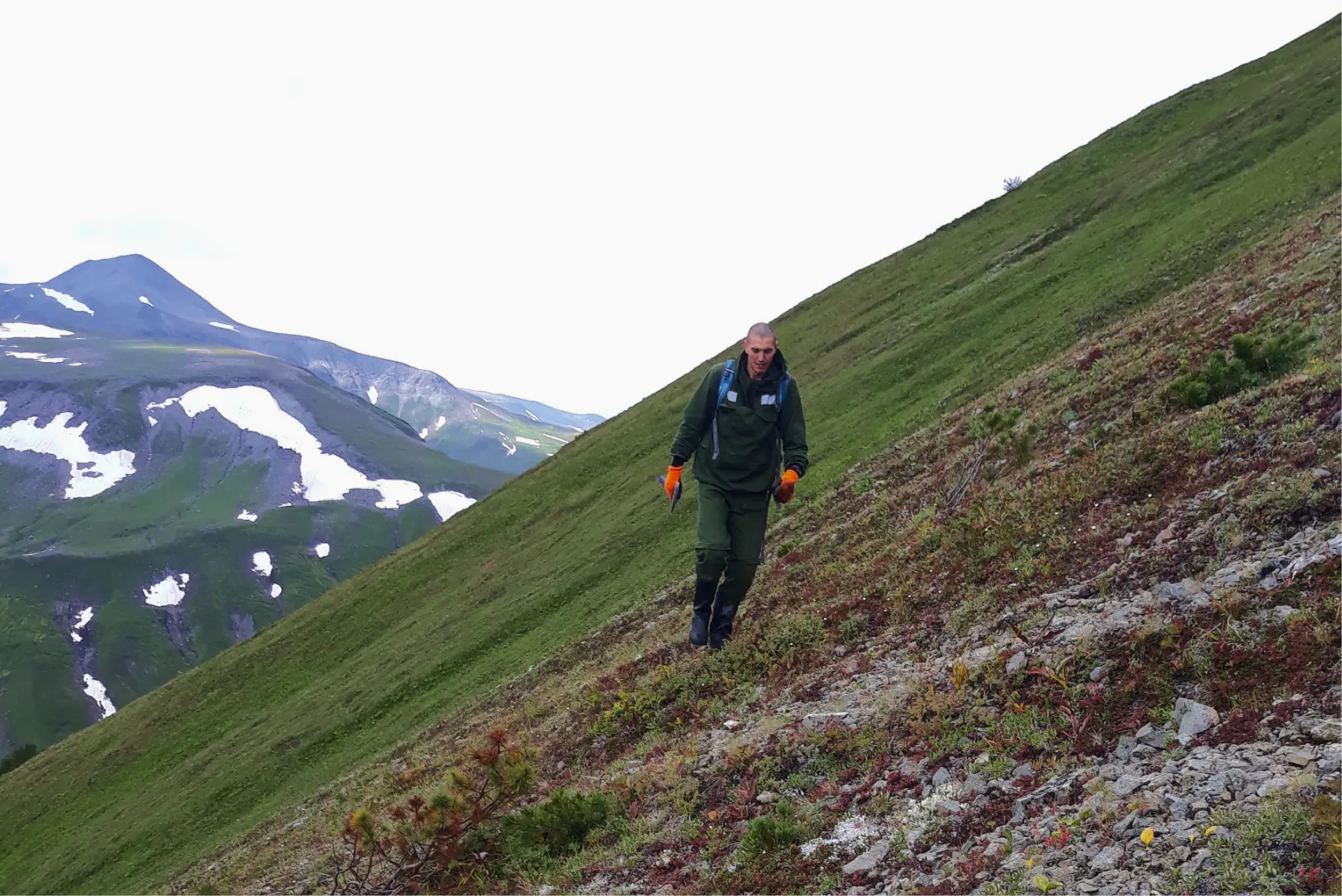
This is due to the peculiarities of the relief on Kumroch: it is very complex. “Very scary mountains,” is how Mikhail describes it. This area has steep slopes with wet slippery grass, sheer rocks and dwarf alder – dense bushes through which you have to literally crawl. “Sometimes we walked 50 meters an hour,” he says. All this makes even a short route exhausting, and planning critical.
wp:premium/video-box {“blockId”:”premium-video-box-2dcd847220cc”,”videoURL”:”https://plvideo.ru/watch?v=V13lwqUzWlGR”,”overlay”:true,”classMigrate”:true,”overlayStyles”:[{“overlayI mgID”:19054,”overlayImgURL”:”https://geoconversation.org/wp-content/uploads/2025/06/preodolevaem-vodopad.mp4_snapshot_00.02.672.webp”}],”caption”:”Overcoming waterfall: geologists climb rocks and avoid a water obstacle along a steep slope”,”hoverEffect”:”zoomin”,”thumbnailSrc”:”https://i.ytimg.com/vi/V13lwqUzWlGR/maxresdefault.jpg”,”className”:””}Along the routes, participants went in pairs – it’s safer, there’s always a safety net. The leader was responsible for forming pairs, focusing on the physical fitness of the participants and the complexity of the routes. The stronger geologist was paired with a strong worker, and those who were tired were assigned to the easier routes. If someone was very tired, an easier site was selected for him.
Before leaving, each pair was given:
- GPS – to know where you are and where you are taking samples;
- walkie-talkies – for communication;
- route plans;
- bags with tags for samples;
- I’m going for the day.
Usually we walked 10–12 kilometers per day. Sometimes, on their own initiative, the couple could overcome 20 km. Before leaving, everyone announced what they were planning to do, and the group went their separate ways.
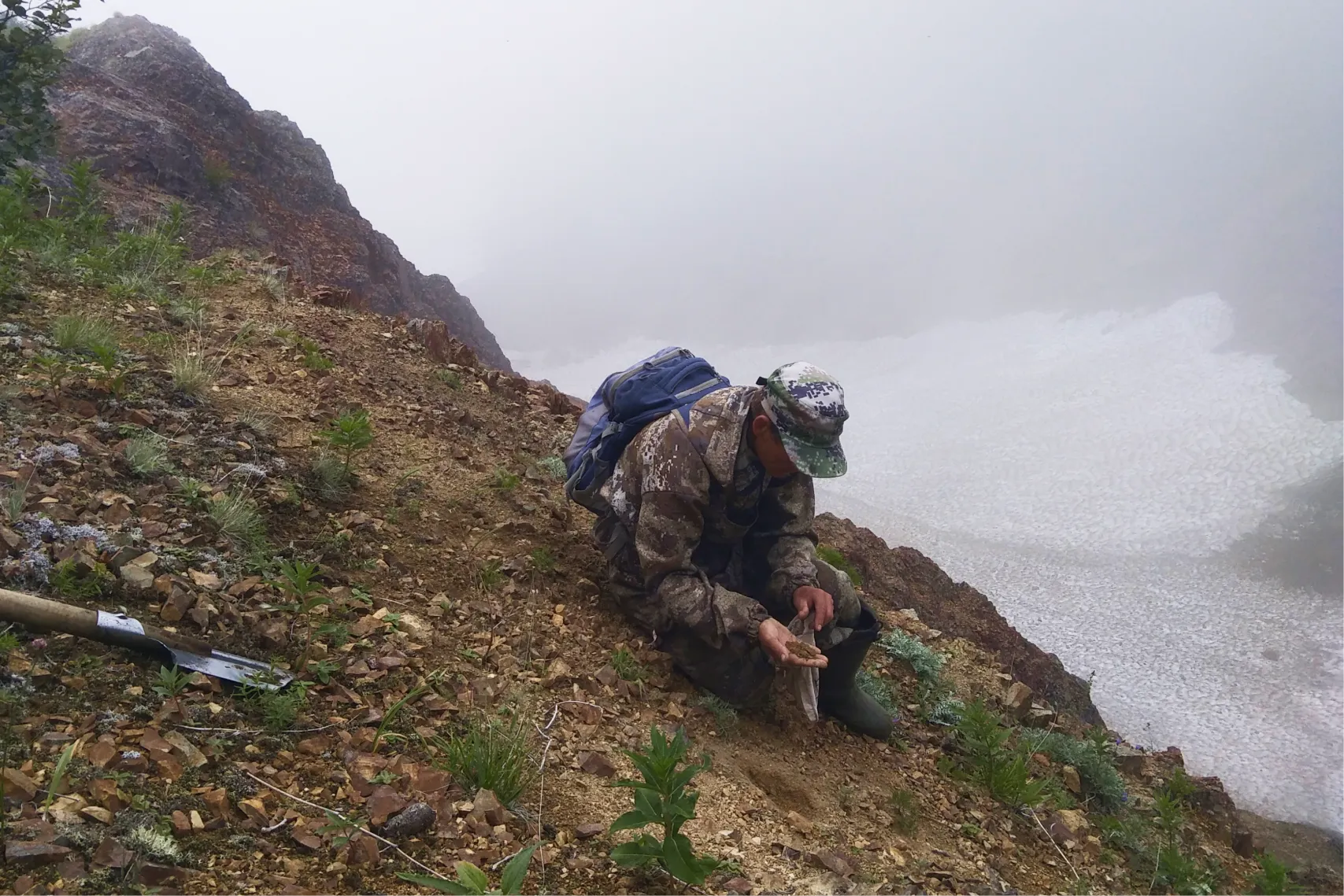
Work on the route
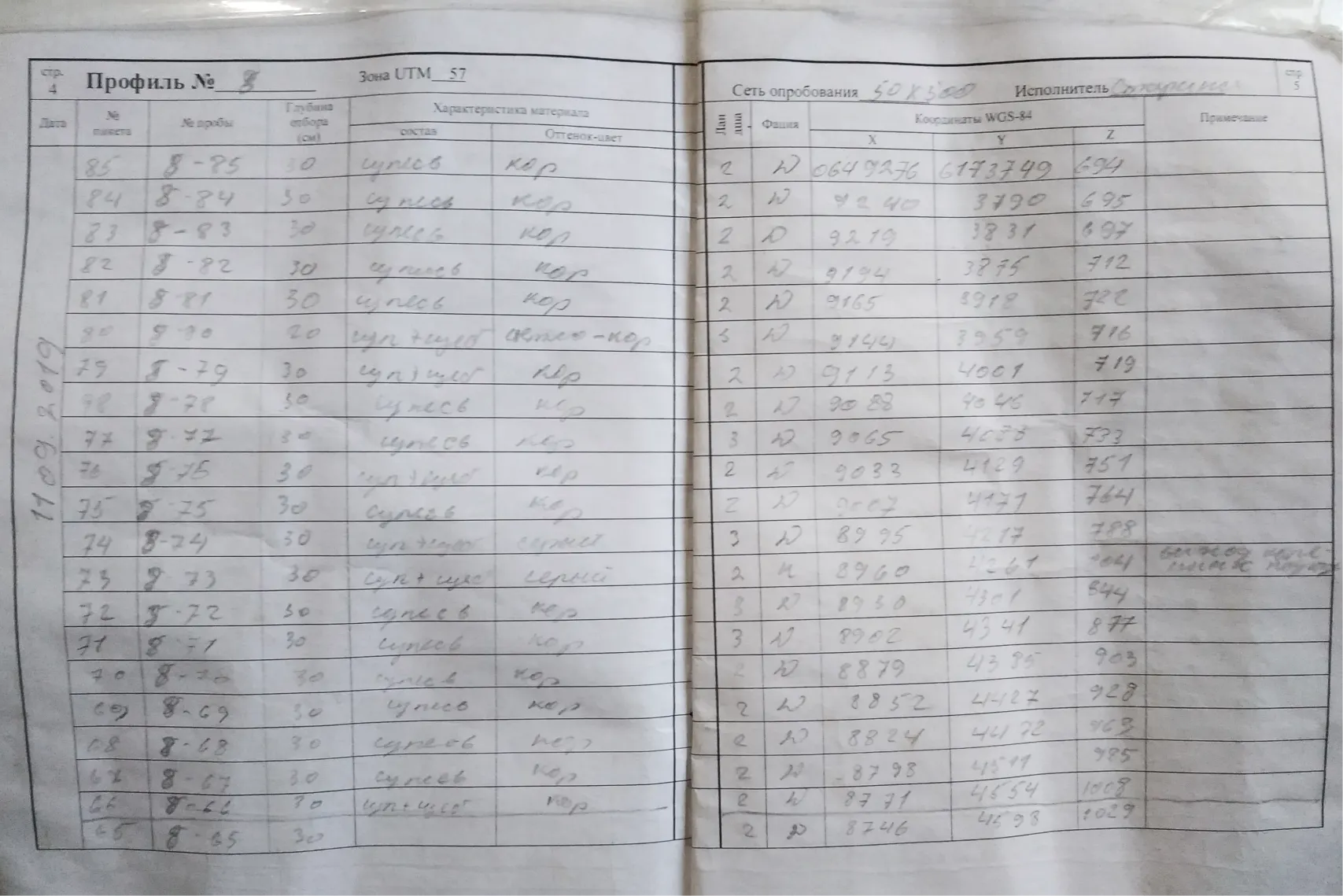
After the group disbanded, each couple went on their own route. They tried not to move too far from each other so that if something happened they could call for help. The worker dug, and the geologist decided whether the material was suitable for the sample. The main requirement is sand without impurities: without roots, vegetation, crushed stone and pebbles. If the material was suitable, it was placed in a bag with a tag. Usually they took about 200 grams of sample – this is enough for geochemical analysis. If the sample still contained crushed stone or pebbles, the weight increased to 600 grams or even kilogram.
wp:premium/video-box {“blockId”:”premium-video-box-6091ed22e5f9″,”videoURL”:”https://plvideo.ru/watch?v=7T3Vy_2e5yhg”,”overlay”:true,”classMigrate”:true,”overlayStyles”:[{“o verlayImgID”:19085,”overlayImgURL”:”https://geoconversation.org/wp-content/uploads/2025/06/otbor-proby.mp4_snapshot_00.11.194.webp”}],”caption”:”Process taking a geochemical sample: the geologist selects a suitable soil, fills the bag and signs the tag”,”hoverEffect”:”zoomin”,”thumbnailSrc”:”https://i.ytimg.com/vi/7T3Vy_2e5yhg/maxresdefault.jpg”,”className”:””}The manager developed route schemes in advance, taking into account the terrain and logistics. Kamchatka is not a place where you can simply walk from the beginning of the profile to the end: it is ineffective and too difficult. Therefore, samples were collected in fragments, focusing on individual zones. “You climbed up the stream and worked a square there,” explains Mikhail. At the same time, they tried not to lose altitude: ascent and descent in such conditions take too much effort. “I’d rather walk 500 meters horizontally than 200 meters – but with an elevation change,” he adds.
There are also wild animals in Kamchatka. Bears met regularly, but they didn’t pose much of a threat—they were timid and immediately ran away when they saw a person. For protection, the team had bear spray, hunter signals, whistles and even a gun, but walking with it was twice as difficult: “It clung on all the time, and it was almost impossible to walk through the dwarf forest with it.”
wp:premium/video-box {“blockId”:”premium-video-box-5163e7fabaf2″,”videoURL”:”https://plvideo.ru/watch?v=8FyqMlglxkZY”,”overlay”:true,”classMigrate”:true,”overlayStyles”:[{ “overlayImgID”:19089,”overlayImgURL”:”https://geoconversation.org/wp-content/uploads/2025/06/medvedi.mp4_snapshot_00.12.443.webp”}],”caption”:”Geologists hiding behind a rock and preparing protective equipment after an encounter with a bear in the mountains”,”hoverEffect”:”zoomin”,”thumbnailSrc”:”https://i.ytimg.com/vi/8FyqMlglxkZY/maxresdefault.jpg”,”className”:””}Return from the route
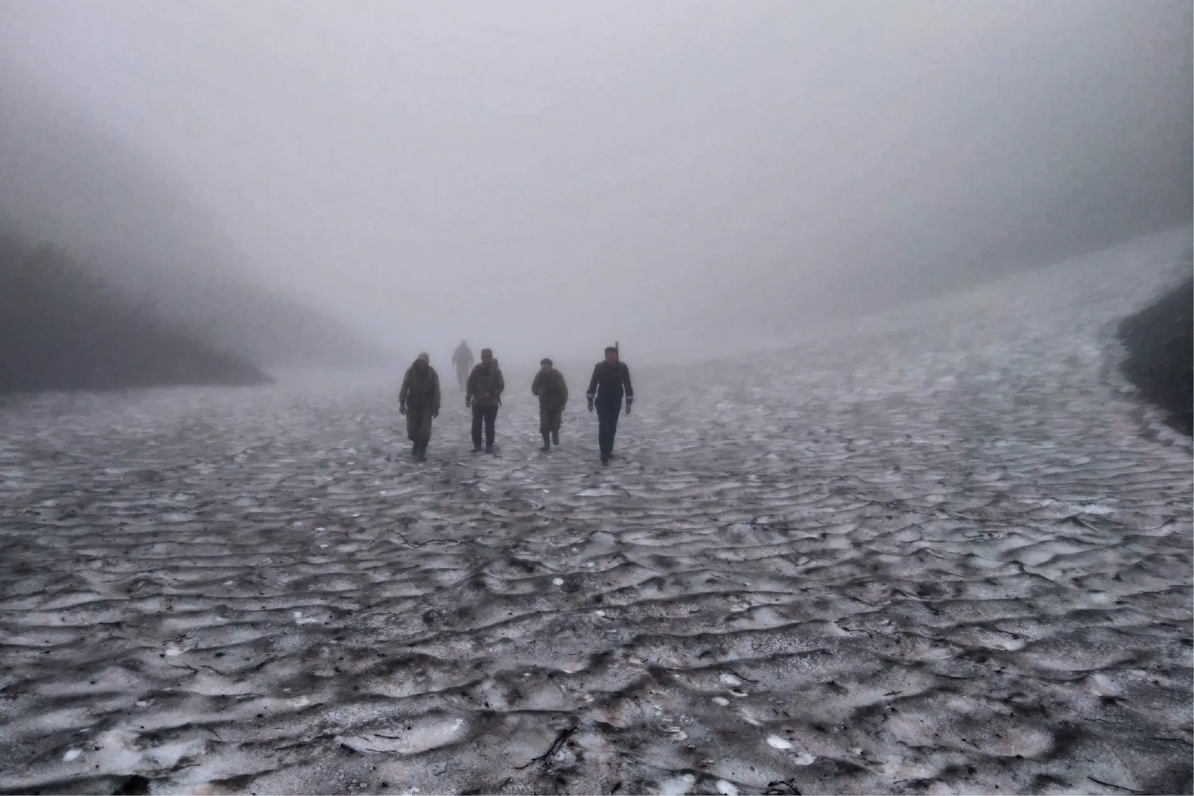
The return journey was not always easy. Sometimes the GPS would fail, and fog would rise in the mountains, and literally nothing could be seen. In such cases, route pairs could get lost. To prevent this from happening, we always agreed in advance where we would meet and kept in touch by radio. We also had route sheets with reference points on hand – they could be used to navigate even in bad weather.
Working in fog and rain is common. Mikhail explains:
“We, of course, worked in violation of safety regulations – we walked in the rain. But it’s even difficult to tell whether it’s raining or not, because you’re working in low clouds. When you climb a mountain, you literally walk in a cloud, in a wet fog. Therefore, no matter how hard you try to avoid it, you still constantly walk around damp. And this elfin wood is also raw. I just walked through and I’m already wet.”
Such conditions are very exhausting. Therefore, if a person was tired, he could take a day off, sleep off, or temporarily switch to another job – for example, do household chores in the camp. It was important not to strain yourself, but to maintain a stable rhythm and maintain strength for the whole season.
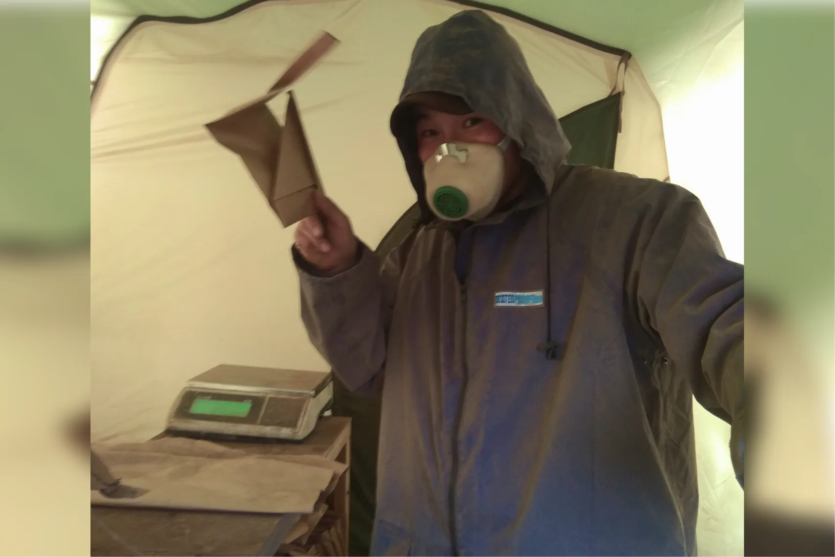
Preparing samples for sending to the laboratory
After returning to the camp, geochemists prepare the collected samples for laboratory analysis. This is important – the accuracy of the results and further understanding of whether there are signs of a deposit in the area depend on the quality of this preparation.
1. Drying
First, the samples are thoroughly dried to remove moisture. If this is not done, the material will not be sifted. In Kamchatka, due to high humidity and constant rain, a special drying cabinet, which allows you to dry the material quickly and evenly.
2. Sifting
After drying the sample sift through a sieve — this allows you to separate the desired fraction and get rid of too large inclusions that can distort the results
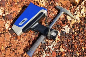
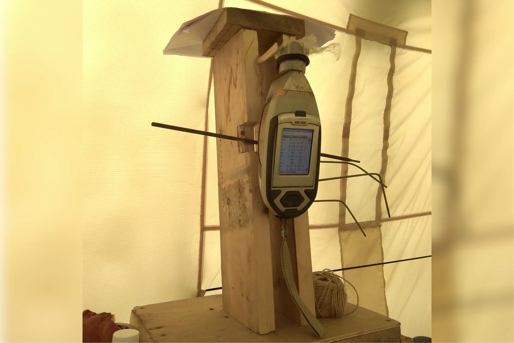
3. Express analysis
Then carry out X-ray fluorescence (XRF) rapid analysis. It helps to quickly evaluate the content of the so-called satellites of gold – copper, zinc, arsenic. These elements indicate the possible presence of gold nearby. Gold itself is not determined by this method, but promising samples can be identified based on satellite anomalies.
4. Anomaly mapping
After express analysis (XRF), we build intermediate maps of anomalies – areas where the content of certain chemical elements (for example, gold satellites: copper, arsenic, antimony, etc.) noticeably deviates from the norm. Such anomalies can indicate the presence of gold, even if it itself is not yet visible.
The main thing is that these maps are formed in the field and allow you to quickly adjust geological exploration work. Geologists can immediately clarify the routes: where it is worth carrying out a more detailed survey, and where, on the contrary, they can save effort. This helps you make decisions quickly and use your expedition time more efficiently.
5. Packaging
At the final stage, the samples are labeled, packed in zip bags with tags, and then placed in transport containers. After this, they are sent to the laboratory for a detailed analysis – it is this that will provide the final data for constructing geochemical maps and assessing the prospects of the site.

How to grow to a field manager
Field routes are not just about “digging holes.” Here you are grow as specialists: learn to observe, analyze, work with geological information. That is, it is the professional ones who are being upgraded, geological skills, not just physical endurance.
At the same time, already from the first season, managerial qualities: you learn to make decisions, distribute tasks in pairs, take responsibility. Thus, not only professional expertise gradually increases (horizontal growth), but also a basis appears for growth to field work manager (vertical track).
If you want to grow not only deep into the profession, but also upward – to the role of field work manager – this is what you should pay attention to now. Look what he’s doing – take note:
Planning
The manager himself builds the route: he takes into account the terrain, cross-country ability, distance, weather conditions, weight of samples and equipment. He is responsible for ensuring that the team is not overloaded and that the work is carried out efficiently.
“I built the routes myself – I looked at where I could go, how many samples I could carry, and what condition the participants were in. I distributed the team into pairs and selected a suitable route for each,”
— says Mikhail Perebatov, head of field work at Kumroch.
And here it is important: even in your first field practice, you can begin to develop planning skills. Mikhail always listened to the team’s suggestions – if you see a way to complete the route faster or more conveniently, do not be afraid to voice it. Initiative is valued here.
“Yes, I accepted offers. We go together, and sometimes the guys suggest: let’s go here – and it’s really more convenient there. This is fine”,
– says Mikhail.
Communication
There are in the fields fatigue, burnout, minor conflicts – especially if the team works in difficult conditions. The manager knows how to talk to everyone in a timely manner, support them, notice when a person needs a break, and, if necessary, adjust the workload.
“To prevent team spirit from falling, I talked one-on-one with everyone and tried to prevent conflicts. If I see that a person is having a hard time, I can offer a more feasible task – laying out a path to a tent, for example. Or give it a day off – sleep, switch gears. We also had forced days off – when due to bad weather we could not go anywhere,”
– says Mikhail.
And even if you are not a manager, communication skills can be improved from day one. Almost always you work in pairs – like a geologist and a worker. This means being able to negotiate, explain exactly what needs to be done, and build respectful working relationships. Such skills are the foundation of teamwork and future leadership.
Work with the customer and quality control
The field manager is the link between the customer and the field team. He not only plans the work, but is also responsible for it to those who order the research.
“We agreed on the terms of reference with the customer in advance: where the profiles will be, how many samples need to be taken. Already in the fields, I sent daily reports on the work done. Sometimes we adjusted the technical specifications together – for example, if the patency turned out to be worse than expected, and the planned volume of samples was simply unrealistic,”
– explains Mikhail.
It is also important that the manager controls the quality of work: he monitors how samples are taken, helps newcomers, and is responsible for ensuring that everything meets the standards. To do this confidently, you need to have a good understanding of the topic – from geochemistry to logistics.
Of course, at the start you are unlikely to be allowed to communicate with the customer or agree on technical specifications. But already in the first field, you can take on an area of responsibility: keep records of samples, help fill out route diaries, organize a database, or participate in daily reviews. This allows you to quickly understand the processes and grow to the position of field work manager in 1–2 years.
The first field is not about strength, but about character
Field experience will be your first real step into the profession. You will learn to work in a team, touch the rock, master express analysis and see the result of your work. You will also improve your patience and planning skills. Elf trees, bears, and other difficulties along the route will teach you this.
Bring your guitar because geochemistry is about adventure and getting out of your comfort zone. Later, on the “Burezhka”, there will be a different geology – it’s already a complete routine there. Now have fun and admire the amazing views!
The material was prepared with the support of the Russian Ministry of Education and Science as part of the Decade of Science and Technology